 FACTS & TRENDS
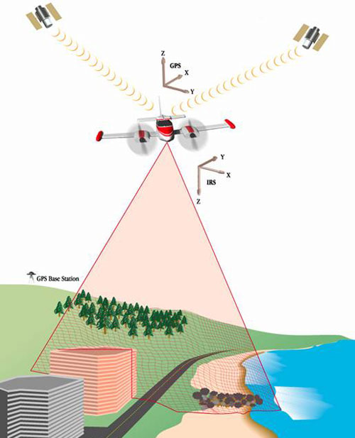
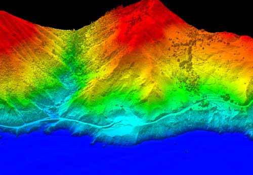
- LIDAR is a remote sensing technology that uses lasers to estimate elevation.
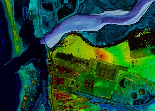
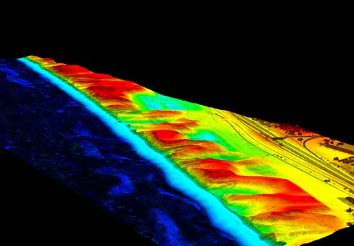
- Repeat LIDAR mapping is the most efficient method for quantifying processes such as coastal erosion and for mapping the changes.
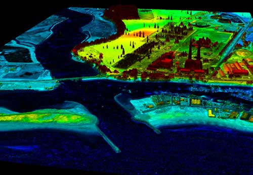
- Data obtained from LIDAR flights are key to modeling the hydrology of Elkhorn Slough.
In April, 2004 the Monterey Bay National Marine Sanctuary along with the National Ocean Service (NOS) Remote Sensing Division from the National Ocean and Atmospheric Administration (NOAA) recently completed a pilot project to map the Eklhorn Slough area and portions of the Big Sur coast with Light Detection and Ranging (LIDAR) and new digital camera technology. NOAA’s Cessna Citation II Jet was used as the research platform.
The high accuracy elevation data collected from the Elkhorn Slough flights will be used to in conjunction with CSUMB’s Sea Floor Mapping Lab’s bathymetry data. The goal is to create a seamless elevation model of the terrain and underwater features that will aid in managing erosion in the Slough.
The Big Sur flights were focused on persistent land slide areas. This elevation data will be used in an attempt to establish a baseline for analyzing slide volumes and trajectories. In addition, the United States Geological Survey (USGS) sponsored several flight lines from Watsonville to Pacific Grove to study shoreline processes.
More information:
- NOAA Coastal Services Center – http://www.csc.noaa.gov/crs/tcm/
- USGS LIDAR – http://coastal.er.usgs.gov/lidar/
- NOAA Remote Sensing Information – http://www.noaanews.noaa.gov/magazine/stories/mag13.htm