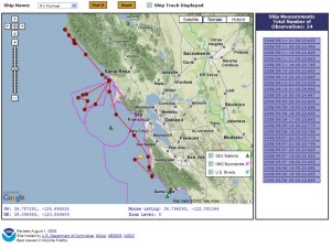
With funding as a part of the Pacific Coast Ocean Observing System (PaCOOS) (http://www.pacoos.org/), the Sanctuary Integrated Monitoring Network (SIMoN) and the National Coastal Data Development Center (NCDDC) developed a Google map (http://www.ncddc.noaa.gov/website/google_maps/PaCOOS/mapsPaCOOS.htm) that shows near real-time positions of the Office of National Marine Sanctuary research vessels Fulmar, Shearwater, Auk, and Manta. Along with position data, the latest oceanographic and meteorological data are also published. This map also plots the locations of all moorings from the West Coast Observing System (http://www.sanctuarysimon.org/regional_sections/obs/) and provides direct access to the oceanographic data recorded by each mooring. For more information, please contact Chad King (SIMoN Research Analyst) at (831) 647-4248 or Chad.King@noaa.gov.