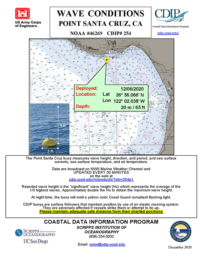
The Coastal Data Information Program (CDIP) deployed the Point Santa Cruz buoy (CDIP #254) on December 6, 2020. Details for buoy #254 can be viewed at the CDIP website.
CDIP is an extensive network for monitoring waves and beaches along the coastlines of the United States. Since its inception in 1975, the program has produced a vast database of publicly-accessible environmental data for use by coastal engineers and planners, scientists, mariners, and marine enthusiasts. The program has also remained at the forefront of coastal monitoring, developing numerous innovations in instrumentation, system control and management, computer hardware and software, field equipment, and installation techniques.
CDIP is operated by the Ocean Engineering Research Group (OERG), part of the Integrative Oceanography Division (IOD) at Scripps Institution of Oceanography (SIO).