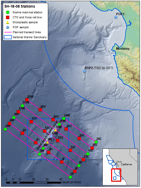
Overview
Follow this daily blog as we conduct a 10-day research cruise within Monterey Bay National Marine Sanctuary with partners Point Blue Conservation Science from July 15-24, 2018. Mesopelagic fish and krill surveys will be conducted within and near the Davidson Seamount Management Zone (DSMZ). We will also be observing marine mammals and seabirds above and adjacent to the Davidson Seamount. Additional research includes oceanographic data and water sampling (CTD), hoop net tows for plankton sampling, manta tows for microplastics, and water sampling for harmful algal blooms, flame retardants, PCBs and pesticides.
Day 1
Day 1 – July 16, 2018
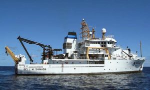
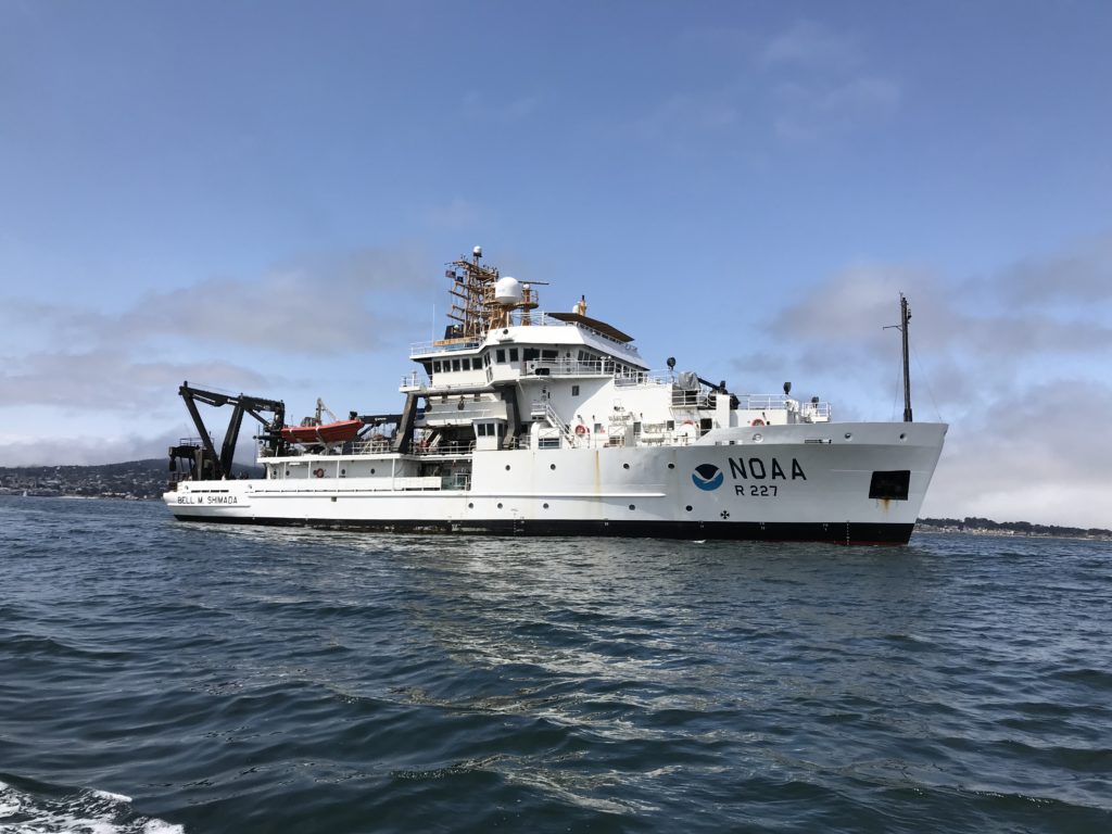
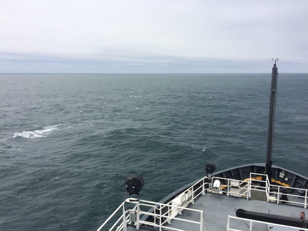
After many months of preparation and one night (7/15) of smooth transit out of San Francisco, today is first chance to conduct science aboard the NOAA FSV Bell M. Shimada in the Davidson Seamount Management Zone, one of 16 Sanctuary Ecologically Significant Areas found within Monterey Bay National Marine Sanctuary. With ideal sea conditions, the research operations plan is right on schedule, with oceanographic sampling and biological surveys getting underway at 0700. The oceanic sample area for this research cruise consists of three transects (approximately 60 nautical miles each) running in parallel from NW to SE, and include various sample stations:
While the day time surveys will focus on marine mammal and seabird observations, and periodic deploying the hoop net, manta trawl and CTD (an instrument used to measure seawater conductivity, temperature, and pressure at depth), the night time will be predominately tucker trawl surveys for krill and mesopelagic (mid-water) fishes. Active underwater acoustics will be continuously collected using the vessel’s scientific echosounder (Simrad EK 60), and the data will be used to help determine higher concentrations of micronekton biomass (i.e krill and fish) for sample collection throughout the cruise.
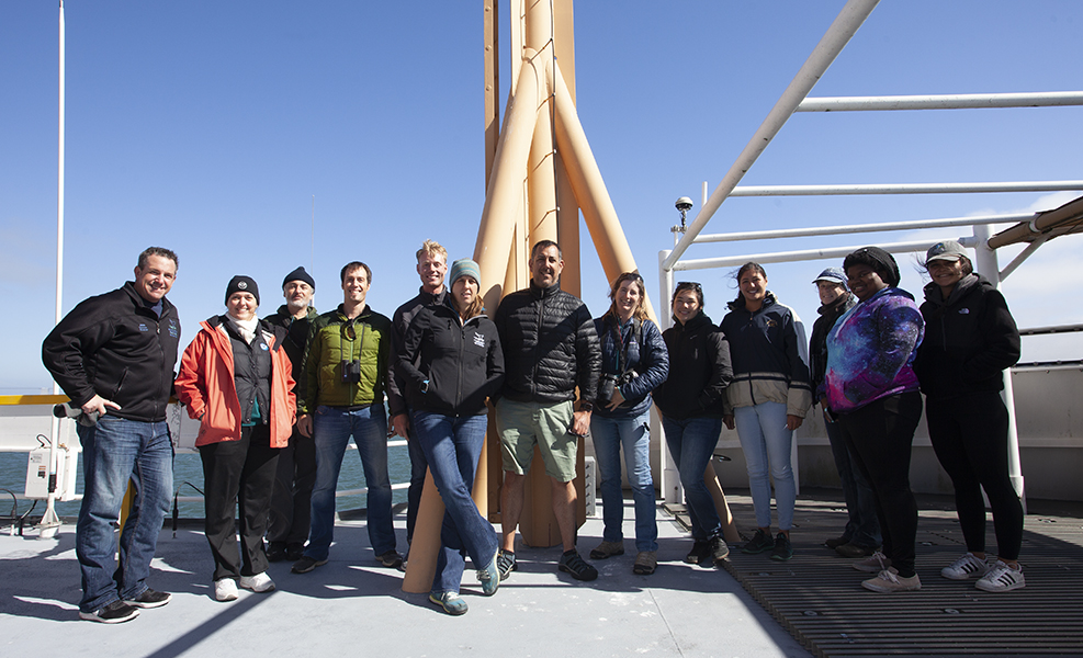
The cruise will be conducted in two legs (July 15-20 & July 20-24), with a return to Monterey Bay for partial crew transfer. The science crew for leg 1 consist of Chad King (Lead Scientist/MBNMS), Erica Burton (MBNMS), Amity Wood (MBNMS), NOAA scholars’ Camisha Few, Olivia Boisen, and Miya Pavlock-McAuliffe, with scientists from Point Blue Conservation Science: Jaime Jahncke (Project Lead), Ryan Anderson, Julie Howar, Grace Kumaishi, Cotton Rockwood, Rudyard Wallen, and Sophie Webb.
As we get underway and the cruise continues with good weather for science, we’ll keep this blog updated with daily highlights and sample collection photos along the way!
Don’t forget to like us on Facebook and follow us on Twitter @MBNMS!
Amity and the science team
Day 2
Day 2 – July 17, 2018
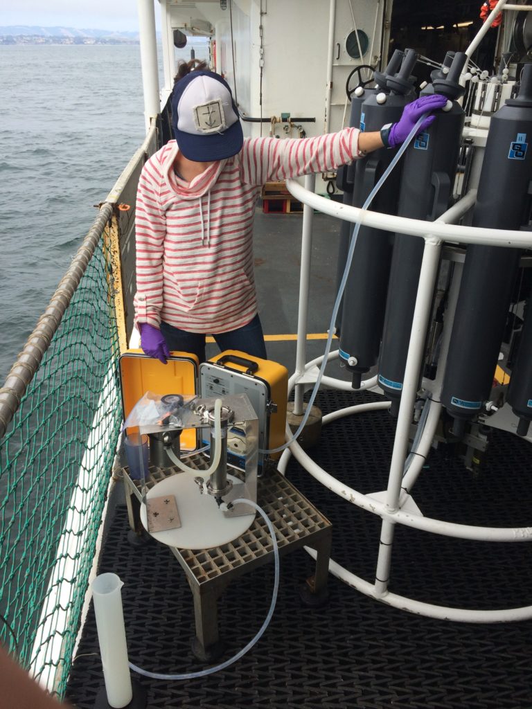
Science Spotlight: water sampling with a CTD
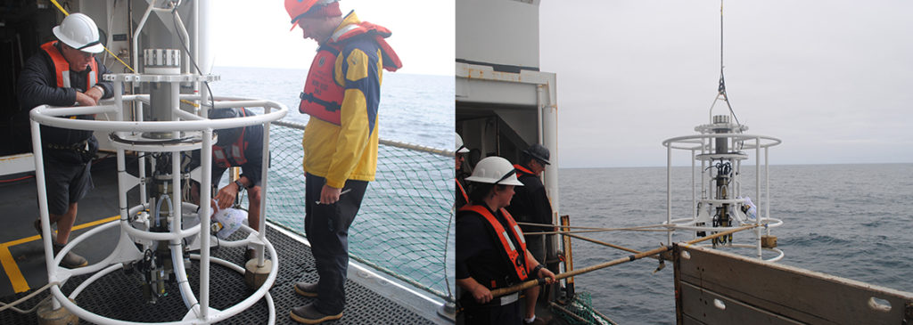
Today we will feature conducting research with an oceanographic instrument called a CTD, which measures conductivity, temperature, and depth (among other metrics) on the way down and back up to the ocean surface. These types of chemical and physical parameters are drivers for influencing the types of organisms that live in under certain environmental conditions and can be precursors to support biomass sampling.
The CTD instrument is made up of a steel rosette frame (like a carousel) that sampling bottles (called Niskin) or sensors can be attached to, then sent to desired depths. Once at depth, the sampling bottles close, triggered by a computer, and captures the water samples which return to the surface to be analyzed further for biological and/or chemical parameters. Attached sensors are continuously gathering data and recording measurements.
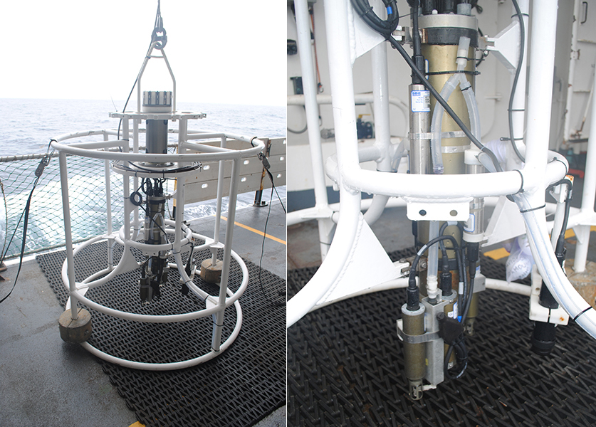
During the day time cruise, we are deploying the CTD to depths of 1000 meters (3280 feet) along a vertical transect, at 10-12 nautical mile intervals, on each of the three 60 nautical mile horizontal transects. Upon descent, the sensors are measuring water pressure, depth, temperature, conductivity, turbidity (suspended sediment), salinity, oxygen, fluorescence (to calculate chlorophyll):
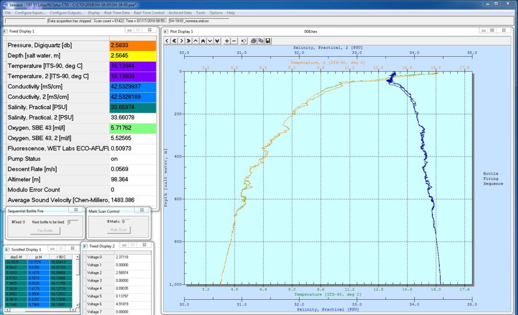
The graph above shows temperature and salinity by depth. Salinity increases with depth, while temperature decreases to near-freezing temperatures.
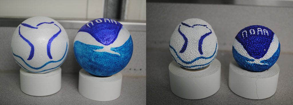
As the deeper you go in the ocean, the greater the hydrostatic pressure, or force per unit area exerted by a liquid on an object. For every 10 meters (32.8 feet) you go down, the pressure increases by 14.6 psi (pounds per square inch). As the CTD is descending to a maximum depth of 1000 meters, there is about 1,422 psi equally on all sides of the object! This gives us the opportunity to engage in a favorite on board pastime – attaching Styrofoam objects, which contain roughly 90% air at the surface, to the CTD:
That’s your featured science spotlight for the day! Check back daily for other science spotlights we are conducting aboard this eight-day research cruise to the Davidson Seamount with partners Point Blue Conservation Science. We’ll feature other science taking place, such as marine mammal and seabird surveys, as well as krill and fish trawls, coming soon!
Amity and the science team
Day 3
Day 3 – July 18, 2018
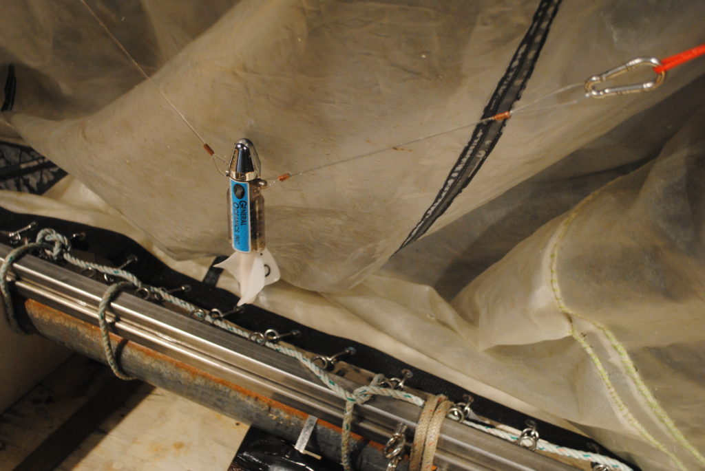
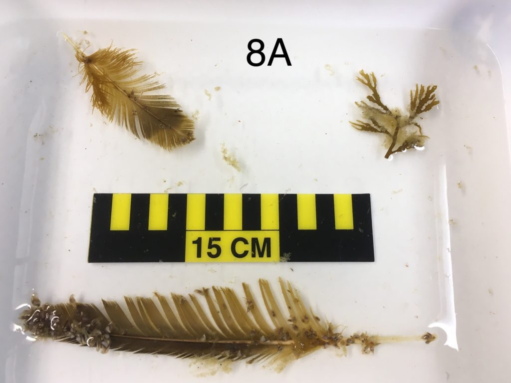
Science Spotlight: zooplankton sampling with a hoop net
Another science goal on this cruise over Davidson Seamount is to collect zooplankton (drifting animals) at 50 meters (164 feet) depth using a type of sampling net called a hoop net. This equipment is comprised of a towing line and bridles, to be able to deploy and retrieve the net, attached to a large steel hoop. A nylon mesh net is attached to the large hoop, with varying mesh size, depending upon the target species to be collected. For sampling zooplankton at this depth, we are using a 200μm diameter net, which acts like a funnel for species caught inside the net. A cod end is at the base of the net and acts as a trap for anything larger than 200μm, yet allows seawater and anything smaller to pass through.
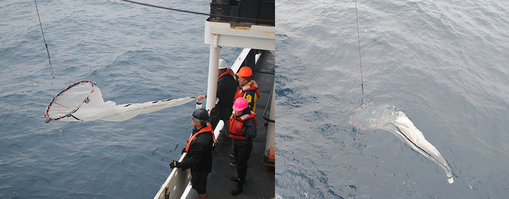
A Time Depth Recorder (TDR) is also attached to the hoop net, recording depth every 10 seconds to verify the net reached 50 meters deep. Once depth is reached, the hoop net is returned to topside and the sample is transferred into a container, using a sieve.
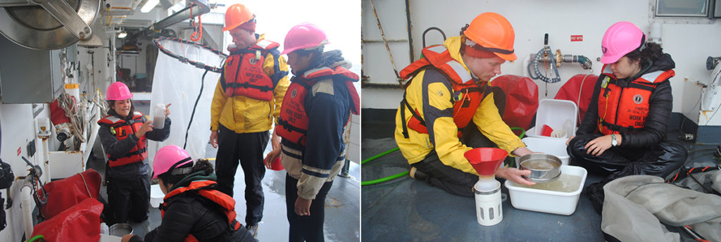
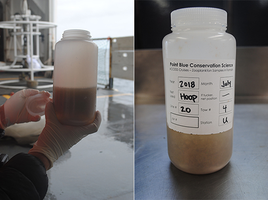
Sample containers are labeled with date and station area, formalin is added for preservation, and they are sorted into crates for storage.
The purpose of this collection is to determine species composition of zooplankton biomass during a diurnal sample at a consistent depth of 50 meters along our 60 nautical mile transects above the Davidson Seamount. Coupled with oceanographic data gathered from the CTD, this zooplankton sampling should help us better understand the linkages between oceanic conditions, prey species, and the importance of upwelling areas relating to the distribution and abundance of seabirds and marine mammals.
Stay tuned for more science spotlight on Day 4!
Amity and the science team
Day 4
Day 4 – July 19, 2018
Science Spotlight: marine mammal and seabird surveys
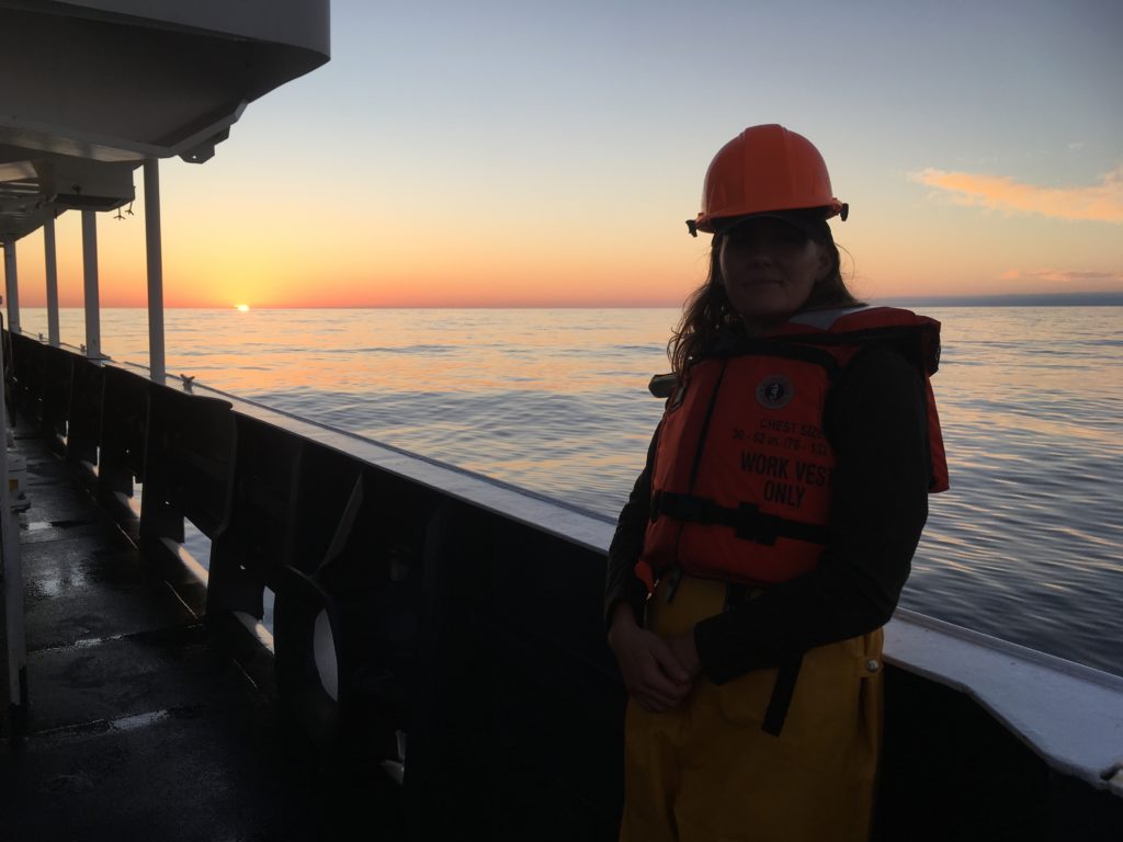
With good seas and a gentle breeze at a Beaufort Scale 3, we headed out to start day four of the marine mammal and seabird visual surveys aboard the NOAA FSV Shimada. This involves maintaining a daily watch on the flying bridge during daylight hours (approximately 0700 to 1900) by two marine mammal observers, one seabird observer, and one center line observer and data recorder. Scientists use both naked eye and binoculars to aid in the survey effort.
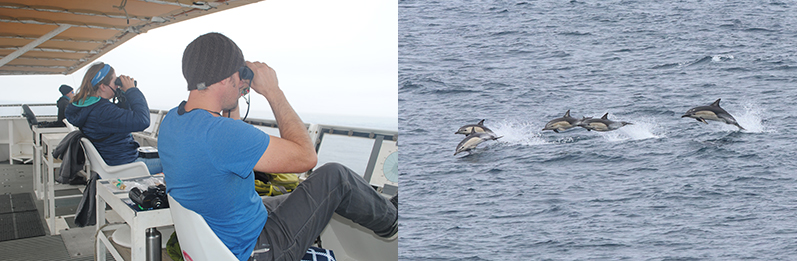
While traveling at 10 knots along our 60 nautical mile lines above Davidson Seamount, we are observing for the presence of marine mammals using a line-transect survey method. Each marine mammal observer visually surveys the area in front of the vessel to the horizon line and is allowed a survey range of 90 degrees to the port (left) and starboard (right) of the observer. The presence of any marine mammal is noted, along with species identification (if confirmed), direction to the animal, number of individuals, and behaviors such as traveling, milling, and feeding.
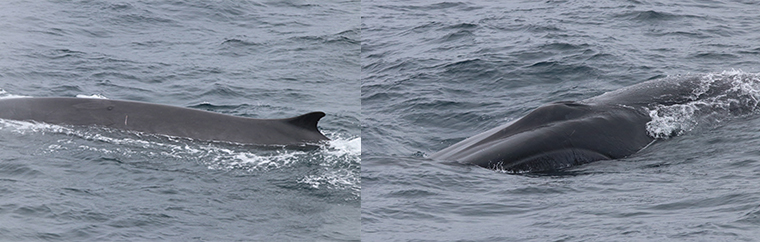
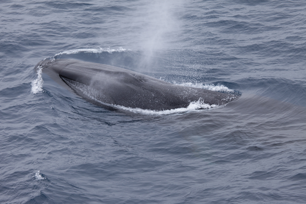
With a few sightings of blue and humpback whales, a majority of identified sightings on this cruise so far is the fin whale (Balaenoptera physalus), the second largest mammal on earth next to the blue whale. Adult fin whales are known to be approximately 60 feet in length (can reach a maximum of 88 feet) and are named for the prominent fin often visible when they surface. They are widely distributed throughout the world’s oceans but are believed to congregate over the Davidson Seamount due to the abundance of prey species such as krill.
Seabird visual observations are conducted slightly differently, using a strip-transect survey method. The seabird observer is stationed on the flying bridge but limits the survey area from 0 to 90 degrees to the starboard (right) side of the observer, and only within 300 meters of the ship. This method allows for a more precise identification of seabirds, as many species are very small and cannot be accurately identified at a great distance. Once a seabird is observed within the 300 meter zone, the species identification is noted, and a behavioral code is assigned, such as sitting, feeding, carrying fish, following the ship, piracy (harassing other birds), or directional flight. If the observer is able to note possible age, sex, or color morphs of the bird, that data is also collected.
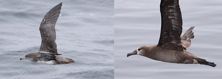
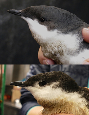
We’ve had some expected sightings for this area to date with black-footed albatross, sooty shearwaters, red-necked phalaropes, and Cassin’s auklets making the list. During the evenings, we have been visited by Scripps and Guadalupe murrelets that land on the vessel during our nighttime tucker trawls. These two species, once considered to be the same and known as Xantus’s murrelet until 2012, have slightly different facial pattern, bill shape, and vocalizations. Though rare due to low population numbers, these small oceanic birds are threatened by oil spills and busy shipping lanes through the Channel Islands.
We are wrapping up day 4 of this incredible science cruise, with very cooperative seas and great vessel crew to assist in gathering the research. Tomorrow we transit to Monterey Bay to transfer some science team members and begin leg 2 of the cruise, continuing existing research and adding water sampling for microplastics, persistent organic pollutants, and harmful algal blooms along the way.
Amity and the science team
Day 5
Day 5 – July 20, 2018
Half way through this 10 day cruise, and we have arrived back ashore in Monterey Bay to do a quick crew transfer before heading back out to sea to resume the science. We are now joined by Jennifer Brown (MBNMS), Nick Ingram (MBNMS), Sophie DeBeukelaer (MBNMS), and Sara Driscoll (Applied Marine Science).
While just off the coast of Monterey, local TV news stations KION and KSBW came aboard the vessel for a tour of the ship and to learn more about the research taking place over Davidson Seamount. Check the TV broadcast on-line on July 20th to see the coverage.
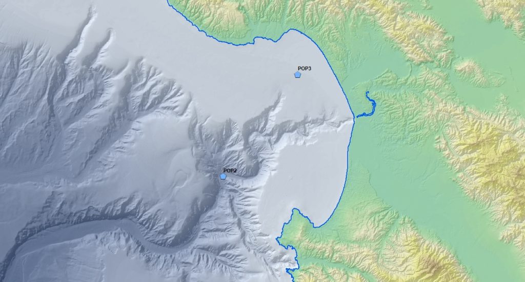
After the partial science team transfer, the vessel headed to northern Monterey Bay off the coast of Santa Cruz to conduct additional water sampling. This sample site, along with one located outside Monterey Bay and another at Davidson Seamount, will aid in tracking concentrations of persistent organic pollutants (POPs) off the coast. The samples will undergo on shore analysis, and the results will be added to the Central Coast Long-term Environmental Assessment Network (CCLEAN) database to better understand the loads of polychlorinated biphenyls (PCBs) entering Monterey Bay National Marine Sanctuary.
More science to come, as the research cruise continues over Davidson Seamount for the next four days until the NOAA FSV Shimada heads back to port in San Francisco on Tuesday, July 24.
Amity and the science team
Day 6
Day 6 – July 21, 2018
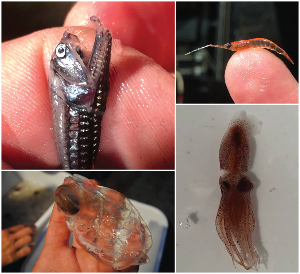
Science Spotlight: Tucker Trawl
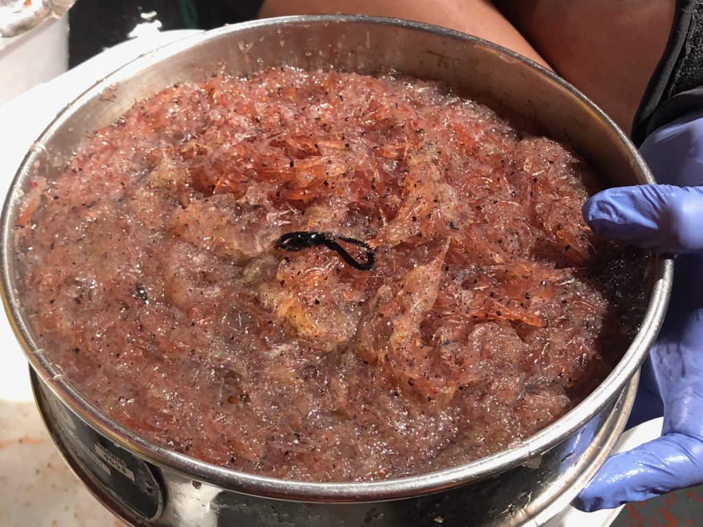
We arrived at our first station of the day just South of Davidson Seamount around 2:30 am and started sampling right away with our tucker trawl. A tucker trawl is a special net system that allows scientists to collect small midwater organisms like krill, larval fish, ctenophores, salps, and other zooplankton by slowly dragging the net behind the vessel at a specific depth. The net is constructed with metal bars at the top and bottom to hold it open laterally, while weights affixed to the bottom bar keep it open vertically as well as bring the net down to depth. As the trawl is towed through the water, planktonic organisms are funneled toward the back of the net and captured in what is known as the “cod end”, a canister like vessel at the end of the net that concentrates the sample to be collected.
Onboard the Shimada, we deploy the trawl with a hydraulic winch and a 200 m (656 ft.) cable, which puts the net about 100 m (328 ft.) below the surface of the water. Once at the desired depth, the net is towed for 10 minutes along our pre-determined transect line before it is hauled back to the boat. The net itself also has a water flow meter so we can calculate the volume of water we sampled with the net. The net also contains a small temperature and depth recorder (TDR) so we can confirm the exact depth the net was towed at.
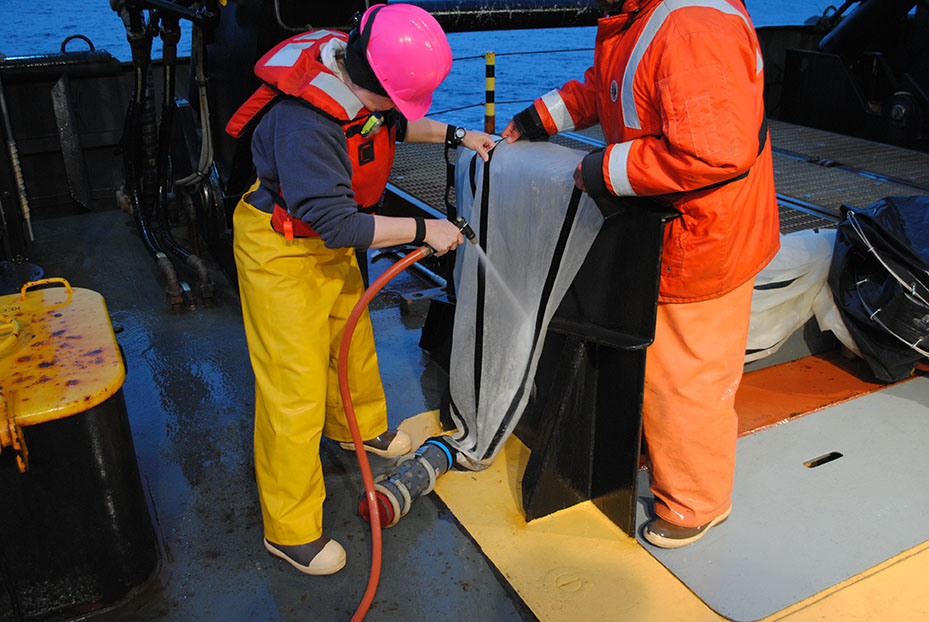
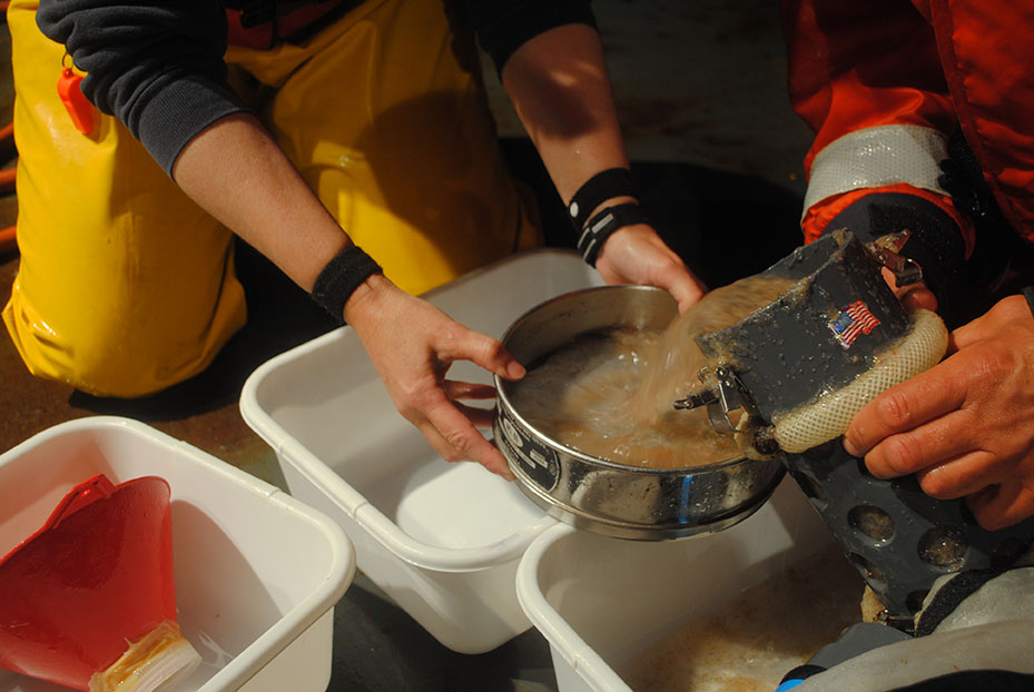
Once on board our science crew carefully rinses down the net to ensure that any organisms stuck inside the mesh are collected in the sample The cod end is then detached, the contents are strained, briefly examined, and then preserved for later analysis back on dry land.
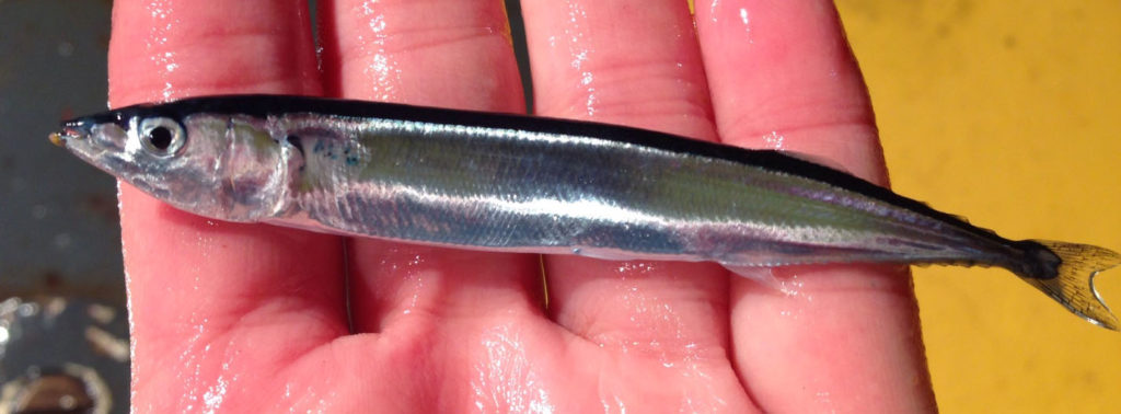
We catch all kinds of interesting things in our tucker trawl including small larval fishes, cephalopods (squid and octopuses), assorted gelatinous organisms like salps and ctenophores, but the most common catch is krill. Krill are small crustaceans of the order, Euphausiacea, and are among some of the most abundant animals on the planet in terms of biomass! They are also a vital food source for fish, seabirds, and marine mammals, which makes them of particular interest to our work out here at Davidson Seamount.
Using nets isn’t the only way we learn about midwater organisms like krill. The Bell M. Shimada’s sophisticated EK-60 echo sounder allows researchers to calculate biomass without having to actually catch the organisms. The echo sounder equipment is constantly recording what is happening underneath the vessel and this data can be used later along with tucker trawl data to calculate biomass. Additionally, net tows in conjunction with echo sounder data improve our knowledge and understanding of using acoustics to estimate biomass.
It’s a 24/7 operation out here on the Shimada, so it is back to work for now, but stay tuned for more updates from Davidson Seamount.
-Nick and the science team
Day 7
Day 7 – July 22, 2018
Cruise Update
Good evening from Davidson Seamount! As the sun sets on day 7 of the cruise, our daytime operations are just about wrapped up and the night time operations crew is gearing up for their first echo sounder transects and tucker trawl tows of the evening.
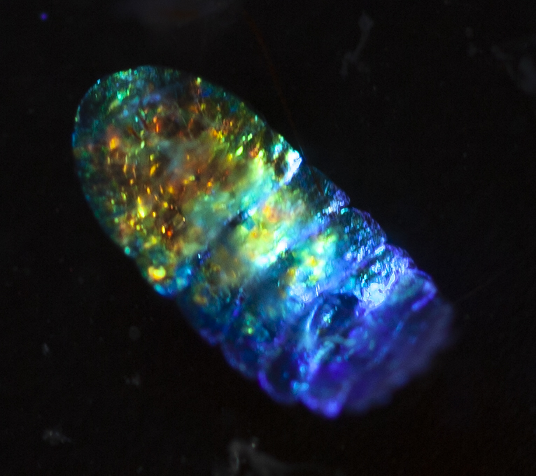
We continue to experience excellent weather and we are moving right along on our sampling schedule. Last night the science crew deployed the tucker trawl seven times before sun up when we switched to our sampling using the CTD to collect oceanographic parameters as well as using a hoop net to collect phytoplankton. Our recent hoop net tows have yielded some especially interesting finds.
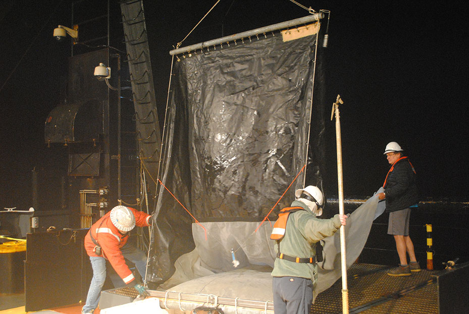
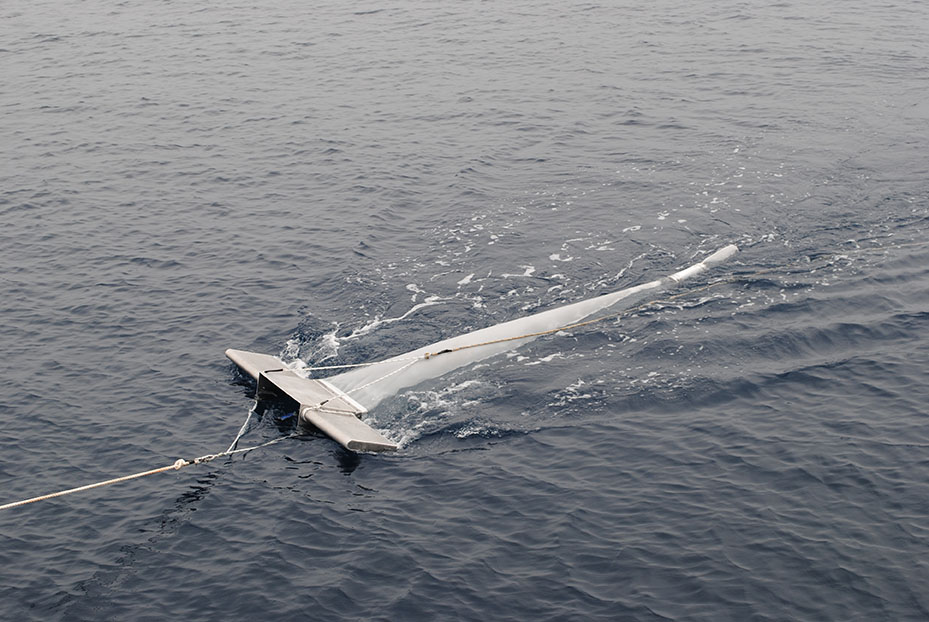
In addition to collecting oceanographic data and biological samples, we are also sampling for something else, microplastics! When plastic enters the ocean, it continues to break down into smaller and smaller pieces as it is exposed to sunlight, seawater, and wave action. These small pieces of plastic tend to concentrate near the surface of the ocean. To sample for the presence of these microplastics over Davidson Seamount we are deploying a specially designed net called a “manta trawl” which skims the surface layer of the ocean to collect any microplastics that might be present in its path. Just like the tucker trawl and hoop net, the manta trawl also has a flow meter that lets us calculate the concentration of microplastics should we find any in the samples.
We had some amazing encounters with some of the magnificent marine mammal species that inhabit this remote patch of ocean above Davidson Seamount. Our sharp eyed marine mammal and seabird observers spotted several fin whales, Balaenoptera physalus, today! Normally these ocean giants are seen at a fair distance but we were treated to a show when one passed very close to the ship.
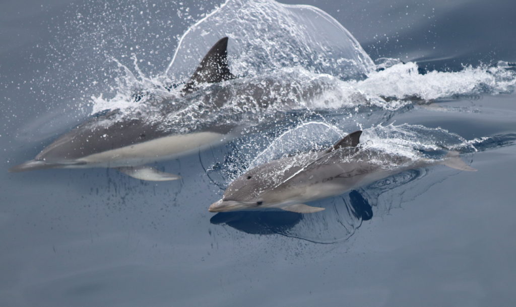
There were also several groups of short-beaked common dolphins, Delphinus delphis, spotted on today’s transects. The largest group spotted consisted of about 150 individuals! These animals are often found in the waters near undersea ridges and seamounts like Davidson. These areas are usually the site of strong upwelling, a process that brings nutrient rich water from the deep sea up to the surface, which provides excellent feeding grounds for marine mammals and seabirds.
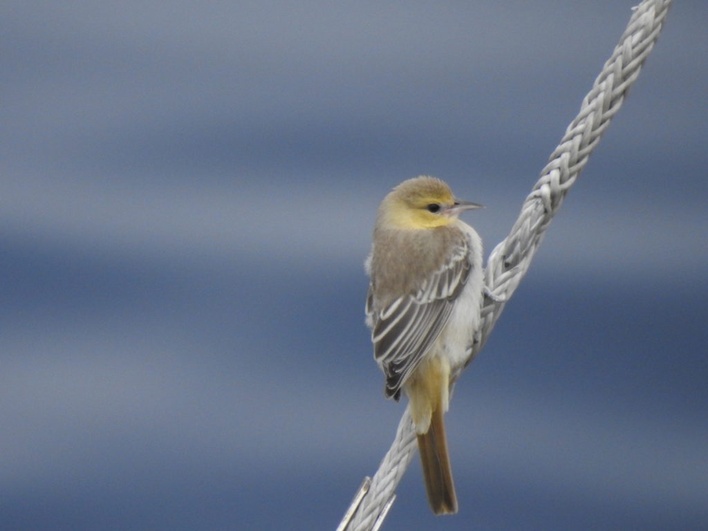
We also had a special visitor come aboard today. A young Bullock’s Oriole landed on the deck early this morning and spent the day with us. These bird’s aren’t typically found this far out to sea. It is likely that this individual became disoriented in the fog and ended up offshore. Below is a photo of the bird resting aboard our vessel.
Tomorrow is our last day of sampling, and there is no telling what we might see next so stay tuned for more updates from this exciting expedition to Davidson Seamount!
-Nick and the science crew
Day 8
Day 8 – July 23, 2018
Last day of sampling!
Today is our final day of sampling aboard FSV Bell M. Shimada on our cruise to Davidson Seamount. The excellent weather we have experienced over the last few days has helped us stay right on schedule. Our night time operations crew was able to deploy and recover the tucker trawl another seven times last night along our transect. which wraps up our tucker trawl sampling for this cruise. As for day time operations we completed another full transect with marine mammal and seabird observations, hoop net tows, and water column profiles with the CTD.
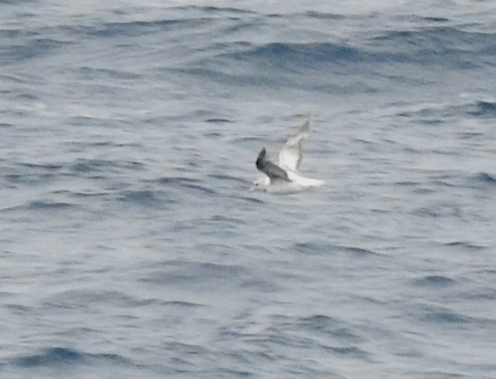
Slightly higher winds resulted in choppier seas today, which made it a little bit tougher for our seabird and mammal observers to spot the animals around the boat. Despite less than ideal conditions, our highly skilled observers were still able to document some of the awesome creatures that call this place home. One interesting find was a northern fulmar, Fulmarus glacialis. Northern fulmars have two main color morphs, a dark morph consisting of uniform gray coloration and a light morph consisting of a white head and body with gray wings and tail. Typically, the light morph is more common in the northern part of the range and the dark morph more common in the southern part of the range.
We also spotted two Cuvier’s beaked whales, Xiphius cavirostris, which are rare and usually found in offshore pelagic waters greater than 1,000 meters (3,300 feet) deep. The summit of Davidson seamount is almost 4,000 feet below the surface, making the surrounding waters a very suitable habitat for these animals. Unfortunately, the rough seas and distance at which we spotted the animal prevented us from getting a photo.
We have successfully completed all of our sampling at Davidson Seamount, but we aren’t done yet. Throughout the course of this second leg we have been taking water samples to check for persistent organic pollutants (POPs) and still have one last area to sample. We have already successfully collected one sample from northern Monterey bay as well as one from Davidson Seamount. As we head north away from the seamount we have set a course for a location just outside the mouth of Monterey Bay directly over Monterey submarine canyon.
Once on station, we will collect about 200 liters (52 gallons) of seawater from just below the surface. That water is then filtered using a small pump and specially designed filter that will concentrate any POPs for later analysis in a lab setting. Types of chemicals that will be tested for include polychlorinated biphenyls (PCBs) and polybrominated diphenyl ethers (PBDEs). Both of these chemical types are commonly used in flame retardants, pesticides, and plastic products as a stabilizer. By analyzing water from different areas both nearshore and offshore we can better understand how POPs might be distributed.
As the sun sets on this final day of sampling the crew is busy rinsing down equipment, packing up their belongings, and preparing for our arrival into San Francisco tomorrow afternoon. Stay tuned for more updates and a cruise recap tomorrow!
-Nick and the science crew
Day 9
Day 9 – July 24, 2018
Transit Day
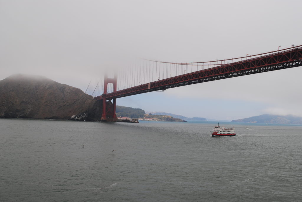
We finished collecting the last of our samples around 2:30 AM and set a course for San Francisco Bay and crossed under the Golden Gate Bridge just before 11:00 AM this morning. As the science crew are packing up their personal belongings, the crew of NOAA ship, Bell M. Shimada are getting her ready to dock. Docking a 208 foot long vessel is no easy task, especially in the ever shifting currents of San Francisco Bay.
As we prepare to disembark we are all reflecting on this amazing opportunity we had to explore such a unique and relatively unexplored region of ocean. Over the past 9 days we have collected marine mammal and seabird observations along 336 miles of transect lines. That is roughly the same distance as a line drawn from Catalina Island to San Francisco. Other sampling accomplishments included 36 tucker trawl tows, 30 CTD water column profiles to 1000 meters (3,300 feet), 30 hoop net samples, and over 600 liters of water filtered for persistent organic pollutants All of this data combined with information collected from the ship’s onboard sensors and echo sounder will give us a much better understanding of the habitat over Davidson Seamount.
The crew of the Bell M. Shimada deserve a special thank you for keeping us safe, on station, and of course well fed while conducting our operations. Their experience and professionalism made them a pleasure to work with, and our research efforts would not have been possible without them.
-Nick and the science crew
Videos
All videos shot by Jaime Jahncke and Ryan Anderson of Point Blue Conservation Science and produced by Jaime Jahncke.
Marine Birds on Davidson Seamount
Sophie Webb, Research Associate with Point Blue Conservation Science, provides seabird highlights from the latest expedition to the Davidson Seamount within Monterey Bay National Marine Sanctuary:
Marine Mammals on Davidson Seamount
Cotton Rockwood, Senior Scientist with Point Blue Conservation Science, provides marine mammal highlights from the latest expedition to the Davidson Seamount within Monterey Bay National Marine Sanctuary:
Sampling Microplastics in the Ocean
Chad King, Research Specialist at the Monterey Bay National Marine Sanctuary, explains how and why we sample microplastics in the ocean:
THE PREY: Sampling Krill and Fish at Depth
Erica Burton, Research Specialist at the Monterey Bay National Marine Sanctuary, explains how and why we sample zooplankton and fish at depth in the ocean: