Cruise Blog: Exploring sea life over the spectacular Davidson Seamount: a research cruise in the Monterey Bay National Marine Sanctuary (May 4-13, 2015)
Follow this daily blog as we conduct an eight-day research cruise within Monterey Bay National Marine Sanctuary from May 4-13, 2015. Mesopelagic fish surveys will be conducted within Sanctuary Ecologically Significant Areas (SESAs), including Davidson Seamount Management Zone (DSMZ). We will also be observing marine mammals and seabirds above and adjacent to the Davidson Seamount, with both traditional human-observer methods and with an unmanned aircraft system. Additional research includes recording of marine mammal and ocean noise (hydrophone), oceanographic data and water sampling (CTD), collection of water samples for environmental DNA analysis (CTD), and filming for video production of NOAA research and collaborative Marine Biodiversity Observatory Network (MBON).
Where is the Shimada now? (live map)
Day 8 – May 12, 2015
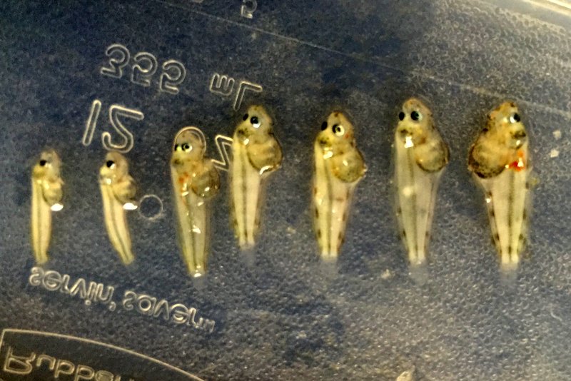
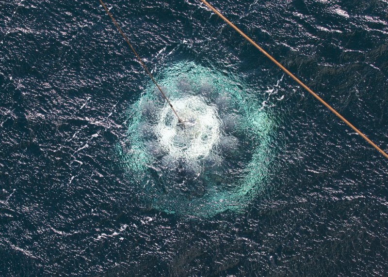
Today was our last day of research on this exciting expedition. As Paul mentioned in yesterday’s post, MBNMS established Sanctuary Ecologically Significant Areas (SESAs) a couple of years ago. These are areas that we believe are special for a number of reasons, and because of that, warrant more research. We followed through in that philosophy with trawls for fishes and CTD casts in four SESAs within and outside of Monterey Bay. One, in particular, is more than 10,000 feet deep, and we sent the Shimada’s CTD to its new record depth of 2,100 meters. The ship’s crew was particularly excited in establishing this new ship record, and we were happy to oblige.
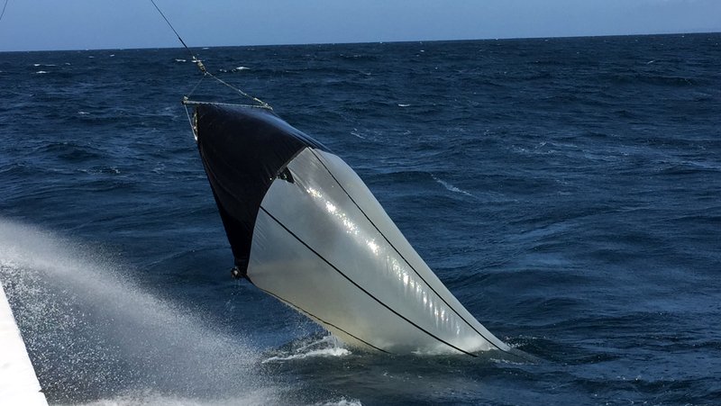
For the entirety of this expedition, we ran 13 fish trawls, cast more than 20 CTDs, observed hundreds of seabirds (some rare), whales, and other marine mammals within dozens of kilometers of transects, extracted DNA from shadows of the sea, consumed 25 meals in the galley (not to mention an embarrassing number of ice cream treats), and made many new friends.
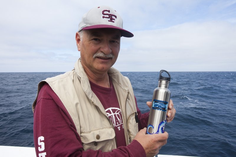
In past expeditions to Davidson Seamount, we’ve seen plastic bottles floating by on the sea surface and plastic trash at 11,000 feet deep. Thank you to NOAA’s Ocean Guardian Schools for their efforts to reduce waste and educate their communities on how to do the same. Using reusable water bottles, like this one from an Ocean Guardian School, is one easy way to reduce trash in the oceans.
This research expedition would not have been possible without great partnerships among many institutions. Thank you:
- National Oceanic and Atmospheric Administration
- Monterey Bay National Marine Sanctuary
- Save The Earth
- University of California at Santa Cruz
- Stanford University
- Moss Landing Marine Laboratories
- Center for Ocean Solutions
- California Academy of Sciences
- Council on Ocean Affairs Science and Technology
- National Marine Fisheries Service
- and the outstanding crew of the NOAA Ship Bell M. Shimada
We’ll have one more entry to wrap-up this expedition in the coming week, but Monterey Bay National Marine Sanctuary and its partners would like to thank you for following this blog. It’s been a pleasure.
Chad
===================================
Day 7 – May 11, 2015
Today’s guest blog is written by MBNMS Superintendent, Paul Michel:
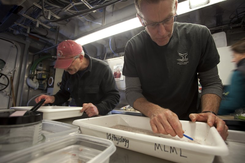
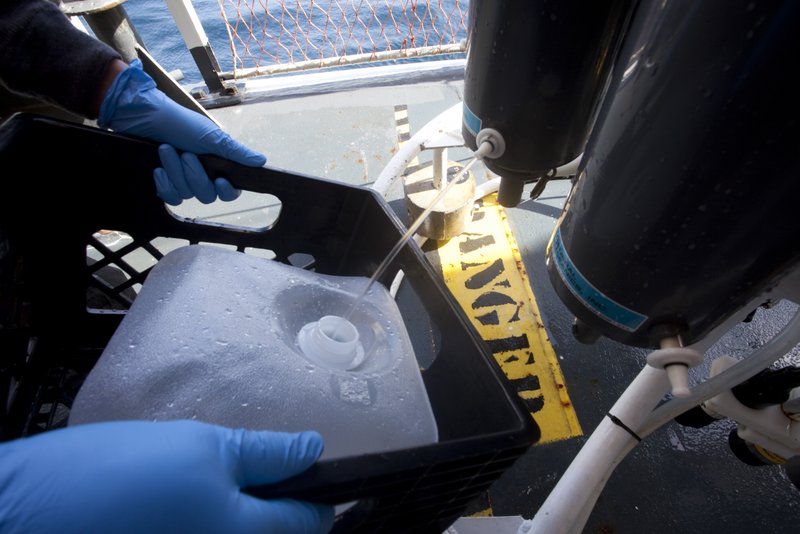
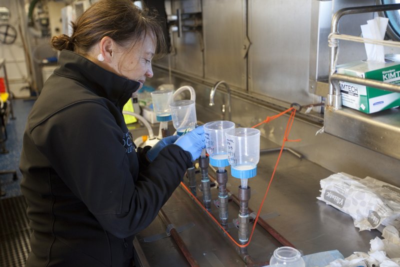
Running from the rough seas that built at Davidson Seamount late on day 6, we started day 7 in the calmer waters of Monterey Bay. Taking advantage of the work done in recent years to identify SESAs, Sanctuary Ecologically Significant Areas, we focused data collection in SESAs 6, 8, and 9 (see map here). We want to build on our knowledge of the SESAs, given that they represent some of the more remarkable, unique, and diverse deep-water benthic habitats in a sanctuary that is so large. While we continued to collect mesopelagic fish, a special focus today was on collecting sea water for DNA analysis, collecting at various depths, both within and outside of the scattering layer, to reveal the breadth and type of organisms there by the DNA trail they leave behind. Very cool!
The relatively calmer seas early in the day afforded more opportunities to enjoy seeing Humpback whales and various seabirds (Fulmars, Shearwaters, Albatrosses), even though that portion of the science mission was over. By mid-morning though, working on the outer edge of the bay, wind and seas picked up, providing great wave and white-cap viewing!!
Being out on the open sea and looking out towards the horizon, I am moved by the immensity, power, and importance of the ocean, that most of this planet is this view of water and sky. I am humbled by this context, as well as by how little we actually know and understand about the marine environment. National Marine Sanctuaries provide us fantastic opportunities for gaining such perspectives and pursuing meaningful science.
Paul
======================================
Day 6 – May 10, 2015
Happy Mother’s Day!
Today’s guest blog is written by MBNMS Superintendent, Paul Michel:
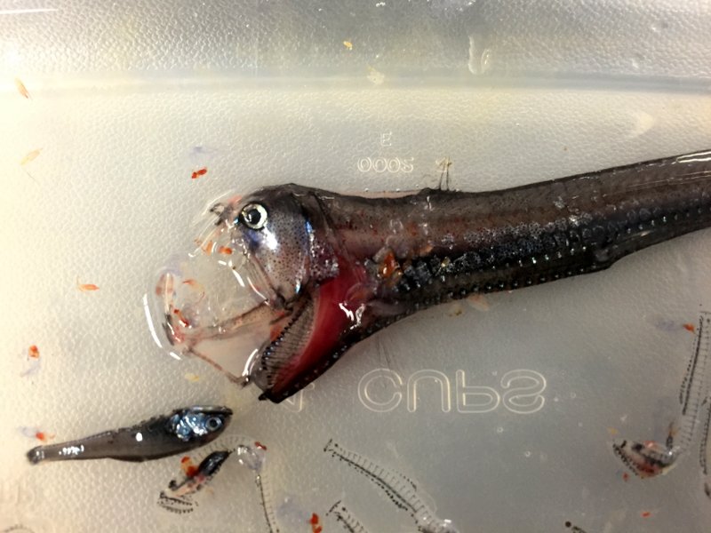
Today, on a slate-blue sea and gray skies overhead, seventy miles offshore and over the Davidson Seamount, we went after the largest migration of animals on the planet. That’s right, we targeted the “scattering layer” – a thick (100-150 meters) band of small creatures which rise and fall with the day and night, coming closer to the surface (50-100 meter depths) at night, and falling to 350-450 meter depths during the day (on average here). Our specific focus was on collecting and recording mid-water (mesopelagic) fishes. The trawl net captures a small canister of odd-looking, tiny organisms. Sorting through the soupy gelatinous mass, we pick out the small fishes, which if were our size, would be very scary creatures indeed, much like the viperfish below!
The scattering layer got its name from the early days of sonar, when mariners were confused by the scattering and reflection of the sonar, giving an impression of a much shallower sea, when in fact it was this layer of biomass that was interfering with the depth finding sonar. Today, we recognize the importance of the scattering layer as a foundation of the food chain. Larger fishes, like tuna and salmon feed on organisms in the scattering layer. Many of the organisms found in this layer spend their entire lives here, while others are larvae or juvenile stages that move on (like octopus and squid).
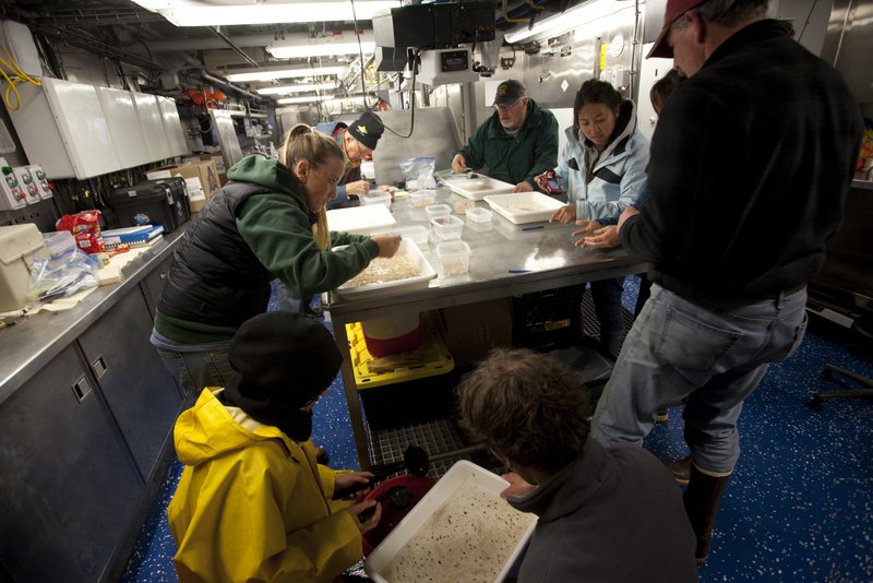
Understanding the scattering layer and mesopelagic fishes above the Davidson Seamount, and comparing this to other areas, will tell us a lot about the biological effect and importance of the seamount.
-Paul
================================
Day 5 – May 9, 2015
We pulled into northern Monterey Bay around 5 am, welcomed by calm seas near Santa Cruz. Today, we “changed out” science crew (there are four of us staying for the entire duration). Santa Cruz Harbor Patrol graciously contracted out their vessel to us, and being that it’s encased by an inflated galvanized rubber hull, it made pulling aside a huge metal ship as safe as it could be. Personnel transferred to each vessel via a “Jacob’s ladder,” or a rope ladder. Our first visitors were VIPs from shore, including Sanctuary Exploration Center volunteers, Save the Earth founder Neal Pargman, and members of the media. They toured various stations on the Shimada, each manned by a scientist with gear and stories, getting a crash course in the cruise overview including unmanned aircraft systems, acoustic identification of whales and dolphins, a stop with the CTD on the starboard deck, a tour of the bridge, and how we view marine mammals and seabirds on the flying bridge.
Throughout the morning we transferred leg 1 scientists off and leg 2 scientists on. Andrew DeVogelaere and I briefly went to shore to give a presentation to the media and public and the Sanctuary Exploration Center before getting back onto the Shimada with leg 2 participant and MBNMS Superintendent, Paul Michel. Look for Andrew’s interview on KSBW-8, and a nice article in the Santa Cruz Sentinel.
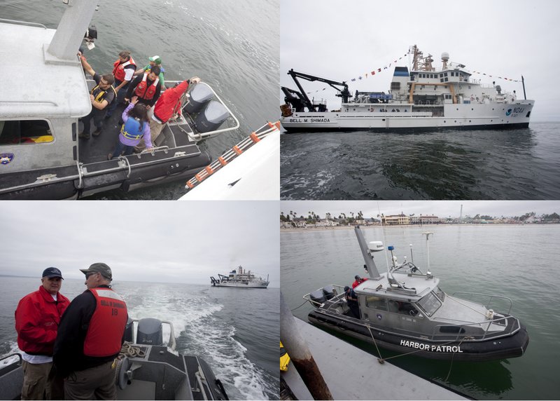
On the way to Sur Ridge, we unofficially counted over 50 humpack whales, pods of Pacific white-sided dolphins, fin whales, and countless birds. The sea was remarkably calm; it’s quite astounding the change in conditions in less than 24 hours. Crew can walk the hallways without fear of dislocating a shoulder.
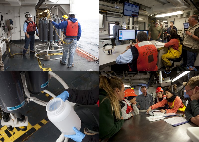
At Sur Ridge, we deployed two CTDs to 500 meters for profiles of salinity, temperature and oxygen, followed by a tucker trawl to sample mid-water fishes at 500 meters. We licked our lips in anticipation for what was in the cod-end, and we were not disappointed. Although full of gelatinous creatures, krill and an assortment of invertebrates, we were after the fishes. As I write this, scientists are buzzing with activity in the wet lab, giddily sorting fishes into families. We’ll have a more general report of what we find over the next few days.
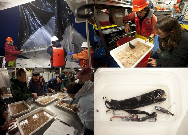
We are now heading to the Davidson Seamount, where we expect to cast CTDs between 1 and 3 AM, which will include water sampling for our environmental DNA project, followed by a mid-water trawl at 500 meters around 5 AM. The rest of the day will include a repeat of these tasks.
Lots to do! I’m going back to the wet lab with my camera.
Chad
=======================================================
Day 4 – May 8, 2015
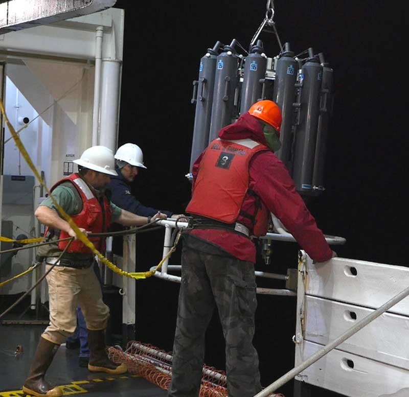
Some of our science crew stayed up until the wee hours of the morning to deploy a CTD twice. This common oceanographic instrument measures temperature, salinity and oxygen (among other metrics) by depth on the way down and back. One was deployed to a depth of 1,200 meters near the summit of the Davidson Seamount, the second to 1,000 meters on the slope of the seamount. The summit is approximately 1,250 meters below the surface.
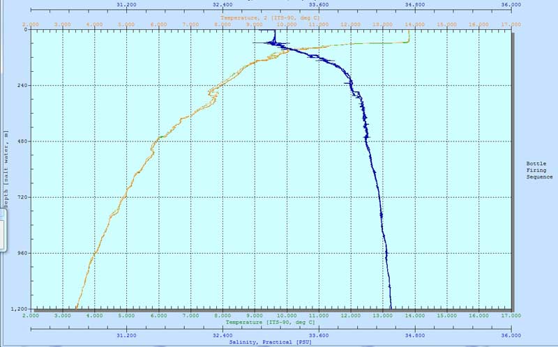
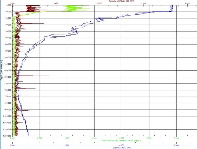
The graph above shows temperature and salinity by depth. Salinity increases with depth, while temperature decreases to near-freezing temperatures. Oxygen levels are a bit different, and as you can see in the graph below, actually declines sharply with depth before rising slowly again. This well-known zone to oceanographers and marine biologists is the “oxygen minimum zone (OMZ)” typically between 600 and 800 meters off of central California. Typically, the top layer is mixed well with the atmosphere, providing plenty of oxygen to organisms there. As organic matter falls deeper, bacteria use oxygen to break it down. Eventually, the consumption of oxygen exceeds the rate at which it is replenished. This depth zone is not devoid of life, but generally has a lower richness and diversity, and many animals that do live here have adapted to the low-oxygen environment. The CTD graph below shows the OMZ was about 660 to 780 meters, a typical range. Oxygen starts increasing again as one goes deeper due to a decrease in bacterial metabolism of organic matter.
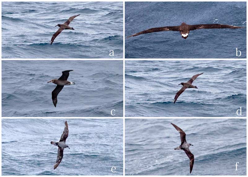
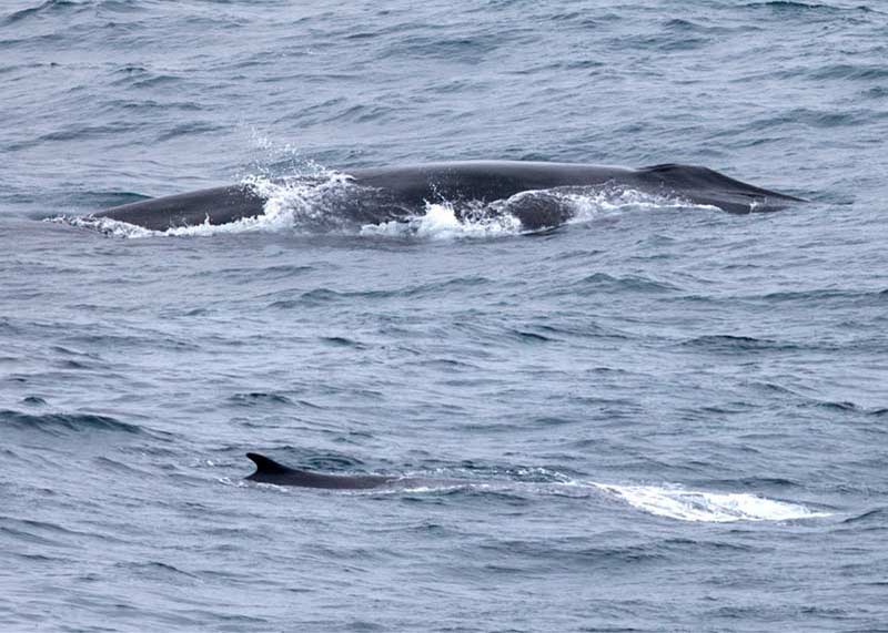
Winds were down to “only” 20 knots today and a swell of a “mild” 6-9 feet. However, this was a significant improvement over the 30-35 knot winds and 15 foot waves we experienced earlier. This made marine mammal observations much more comfortable. We transited over the Davidson Seamount in five stratified transects, each one perpendicular to the seamount’s main axis. Most of the birds seen yesterday and the day before were seen again, with the addition of a Hawaiian petrel, a rare sighting, and many of the observers’ first glimpse of that species. Two unidentified whales, a fin whale (pictured below the birds), Pacific white-sided dolphins and a blue shark were seen.
We went down swinging with the UAS, going 0-3. The pilots depart tomorrow, so we will not be able to conduct any aerial observations of marine mammals. The winds were calm enough to fly today, but the swell prevented a safe launch and recovery of the work boat used to retrieve the UAS after a water landing.
This evening, we will start steaming towards Santa Cruz for a media event on the ship and at in town. If you are interested in attending, the event will start around 10 AM at the Sanctuary Exploration Center. Additionally, Chet Forrest, author of “Emotions for the Oceans” will be signing books at 11 AM.
On the way to Santa Cruz, we will cast a CTD over Sur Ridge, a site where we recently discovered long-lived and rare corals and symbiotic clams in December 2013. During our stop in Santa Cruz we will be switching out science crew, with leg two focused on fish trawls and eDNA sampling. The Monterey Bay National Marine Sanctuary would like to send a big “Thank You” to the leg 1 scientists, most of whom will be departing tomorrow (pictured below)!
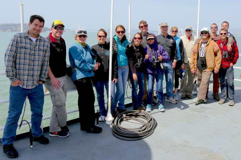
Chad
=====================================================
Day 3 – May 7, 2015
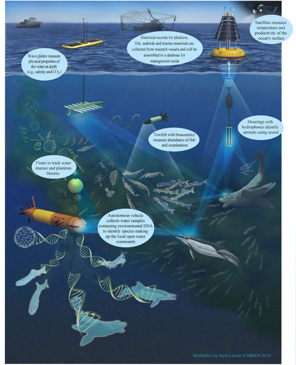
All of the studies we are conducting will be integrated into the Marine Biodiversity Observation Network (MBON), which is a national pilot program to monitor the health of Monterey Bay and Florida Keys National Marine Sanctuaries. Related to the graphic below, which pictures only a portion of the work going on in central California, we are using tools such as an Acoustic Doppler Current Profiler (ADCP) to measure ocean currents, hydrophones to record whale sounds, echosounders to locate schools of fishes and other organisms, Unmanned Aircraft System (UAS) to observer marine mammals, fish trawls to study midwater fishes, and eDNA to detect what organisms were in a sampled patch of water within the past couple of days.
The weather was rough again today, but we managed to run a transect across the Davidson Seamount and adjacent to it. An unidentified whale and Pacific white-sided dolphins were seen in addition to a myriad of seabirds similar to what were observed yesterday.
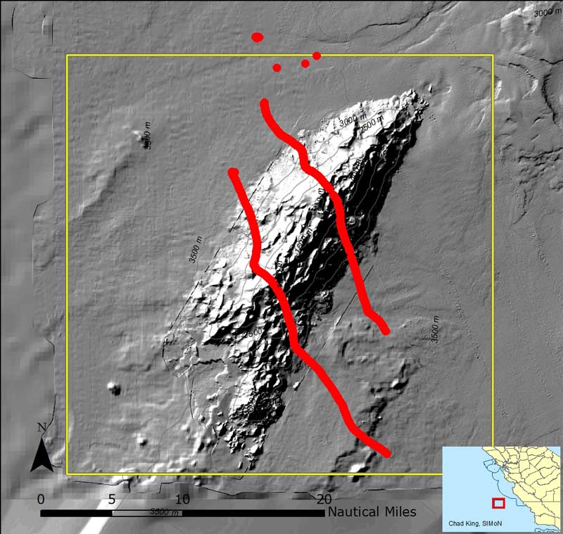
The two remaining hydrophones were retrieved just southeast of the Davidson Seamount (see map above), and several whale calls were recorded. Below is an audio recording of a fin whale (Balaenoptera physalus) recorded today. It has been sped up by a factor of 5, and is distinct with its percussive sound. You have to listen closely. This audio recording lets us know that fin whales are in the area, even though we haven’t seen one.
Audio recording of a fin whale from May 7, 2015. The audio has been sped up 5 times. It has a distinct repetitive percussive sound. (Courtesy of David Cade, Stanford)
Tomorrow is our last chance to launch the UAS before the pilots depart on Friday, but the weather is supposed to calm down. This may provide us a better opportunity to see many more marine mammals that have probably been hidden by the high seas and high density of white caps and seaspray.
Night operations will take the ship in a zig-zag path over the Davidson Seamount while we run the echosounder to detect schools of fishes and the ADCP to measure ocean currents. Between midnight and 3 AM, we will deploy two CTDs to obtain a profile of salinity, temperature, and oxygen by depth down to 1,200 meters and 1,000 meters. Most of the day crew will be sleeping by then, but as we wind down this evening, we’ll be catching up on work, watching a movie, reading a book, and generally trying not to eat too much ice cream.
Chad
=======================================
Day 2 – May 6, 2015
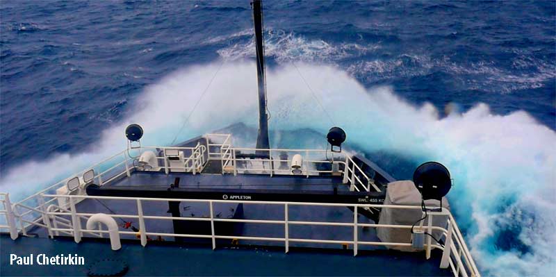
It was an incredibly tough night to sleep for the crew. Most of us woke up around 3 AM when the seas tossed gear from shelves and crew just about out of their bunks with the spiking undulating motion of the Shimada. With resolve and various caffeine sources, the crew pressed on to start the first full day of research.
Three hydrophones were deployed between 2:30 and 8:30 AM in three different locations just northwest of the Davidson Seamount. These underwater microphones will record sounds from marine mammals over the next two days as they drift. We can find them through a map updated with their live GPS coordinates, and when the ship approaches, we can zero in on their location from a radio signal they actively transmit. Unfortunately, the GPS signal on one of the hydrophones has failed, so we had to retrieve it in the late afternoon. That means we won’t have precise location information for the source of sounds recorded, as you need three hydrophones to triangulate.
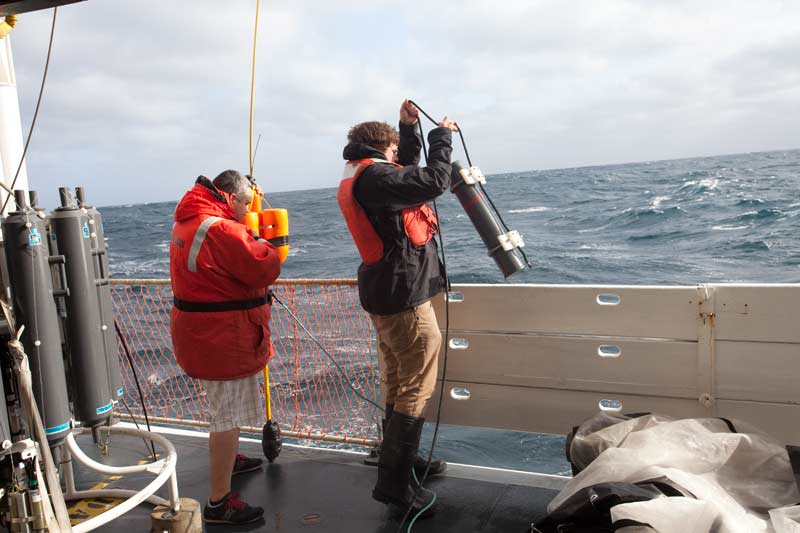
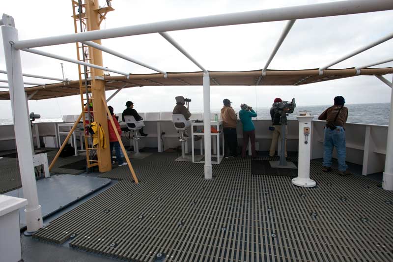
Marine mammal and seabird observation transects began at 9 AM this morning, but we cannot analyze the data collected today, as conditions are above a Beaufort 5 (17-21 knot winds and 4-8 foot seas). Seas were at a Beaufort 6 and 7 throughout the day. High seas prevent us from seeing very far from the ship, limiting our potential view of animals. The Shimada’s bow nosed into waves as high as 15 feet, producing some spectacular images, but we didn’t even capture the biggest waves of the day. However, any qualitative observations are still valuable to us. Although we did not see any marine mammals, we did encounter seabirds, including Murphy’s and Cook’s petrels, Leach’s storm petrels, Layson and Black-footed albatross, Sooty and Pink-footed shearwaters, and Northern fulmars. Ocean sunfish (Mola mola) were the only non-birds observed.
The unmanned aircraft system (UAS) could not fly today due to the high winds and seas. The forecast calls for poor conditions to continue tomorrow before abating on Friday, so we’re hoping that we can at least fly then so as to avoid a full cancellation of this project. The best laid plans…
Despite planning a complex scientific mission over many months, in the end, Mother Nature has limited our accomplishments these first two days. Alas, there are still seven more!
Chad
======================================
Day 1 – May 5, 2015
Yesterday was the culmination of months of preparation for this research expedition, but we can finally switch from logistics mode to research mode. All 38 research and ship crew boarded without incident, and all scientific gear made it aboard in one piece.
WHEW!
After stowing equipment and settling into staterooms, various groups spent their last night “on land” by strolling to dinner, enjoying the Giants’ game at nearby AT&T Park, or simply enjoying a movie or a good book before drifting off to sleep.
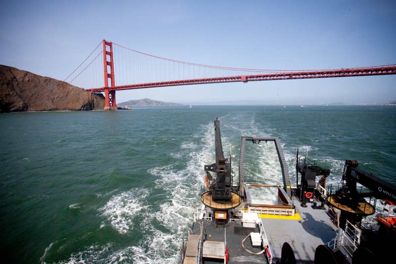
Our original departure time from Pier 50 was pushed back from 9 AM to 2 PM, but it will not impact research operations, as we will still arrive at the Davidson Seamount before dawn tomorrow. The delay did, however, provide scientists with additional time to prepare and calibrate their instrumentation; wise not to do this on a rocking boat! After leaving the dock, we assembled on the flying bridge to a visual treat when we sailed under both the Bay and Golden Gate Bridges, accompanied by the stunning San Francisco skyline.
Our first full day of research activities will start around 2:30 AM tomorrow when we will deploy three hydrophones near the Davidson Seamount. These hydrophones will be allowed to drift for two days, recording marine mammal sounds. Once the hydrophones are collected, the location of each marine mammal recorded will be triangulated by using the position of all three. Most whale sounds can be identified to species, while dolphins can be more complex to assign. After sunrise, marine mammal and seabird observers will man their stations on the flying bridge and record any species, counts and locations they can see with binoculars or “Big Eyes,” which are two powerful binoculars (45x) attached to a stand and an articulating yolk. Finally, two NOAA pilots will launch an unmanned aircraft system (UAS) to observe marine mammals via live video transmitted from a fully gimbaled video camera. The results from all three projects will be compared and contrasted, but also integrated to form a more holistic view of marine mammal presence and diversity over and near the Davidson Seamount.
Unfortunately, the marine forecast is not a good one, calling for high winds and seas. This may put the UAS operations in jeopardy, as the plane can’t fly in high winds. We all have to remember that Mother Nature is the boss out here, and we have to work around her conditions!
Don’t forget to like us on Facebook and follow us on Twitter @MBNMS.
Chad
======================================
April 27, 2015
We are exactly one week away from boarding the NOAA ship Bell M Shimada in San Francisco, and boy is there a lot of preparation that goes into a cruise like this! We are in the last throws of receiving science equipment, calibrating sensors, confirming truck rentals, scheduling forklift operators, finalizing cruise instructions and media relations, developing bios and cruise blogs such as this one, and many, many mundane tasks that are necessary to pull off a research cruise with so many moving parts and people.
You can read more about the background of this project, sampling locations, and methodology on our project background page. Also, our chief scientist has developed this handy little infographic that summarizes the research we will be conducting:
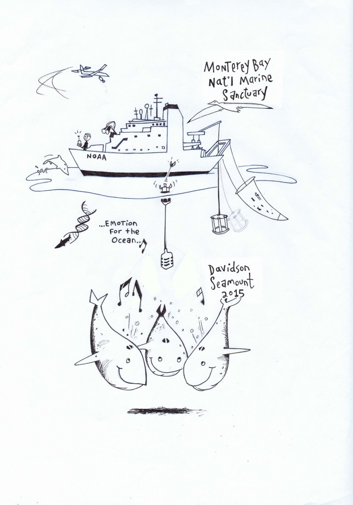
Until then, follow along daily between May 4 and 13…this should be an exciting expedition!
– Chad