DAY 6 – December 16, 2013 – Going Home
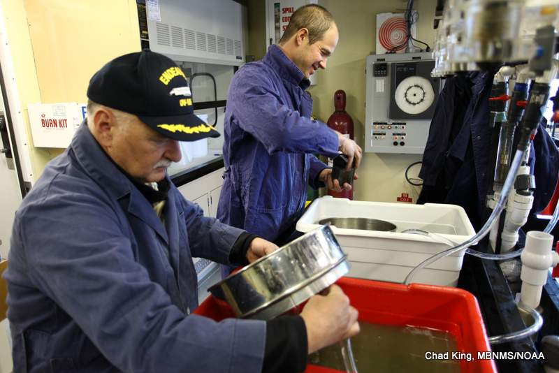
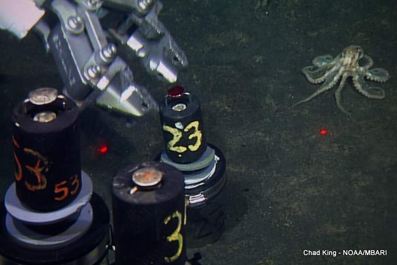
We wrapped up this six-day expedition with our shallowest set of dives. Like days one and three, today’s goal was to collect sediment push cores, urchins and other macrofauna inside and outside of three cages, but this time from the 200 meter depth zone instead of the 600 or 1,000 meter zone. In fact, the ROV Doc Ricketts is not permitted to operate shallower than 200 meters. However, this is still far beyond the depths of normal SCUBA diving. The first dive was almost aborted, as winds were a fairly strong 22 knots, but the winds calmed down, and diving continued. A total of 90 sediment push cores were collected (30 on each dive). In between each dive, the science crew got busy once again sieving the mud away from the sediment and animals for preservation to be identified and counted later.
Many animals were attracted to the cages, including spot prawns, octopuses, basket stars, sea stars, sea cucumbers, and several species of rockfishes. At one point, there was even competition between several octopuses and spot prawns for some urchin gonads that were spilled when an urchin was cracked open accidentally.
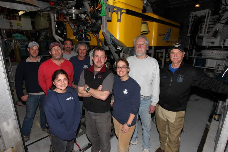
We exceeded expectations for this six-day research cruise. We accomplished every goal set forth, further documented the state of a lost shipping container, explored and discovered a new area of dense forests of corals and sponges and cold seeps at Sur Ridge, and assisted Dr. Barry with his long-term deep-sea benthic ecology experiments. The weather cooperated, technology did not let us down, and the crew of Monterey Bay Aquarium Research Institute’s research vessel, Western Flyer, could not have been more professional, going out of their way to meet our every request and need.
We are set to pull into Moss Landing Harbor during high tide at 9:30 pm, so most of the crew will get home late tonight, but will be glad to sleep in our familiar beds.

Thanks for checking out our cruise log, and look for more information about this research trip in the near future! We’ll be releasing preliminary species lists, uploading pictures to our photo database and creating short videos, among other resources for the public. You can also view MBARI’s cruise log, which includes information about the entire science crew. In the meantime, you can keep up with this project and general information about the Monterey Bay National Marine Sanctuary at the following resources:
- Monterey Bay National Marine Sanctuary Website
- Sanctuary Integrated Monitoring Network
Cheers!
Chad King
====================================================
DAY 5 – December 15, 2013 – Seeing the Forest for the Corals
While a typical day of diving with an ROV is exciting, most of the time there is a target, collections to take, measurements to make, and limited time to do it. This can add pressure to the scientists and crew if weather or a mechanical problems delay tasks. Today was not a typical day.
We explored.
Without the constraints of a “to-do” list, we made two dives on Sur Ridge, a moderate-sized bump on the seafloor, about 28 miles offshore of Point Sur, CA. There have only been a couple of dives on this feature by a geologist about 10 years ago, but not in this area. We were the first humans ever to see this part of the seafloor.
This feature is about 11 miles long and 3 miles wide, or about the size of Manhattan Island.
Now, the ROV only can see about 15 feet wide and might travel only a mile in a day. Think about it. This is the same as if someone lowered you by helicopter into Manhattan, in the dark. Now, you turn on your flashlight and go about 1 mile forward. Now, tell me you can surmise what the entire island looks like? Most likely you didn’t see Wall Street, or Madison Square Garden, Rockefeller Center, maybe not even Central Park or even a Chinese restaurant, yet those exist on Manhattan, and you would’ve never know it after even a few “dives.” This is why scientists need to conduct many, many dives in an area to even begin to have an idea of what the ecology might be like.
Today was a perfect example of how different an area can be from one end to the other.
In 2006, MBNMS and MBARI made many dives on the Davidson Seamount, an extinct underwater volcano that last erupted 9 million years ago. Davidson is much, much larger than Sur Ridge at 26 miles long and 8 miles wide. Its elevation is comparable to the Sierra Nevada Mountains at 8,000 feet tall, yet its summit is still 4,000 feet below the surface. Beautiful, rare, and slow-growing corals were found all over the seamount, but primarily near the summit. Why?
Corals are suspension feeders; the colony uses its individual polyps to grab particles of food out of the water. Since higher water flow means more food, corals are found on peaks, ridges, and areas of sharp slope change, as water is generally flowing faster up these features, bringing food with it.
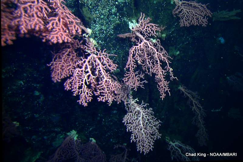
So, we targeted high slope and ridged areas in the northern part of Sur Ridge. Although we had high expectations for this dive, what we saw blew our socks off. Corals immediately appeared on the screen, and following the ridge up to the summit, the volcanic rock was just covered with individuals of the majestic Bubblegum coral that rivaled the size of those found on Davidson Seamount. The diversity and density far exceeded our collective predictions, and they were continuous up the side of the ridge, a 300 meter change in elevation! Everyone in the control room that wasn’t driving the ROV were either snapping photos, annotating the live map, taking digital frame grabs, or writing down data wildly. I think I saw a few people drool, too. It was observation like these that catalyzed the addition of the Davidson Seamount to the Monterey Bay National Marine Sanctuary in 2009, which protects the seamount, and its long-lived corals, from being disturbed in any way.
One of the tough decisions with exploration is “where to go next?” Although we probably could’ve found more large and diverse corals in the northern section of Sur Ridge, the decision was made to pick up the ROV and travel about 6 miles south. Again, we targeted an area with the sharpest rise in elevation, in hopes the observations would be similar to dive one.
They were not.
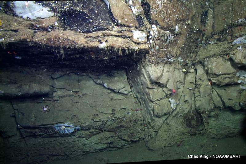
We were presented with a rising landscape, but oddly, most of the rock seemed to be sedimentary, and not igneous like in dive one. We saw mudstone and other relatively fragile rock broken up into shards and clumps, collapsed downslope or below outcrops. Very little to no coral. Why? These long-lived, slow-growing corals need a solid substrate upon which to grow on, and fragile mudstone doesn’t suffice. Despite the few small corals we did see, the dive was still informative, maybe not as “sexy” as the prolific corals from dive one. Personally, I found the geology fascinating, and the sponge density was still quite high.
Funny how sometimes the mundane can surprise you. There was just about an hour left in the dive, cruising south along the top of the ridge, when Dr. Jim Barry noticed a small white oval shape in the corner of the screen. I happened to be operating the ROV camera at the time, so I panned and zoomed to the object in question, and it appeared to be a clamshell. What’s a clam doing on Sur Ridge? Well, that’s the reason why Dr. Barry recognized that small object in a sea of small objects. He’s a bit of an expert on vesicomyid clams, which is a special family of clams that have formed a symbiotic relationship with chemosynthetic bacteria that live inside its gut. It’s a complex chain of events, but essentially, these bacteria convert sulfides into energy for the clam. These sulfides only come from three known sources in the ocean (thus far): cold seeps, hydrothermal vents, and whale falls. Cold seeps area areas where fluid methane escapes through fissures in the rock. Bacteria living within the sediment at cold seeps or colonies that digest whale bones use methane as their energy source to convert sulfates into sulfides, which are then in turn used by the symbiotic bacteria. Symbiotic bacteria near hydrothermal vents, on the other hand, use hydrogen sulfide that is coming directly out of the vent. There are no hydrothermal vents on this part of the coast, and although there are clams on whale falls, they are of a different species. That means a cold seep was near, so the hunt was on.

Dr. Barry surmised that the clamshell just rolled downhill, and he was right, we traveled a bit up the slope and found several live clams half-buried in the sediment. The pilot then noticed four additional clusters of clams to the left, and it left Dr. Barry befuddled. He never would have expected cold seeps on this ridge. But, there they were, as plain as day. A somewhat giddy Dr. Barry requested a few clams be taken as samples so that he can verify their species, and there were several species within these clusters. This is a very exciting and important find.
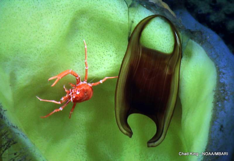
As our dive drew to a conclusion, it had one more spoil to throw our way, I noticed a small dark purple glob floating in the shadows and called it out. The ROV pilots oriented the vehicle in that direction to enable camera zoom. As I enlarged the creature, one pilot blurted out, “baby vamp!” Indeed, it was a juvenile vampire squid (Vampyroteuthis infernalis). No wonder these are made into stuffed animals.

Tomorrow is the last day of this extraordinary research cruise. Who knows what tomorrow will bring?
Chad
=============================================
DAY 4 – December 14, 2013 – We Get “Corny”
The weather has been excellent for the first three days of this trip, but overnight, the winds kicked up quite a bit, rocking the ship more than a few degrees to each side, which made sleep more difficult. At least I remembered to turn on the heater in my room to avoid a frigid morning.
After an early morning “jigging” for Humboldt squid with a Hopkins Marine Station (Stanford) PhD student and my MBNMS colleagues, the first order of business was to retrieve a benthic respirometer. This car-sized contraption was placed at a mind-boggling depth of 10,500 feet, or 3,200 meters just two months ago by Dr. Jim Barry. In October, galtheid crabs (squat lobsters) were placed into respiration chambers by the ROV. Every four hours, the oxygen levels are dropped at varying rates before being flushed with fresh seawater. These numerous intervals give an average respiration rate for the crabs, which served as a baseline for the addition of seawater with a higher than normal amount of carbon dioxide (CO2), which was pumped from bags on the respirometer. This experiment tested the crabs’ tolerance to high CO2 levels, an extrapolation of what is currently happening to the world’s oceans. Each year about 1/4th of our CO2 emissions are absorbed through the sea surface. That extra CO2 reacts with ocean waters to make the oceans more acidic. Deep-sea animals cannot tolerate a rapid rise in pH, and they will be among the first to suffer dire consequences if humans don’t take steps to abate CO2 emissions over the next few decades.
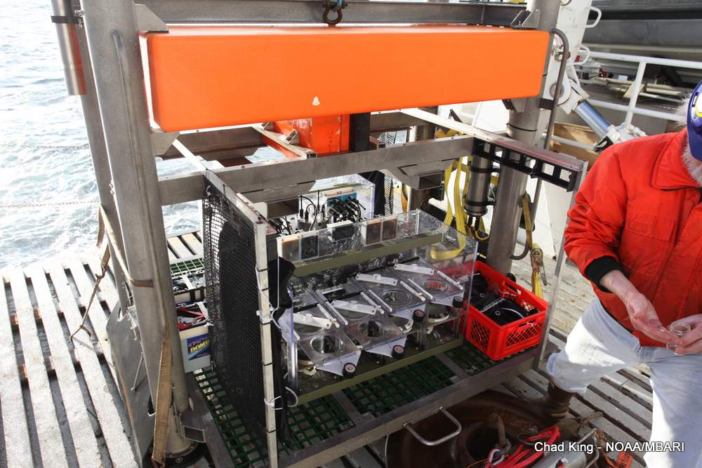
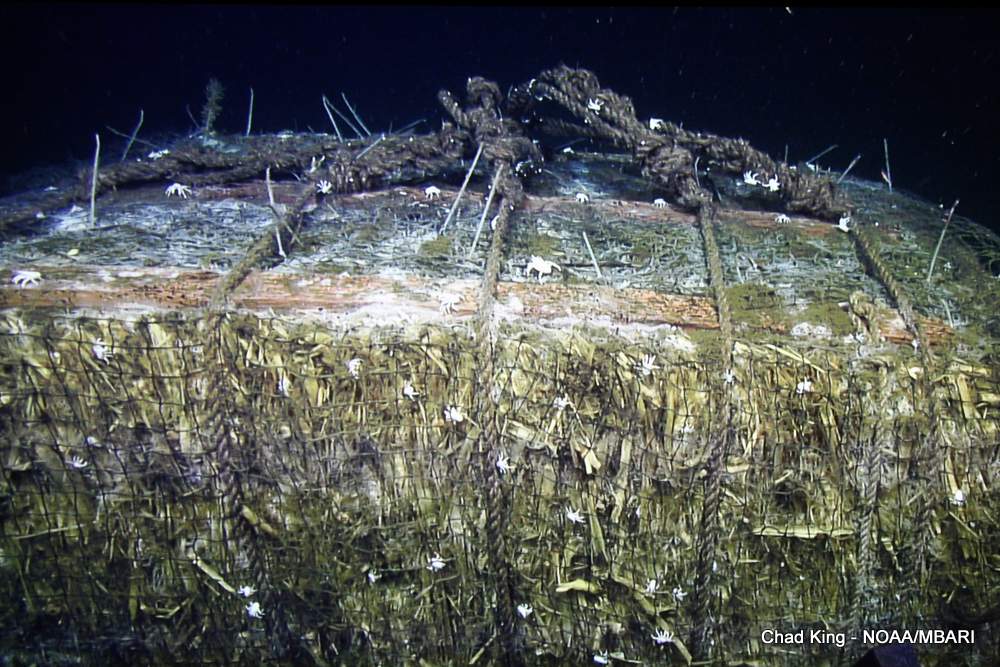
“Doc Ricketts” only dove once today, to a site where Dr. Barry sunk a large “corn bale” in 2009. A corn bale is what is left from a corn plant after the ear of corn is harvested. This cellulose material is bound into a large (4x4x8’) bale and is normally burned to be eradicated. Of course, burning this material puts more CO2 into the atmosphere, so Dr. Barry had an intriguing thought. Since there are very few deep-sea animals that can digest cellulose, why not sink a large corn bale as a way to “sequester” CO2, or prevent it from ever entering the atmosphere or ocean chemistry? It may sound crazy, but any idea to stymy climate change is worthy of experimentation. This bale also sat almost two miles below the ocean surface, so it took more than two hours for the ROV to reach bottom. The talented ROV pilots had a difficult mid-water current to deal with, which was pulling on the umbilical, or the line that connects the ROV to the RV Western Flyer. While compensating for this “pull,” the pilots sampled sediment around the bale, collected some galtheid crabs that were crawling all over this bale, and used an instrument called the “hokey pokey” to measure oxygen levels outside and inside the corn bale. According to Dr. Barry, these crabs actually can digest some of the corn bale, since their gut contains bacteria that produce cellulase, and enzyme that can break down cellulose. Now, while these crabs certainly aren’t adapted to corn bales thrown into the ocean by humans, there are occasional sources of cellulose, such as logs that were pushed out to sea by storms. That’s happened for millennia.

We almost forgot a tradition with these deep dives. Using Sharpies, visiting crew typically adorn styrofoam cups with names, designs, patterns, dates, etc. The incredible pressure from over 10,000 feet crushed our cups to the size of a large thimble. It’s quite amazing to see the transformation, and it makes a nice gift or a conversation piece for the office desk.
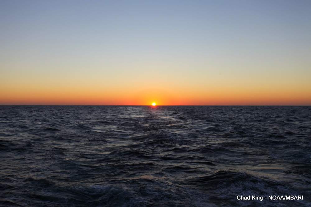
Once again, the day bid us adieu with another fiery sunset, followed by the first “green flash” that I have ever witnessed. Tomorrow, we explore a prominent submarine geologic feature called “Sur Ridge.”
Chad
PS – “Popular Science” featured this expedition in its December 13 edition of PopSci.com.
============================================
DAY 3 – December 13, 2013

MBARI’s tireless crew of professionals launched the ROV at 0630 sharp, while most of the science crew were wiping their eyes from slumber as we entered the control room sporadically, most with a source of caffeine in hand. All three of today’s dives continued the collection of urchins and sediment push cores inside and outside of cages that we started on day 1 of this cruise. Dr. Jim Barry and his team placed these cages in September 2011 to determine if urchins have any effect on the local ecological community. You can read more about the background Dr. Barry’s experiment from his day 1 cruise log on MBARI’s website.
During transit to the seafloor and back, we have lots of time to encounter creatures that live in the mid-water. By volume, this is the largest habitat on Earth! Often we encounter bizarre, strange, or rare creatures, and MBARI has made numerous discoveries within this vast area. We typically encounter many gelatinous animals, including jellyfish, ctenophores, and siphonophores, as well as animals that have a little more substance to their form, such as squid (Humboldt and market) and fish. Today, we encountered a massive school of hake around 300 meters, probably attracted by the lights. One individual even got stuck head-first into one of our sediment core buckets. It wasn’t physically restrained, but it couldn’t figure out how to simply back out of the container. Don’t worry, the ROV pilots made sure that it didn’t ride to the surface. It’s back home with its own kind.
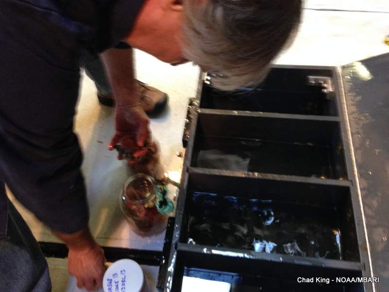
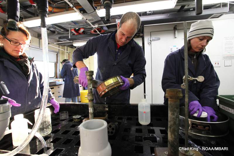
Once the ROV was back onboard after each of the three dives, MBNMS scientists went to work, donning thick lab coats and latex gloves to process sediment samples. Tasks included sieving mud and preserving the macrofauna (tiny animals that live within the sediment), preserving samples of mud to conduct carbon-hydrogen-oxygen (CHN) analyses, and of course washing the dishes to help prep the push cores for the next dive. It’s not all glamour work!
Many of the images that have been and will be captured on this cruise will be available for free (non-commercial use only!) from SIMoN’s extensive photo library. There are currently more than 4,300 images of more than 900 species that have been observed in MBNMS. Many other images document human interactions with the ocean, beautiful landscape and seascapes, and past important Sanctuary events. Many of these photos are also available in our convenient iOS app, “SeaPhoto,” which is available for free from Apple’s App Store.

We’re half-way done with this expedition, and we have many exciting sites yet to visit. Tomorrow, we are going deep, very deep. Come back and find how how deep!
– Chad King
===========================================
DAY 2 – December 12, 2013
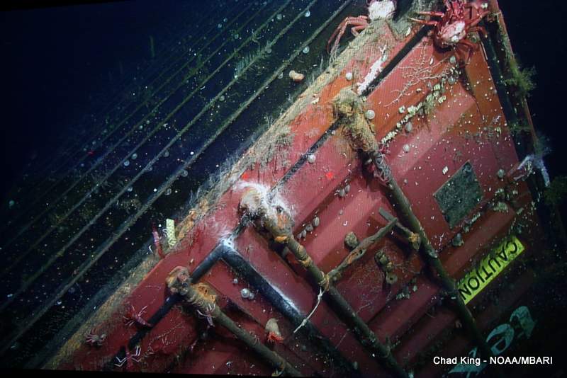
The ROV was launched at 0630, but it took almost an hour for it to hit the shipping container’s depth of 1,280 meters, or more than 4,200 feet deep. It’s the equivalent of the length 13 football fields, almost three times the height of the Empire State Building. What’s incredible is that this is relatively shallow for Monterey Bay National Marine Sanctuary, where its deepest areas reach more than 13,000 feet deep, or more than three times the depth of water over this shipping container!
Upon “touch down” on the seafloor, the pilot slowly navigated the ROV “Doc Ricketts” toward the container, which appeared as a strikingly contrasting bright rectangle against the dull blacks of the ROV’s radar sweep. As the crimson hue of the container’s paint came into sight, I was reminded of the fact that as many as 10,000 of these are lost at sea every year! It’s a mind-boggling statistic, but only a small part of a world-wide problem, called “marine debris.” Whether be it something large, like this container, or as small as a soda can, they call can adversely affect marine ecosystems. Perhaps most people are not aware of marine debris because most of us don’t see it. I’m hopeful that what we are doing will help bring some light to the issue and cause change. Marine debris will be the theme of this year’s free “Sanctuary Currents,” happening on April 26, 2014 at California State University, Monterey Bay.
After the initial approach to the container, we took time to smell the roses, or in this case, watch the animals sway in the moderate current (that won’t be on a greeting card anytime soon). We needed high-quality video clips of the container to determine the state of its general condition, what the current biological “neighborhood” looks like. By comparing photos from 2004, 2011 and today, we can begin to put together a timeline of what first “recruited” onto the container, and what has colonized since. So, we took our time to video tape every side of the container, stopping occasionally to get those close ups. We often got lost in the beautiful diversity of even the tiniest colorful individual among a sea of whimsical creatures.
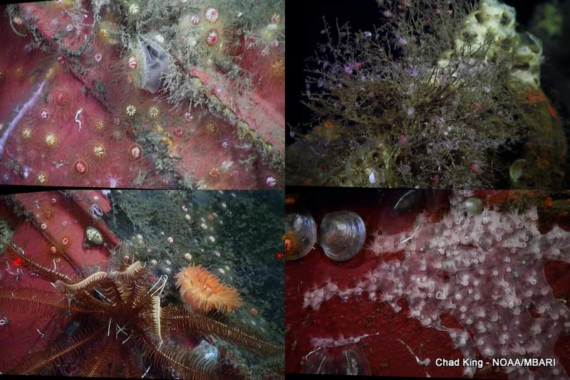
After many laps of video surveys around the container, high-definition camera was pointed forward, and the distance of seafloor within view was fixed at approximately 1 meter before we would travel forward in a relatively straight line. These are called transects. Since we can identify and count the animals within a known linear distance, it’s then trivial to calculate densities, or number of animals per unit of area. These numbers will help determine if the container is having an effect on the types of animals and their densities around the container, as compared with “control” or normal levels, as far away as 500 meters from the container.

Our initial anecdotal impressions are that the container has more and new life growing on it than it did in 2011. The container is also showing signs of rust where the paint has peeled away. It also appears that white bacterial mats are growing around areas that we suppose water is coming out of the container. Since many colonies of bacteria dine on sulfides, we are curious if sulfide compounds are leaching out of the container, which apparently contains 1,200 steel-belted Michelin tires. The original rumor was that the container was full of expensive French wine. If that were true, perhaps we would have opened the doors today!
Understanding the potential toxic effects from the container’s paint, which is slowly peeling and chipping away, is another priority of this mission. Sediment cores were taken right under and around the container, and as far as 500 meters away; a total of 48 samples! Once these samples came to the surface, the science team quickly preserved the sediment for heavy metal analyses to be performed at a later date. Analyses from 2011 indicated the presence of heavy metals closer to the container. Since these heavy metals may have an effect on life on and around the container, we also collected animals from the container itself, close to the container, and far away. Samples primarily consisted of the snail Neptune sp and their egg stalks, but also included anemones and scallops. These animals will also be analyzed for heavy metal content within their tissue.
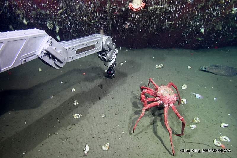
What a day! All in all, we accomplished everything we set out to do, and hopefully today will help answer: 1) how has the biological community changed on the container? 2) are there heavy metals present in sediment near the container? and 3) are there heavy metals present in animals living on or near the container?
Anything that could go wrong didn’t go wrong. There were no major mechanical problems or equipment failures, no lost samples, flat and calm seas with sunny and clear skies. It’s one of those rare moments when technology and Mother Nature call a truce on a few hopeful humans.
Let’s hope the truce still stands tomorrow.
Chad King
===========================================
DAY 1 – December 11, 2013

The departure (and arrival) of the RV Western Flyer is at the mercy of the tides, as there needs to be an ample depth of water at the mouth of Moss Landing harbor for the vessel to make safe passage above the muddy bottom. As a result, we embarked under an early golden sunrise warming up a rather frigid morning, ready to begin our day of research. We were greeted by sea lions and humpback whales, involved in a feeding frenzy within a few miles of the harbor.
As is tradition, and a requirement with these cruises, our ears were greeted by a blasting alarm bell, notifying us that the safety drill was starting. The science crew went to their bunks to retrieve their “gumby suits,” which are large red survival suits, and mustered in the wet lab. The second mate reviewed all safety guidelines, and ship protocol that all crew and passengers are expected to follow.
On the way to the first dive location, we collected a sediment trap that had been deployed at a depth of 1,200 meters in Monterey Canyon. To accomplish this, an acoustic trigger unlatched the sediment trap from its large weight, which anchored it to the seafloor for the past six months. After electronic signals indicated that it had surfaced, there was a brief moment of concern, as it could not be visually located for about 10 minutes. The radio beacon also seemed to be non-operational. When the ship turned in a half-circle, the crew realized that the floats had initially appeared within the stark glare of the sun on the surface of the ocean; in other words, it was invisible to us. The crew performed a technically flawless maneuver to retrieve the float and sediment trap, and secured it to the aft deck before we proceeded to the sea urchin study site.
The crew performed a technically flawless maneuver to retrieve the float and sediment trap, and secured it to the aft deck before we proceeded to the sea urchin study site.
What’s exciting for the Sanctuary is where this urchin study site is located; it’s on the edge of a Sanctuary Ecologically Significant Area, or “SESA.” These special areas encompass remarkable, representative and/or sensitive marine habitats, communities and ecological processes. They will be focal areas for facilitating research to better understand natural and human–caused variation in Sanctuary natural resources. SESAs are not currently part of the MBNMS regulatory regime, yet may be used as a resource management tool. The research conducted within SESAs will enhance our understanding of these special places with the Monterey Bay National Marine Sanctuary, and will help detect any changes over time.
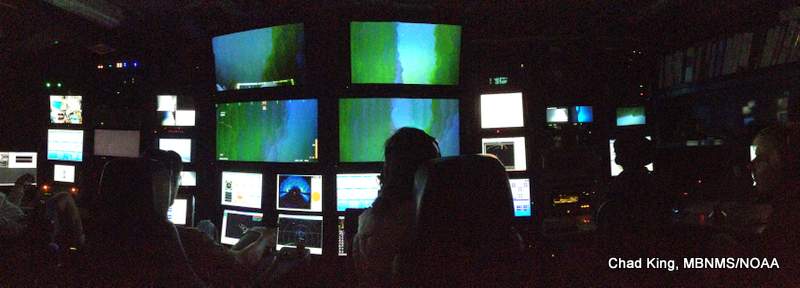
- The control room of the RV Western Flyer includes many large high-definition television screens that broadcast a live image from the seafloor. The ROV pilot and robotic arm operator are seated to the left. The “science chair” is in the middle, guiding operations, while the navigator and video annotator are to the right
This site is one of three sea urchin study sites that were set up about two years ago. At that time, MBARI collected a number of fragile sea urchins (Strongylocentrotus fragilis) at a depth of 600 meters (the middle of their depth range). MBARI then placed these urchins in mesh cages (two meters by two meters by 0.3 meters) on the seabed at three depths (200, 600, and 1,000 meters). MBARI placed six cages at each depth. Three of the cages contained 15 urchins each. The other three cages had no urchins. Some of these urchins were kept in an aquarium that had calcein in the seawater. Calcein is a fluorescent dye that has been used to add a fluorescent ‘marker’ (a fluorescent band, for example) to the skeletal structure of other animals, to help understand their rates of growth. Along with growth rates, Dr. Jim Barry (MBARI), who directs this research, would like to determine the thresholds for life and reproduction in these urchins. Variables that he can manipulate in either the field or laboratory include pH (the acidity of the water), oxygen levels, depth, food and more.
Why are we doing all of this? In a nutshell, to understand what effects these urchins have on the local ecosystem.
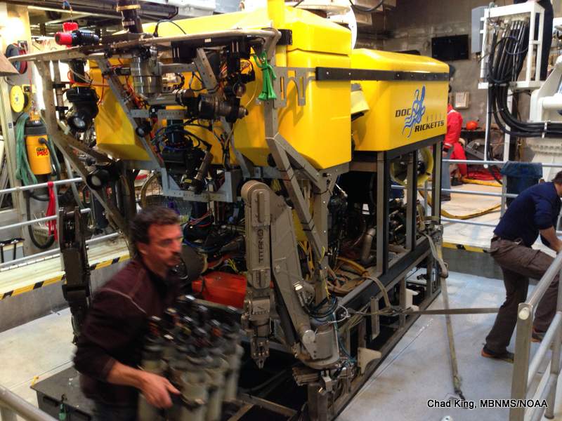
Today’s goal was to collect push cores and urchins from the 600 meter depth zone. MBARI had previously collected the urchins from the 600 meter depth range in October of this year. MBARI has an incredible tool to accomplish this task, it’s a high–tech remotely–operated vehicle (ROV) called the “Doc Ricketts.” This ROV is outfitted with several high–definition cameras, thrusters, high–intensity lights, a suction sampler, water sample bottles and a myriad of other sensors and features. However, the adaptable human–controlled robotic arm makes this tool so versatile. Its mechanical pincers can pick up delicate objects, grasp sediment push cores, hold the suction sampler, and even tie knots! The capability of this arm is only limited by the ingenuity and skill of the crew of the R/V Western Flyer.
The first dive went very well. We finished detailed video surveys and collected 30 sediment “push cores” from “control” sites that were close to the cages that are at depth of 200 meters. Due to the fact that ROV’s “trunk” (really, it’s a shelf or porch on a slideable tray in the front of the ROV) doesn’t have enough room to carry more than 30 cores, we had to make two separate dives.
On dive two, we collected urchins and other macrofauna from three cages, again at the 200 meter depth, as well as many sediment push cores from each cage. We also collected animals from inside the two cages with no urchins. The ROV was back at the surface by about 5:30 p.m., carrying samples, push cores, and the cages from the completed experiments. After a quick dinner, we set out to process all of the samples. Everyone worked hard to subsample the sediment cores, and sieve the sediment to separate the mud from animals. With lots of teamwork, we finished in just a couple of hours, processing 60 cores, and preserving a number of smaller urchins, anemones, and other fauna we had collected. We’ll return here in a couple days to continue this work.
Tomorrow we plan to re–visit the lost shipping container that we first visited in March of 2011. We’re excited about observing any potential changes in the container’s state, both its physical condition, but also any changes to the macrofaunal community adhered to and living around the container. We will also collect sediment samples to test for presence of heavy metals that come from the toxic marine paint that is slowly chipping and peeling off the container.
Chad King
