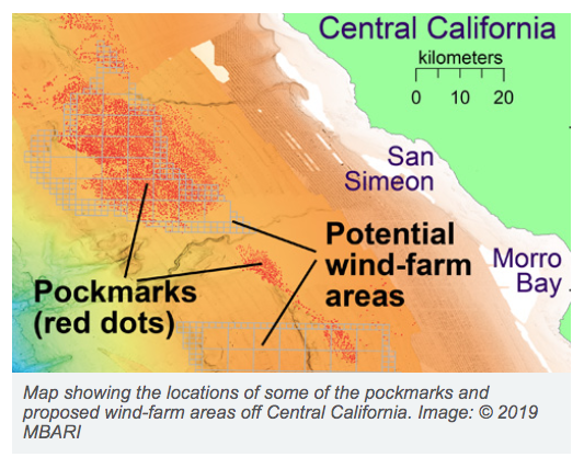
During a recent survey of the deep seafloor off the coast of Big Sur, scientists from the Monterey Bay Aquarium Research Institute (MBARI) discovered thousands of mysterious holes or pits in the seafloor. Scientists and resource managers want to understand how these pits formed because this area is the site of a proposed wind-energy farm.

Exploring at depths between 800 and 1000 m deep, researchers found two different sizes of holes. The larger ones, known as pockmarks, average 175 meters (almost 600 feet) across and five meters (16 feet) deep, and are nearly circular and fairly evenly spaced. Some of these pockmarks were initially discovered by MBARI scientists in 1999 during a seafloor survey using ship-mounted sonar. Over the last few years, additional surveys by MBARI and other organizations revealed over 5,200 pockmarks spread out over 1,300 square kilometers (500 square miles), making this area the largest known pockmark field in North America.
To read more about this interesting find, go to the MBARI web site.