Overview
The deep sea includes habitats around the Channel Islands that extend from 30 to greater than 200 meters over the continental shelf and slope and well over 1000 meters in canyons. Over 90 percent of deep-water benthic habitats in the sanctuary consist of fine sands in shallow regions, grading into silt and clay-dominated sediments in deeper regions (Science Applications International Corporation 1986; Thompson et al. 1993). These soft-bottom particulates are derived from terrestrial runoff and decaying plankton. Coarse sediments occur near Point Conception, and north of San Miguel Island (Blake and Lissner 1993). Fine sediments occur on the sill at the western end of the

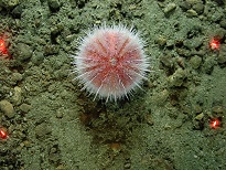
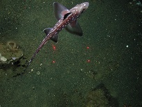
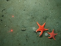
Santa Barbara Channel, and in the Santa Barbara Basin. Most of the deep-water hard bottom substrates are low-relief reefs less than 1 meter in height; some reefs have 1- to 5-meter-high features and may take the form of boulder and bedrock outcroppings. Hard bottom habitat is often found on the highest parts of undersea ridges, banks, and pinnacles such as those found off the northwest end of San Miguel Island. Because light rapidly disappears below 50 meters, offshore benthic habitats do not support marine algae. Invertebrates can, however, be found in these habitats and include sponges, anemones, cup corals, black coral, sea fans, bryozoans, feather stars, brittle stars, sea stars, and lamp shells. Demersal fishes are common, especially various species of rockfish. Due to the difficulty in studying very deep habitats, little is known about these areas in the sanctuary. However, recent submersible studies have begun to reveal the important associations between these diverse fish and invertebrate communities (Tissot et al. 2006).


Photos
Maps
Projects
Assessment of Warty Sea Cucumber Abundance from Video Transects Beyond Scuba Depths Using a Remotely Operated Vehicle
In 2018 scientists from the California Department of Fish and Wildlife (CDFW) and Marine Applied Research and Exploration (MARE) completed surveys of warty sea cucumber (WSC) abundance and distribution at two sites off Anacapa Island (15-60 m deep). The purpose of this study was to characterize previously observed seasonal changes in abundance at depths that are poorly studied for this species.
California Cooperative Oceanic Fisheries Investigations (CalCOFI)
The California Cooperative Oceanic Fisheries Investigations (CalCOFI) was formed in 1949 to study the ecological aspects of the Pacific sardine population collapse off California. Today, the focus has shifted to the study of the marine environment off the coast of California, the management of its living resources, and monitoring the indicators of El Nino and climate change.
CINMS Soundscape monitoring
Biological, geophysical, and anthropogenic sound sources all combine to make up an underwater acoustic environment, or “soundscape.” Because ocean water conducts light very poorly and conducts sound very well, many marine organisms rely on sound for communication, navigation, reproduction, and foraging. Using a network of moored hydrophones around the sanctuary, we can examine how soundscapes vary at each location and across sanctuary habitats.
Climate vulnerability assessment for deep-sea coral ecosystems in Channel Islands National Marine Sanctuary
There is a compelling need to understand the effects of changing ocean climate on deep-sea corals. Deep-sea corals are long-lived animals. Like trees, they grow to be very old and they are sessile, or fixed in place. Their branches provide substrate and refuge to many associated species. So, any natural or anthropogenic threats to deep-sea corals can bring changes to this ecosystem. Warming oceans threaten deep water communities because they are stenothermal, adapted to stable cold-water conditions. Acidified oceans may also be a threat, because stony coral skeletons are comprised of aragonite, a form of calcium carbonate that dissolves under acidified conditions. Scientific studies will help to understand the resilience of deep water species to a changing climate.
NOAA's Deep-Sea Coral FY2010 Assessment for the U.S. West Coast
The marine region off the coast of Washington, Oregon and California accounts for about 7% (778,628 km2) of the total area of the U.S. Economic Exclusive Zone and contains extensive deep-sea coral (DSC) communities. NOAA manages five National Marine Sanctuaries (NMS) on the West Coast: the Channel Islands (CINMS), Monterey Bay (MBNMS), Gulf of the Farallones (GFNMS), Cordell Bank CBNMS), and Olympic Coast (OCNMS). All contain deep-sea corals.Return to the Northern Channel Islands to Monitor Change Over Time, Inside and Outside of Marine Protected Areas
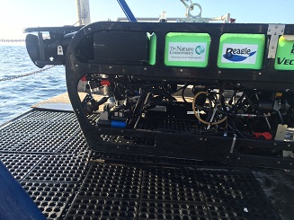
Marine Applied Research and Exploration (MARE) returned to complete ROV surveys around the northern Channel Islands MPAs 5 years after creating its deepwater baseline. The same 10 historical sites, both inside and outside of select MPAs, have been filmed and post-processed annually 2005-2009, with return surveys completed in 2014 and 2015.Santa Barbara Channel Marine Biodiversity Observation Network (SBC MBON)
The Santa Barbara Channel Marine Biodiversity Observation Network (SBC MBON) is designed to provide a complete picture of marine biodiversity in the region. SBC MBON is developing a widely applicable research model that integrates new information with existing data to improve current research and monitoring programs and provide greater insight into marine biodiversity.
Southern California Seafloor Mapping Initiative
Place-based fisheries and coastal zone managers depend on fine scale bathymetry and habitat maps for an array of critical decisions including: navigational safety, disaster response, endangered species and fisheries management, conservation, research, energy development, and marine planning. Yet, in southern California nearly 90% of U.S. waters remain unmapped at an appropriate resolution. As of 2014, the unmapped area within NOAA’s Channel Islands National Marine Sanctuary (CINMS) was over 50% with the majority being characterized by single beam and lead line data from the 1930s. To address this critical information gap, offices across the NOAA family, together with other state and federal partners are uniting and filling the void.
The Southern California Shelf Rockfish Hook and Line Survey
The Hook and Line Survey uses rod and reel gear to sample fish in areas that are difficult to survey using traditional methods such as research trawl nets. These areas include hard seafloor habitats like rocky reefs, boulder fields, and large undersea cliffs and pinnacles. Most of the species targeted by the Hook and Line Survey are rockfish, which are taxonomically classified in the genus Sebastes. Key species of rockfish include bocaccio (S. paucispinis), cowcod (S. levis), greenspotted rockfish (S. chlorostictus), and the vermilion rockfish complex (S. miniatus and S. crocotulus).
Links
American Museum of Natural History - Explore the Deep Oceans
Deep Sea teacher resources and curriculum for grades 6 and up. Topics include: Explore the Deep Ocean, How Deep Is Deep?, Under Pressure, and Dispatch from the Deep.http://www.amnh.org/education/resources/dsv/explore.php
Discovering Hidden Habitats: MBARI & NOAA
Join NOAA and the Monterey Bay Aquarium Research Institute's (MBARI) 2002 expedition to the deep trenches of the Monterey canyon where they discovered previously unknown species.http://www.youtube.com/watch?feature=player_embedded&v=jVrugjn79XY#!
Eisenhower National Clearinghouse: Deep Sea Missions
This video and lesson guide is one of a series whose purpose is to demonstrate the applicability of mathematics to real careers. Deep Sea Missions follows James McFarlane in his duties as chief Remotely Operated Vehicle pilot for the Monterey Bay Aquarium Research Institute. Students join McFarlane as he takes Mary Silver, a professor of marine biology, to the ocean floor to collect fragile marine samples.http://www.enc.org/resources/records/0,1240,003647,00.shtm
MBARI - Cold Seeps
Learn about the benthic communities that are linked to the seepage of methane and sulfide rich fluids from the ocean floorhttp://www.mbari.org/benthic/coldseeps.htm
MBARI - Current Research Projects
Learn about current research projects conducted by the Monterey Bay Aquarium Research Institute (MBARI).http://www.mbari.org/rd/projects/current_projects.html
MBARI - Deep Sea Benthic Invertebrate Guide
Find digital images of small organisms (macrofauna) collected in sediment core samples taken between 200 - 3600 m near Monterey Bay, California by the Monterey Bay Aquarium Research Institute (MBARI).http://www.mbari.org/benthic/fauna.html
MBARI - Deep-Sea Guide
A web-based system that allows for the correlation of visual, descriptive, and observational data with environmental data from multiple sources by providing tools for searching, identifying, and examining occurrence data (e.g., depth, time, abundance) for biological, geological, and experimental observations.http://dsg.mbari.org/
MBARI video of trash in the deep sea
Monterey Bay Aquarium Research Institute shares video of trash observed during deep sea missions with their ROV.http://www.youtube.com/watch?v=mOZngsJU2k0
Monterey Bay Aquarium - Mission to the Deep
Learn more about the fascinating world of the deep sea.http://www.montereybayaquarium.org/efc/efc_mbari/mbari_home.aspx?bhcp=1
Monterey Bay Aquarium - Student and Teacher Resources and Activities
The Monterey Bay Aquarium offers teacher and student resources including: species and habitat-specific information, live cams, classroom activities, and interactive online games.http://www.mbayaq.org/lc/
Monterey Bay National Marine Sanctuary - Cold Seep Communities
A comprehensive and educational scientific characterization of an important habitat in the Monterey Bay Sanctuary.http://montereybay.noaa.gov/sitechar/cold.html
Monterey Bay National Marine Sanctuary - Deeper Bottom Habitats
A comprehensive and educational scientific characterization of an important habitat in the Monterey Bay Sanctuary.http://montereybay.noaa.gov/sitechar/deep.html
NOAA - Ocean Exploration Lesson Plans
Students of all ages can learn about the oceans with near real-time access to a series of multidisciplinary deep ocean explorations. The site offers a set of over 100 hands-on and standards-based lesson plans for student exploration and discovery. Using new technological "eyes" to see, sense, measure, image, and describe a little known ocean world, these lessons bring the excitement of late-breaking ocean discoveries into classrooms.http://oceanexplorer.noaa.gov/explorations/06davidson/background/edu/lessonplans.html
NOAA - Ocean Explorer Program
Explore the ocean realm with NOAA. This Web site chronicles the adventures and discoveries of NOAA's at-sea science and education teams.http://oceanexplorer.noaa.gov/welcome.html
NOAA - Ocean Explorer Program
Explore the ocean realm with NOAA. This Web site chronicles the adventures and discoveries of NOAA's at-sea science and education teams.http://oceanexplorer.noaa.gov/
Ocean Explorer Gallery
Great resource for images and sounds. Collections include maps, living ocean, sound in the sea, cultural heritage, history, technology and explorers.http://www.oceanexplorer.noaa.gov/gallery/gallery.html
Project Oceanography - MBNMS
A University of South Florida distance-learning program for middle school students taught by scientific experts. "Unit II: Monterey Bay National Marine Sanctuary" contains teacher packets on various topics.http://www.marine.usf.edu/pjocean/packets/sp02/sp02.htm
The Pacific Shark Research Center (PSRC) at Moss Landing Marine Laboratories
The PSRC at MLML conducts both basic and applied scientific research on the biology of Pacific Ocean chondrichthyans, serves as a resource center for scientific information on sharks to public policy makers, and participates in collaborative research on national and international issues involving shark, ray, and chimaera biology.http://psrc.mlml.calstate.edu/
University of Delaware - Voyage to the Deep
Learn about an expedition to the deep sea and what scientists found there.http://www.ocean.udel.edu/deepsea