Overview
The Monterey Bay National Marine Sanctuary’s rocky shores are characterized by a fascinating and diverse array of intertidal organisms. The dramatic influence of the mixed, semi-diurnal tidal cycle exposes intertidal invertebrates and algae to large fluctuations in temperature, desiccation (drying out) and wave action, with two high and two low tides per day. This range of environmental variables in turn interacts with biological factors to create the distinct zonation patterns evident on any trip to the rocky shore.
Individual species tend to occupy different parts of the intertidal gradient from the high intertidal zone, where environmental stress is highest, to the low intertidal zone, where biological interactions prevail. The striking vertical range occupied by these organisms has long motivated scientists and visitors to investigate the abundant and species-rich assemblage of intertidal organisms that thrive in the sanctuary. Many of the hundreds of marine species found on the rocky shore do not occur subtidally, contributing to the unique nature of this habitat at the interface of land and ocean.
Rocky shores make up about 39 percent of sanctuary shoreline habitat and primarily occur near the tips of and outside Monterey Bay, extending southward along the Big Sur coast and north toward San Francisco. Human use of sanctuary rocky shores ranges from research and education to harvesting, collection, tidepooling and recreation.
Current research and monitoring efforts have two focus areas:
- establishing the health of this ecosystem
- determining how rocky shores respond to various disturbances
Scientists have conducted baseline surveys of rocky-shore communities, and these systems are in turn monitored to understand trends in the abundance and distribution of numerous intertidal organisms. Establishing such baseline data will allow researchers and managers to assess future impacts on this ecosystem.
Various disturbances, which are well-documented occurrences in rocky shore habitats, can impact the typical patchy distributions of invertebrates and algae found in the intertidal zone. Natural forms of disturbance include waves, predation (e.g., sea otters remove mussels from rocky shores), wave-tossed rocks and logs, and substratum weathering and exfoliation. Anthropogenic (human-induced) disturbances include disease, collection and trampling, oils spills, ship groundings, coastal development and road maintenance.
Conservation Concerns
There are a number of conservation concerns relative to this habitat. These include the following:
- Harvesting pressure and disease can cause declines in rocky-shore invertebrates, including abalone, mussels and limpets.
- The high visitation levels that occur on rocky shores in Southern California have caused changes in the diversity and abundance of intertidal organisms.
- Impacts from oil spills are difficult to generalize because spills vary greatly in amount, chemical composition and degree of weathering before reaching the shore. Research suggests that oil should be kept off shorelines and that cleaning oil from the shoreline can slow intertidal assemblage recovery.
- Physical abrasion from ship groundings can cause very localized damage to organisms and substrates.
- Debris from coastal development and coastal highway maintenance can create periodic disturbances that simulate landslides. These events can immediately eliminate habitat or have long-term impacts related to sand movement and burial on adjacent sites.
- Historically, water quality was a significant issue on sanctuary rocky shores. Primary treated sewage was pumped out on the intertidal shore at Carmel (Mission Point), Point Pinos and Soquel Point until the 1970s. Since then, better sewage treatment and extended sewer lines into the subtidal have eliminated impacts such as altered algal assemblages and waste-strewn areas.
Monitoring
Sanctuary rocky-shore monitoring programs collect information about key population characteristics such as abundance, size, density and diversity. This information helps resource managers and policy makers predict population changes due to both natural and human-induced disturbance and informs decisions about how to best protect these resources.
In the 1700s, whalers followed the gray whale migration to hunt and slaughter the giants for whale oil and other products. Lookouts were placed along points and promontories, and when whales were sighted, shore whaling vessels were launched. Some of California’s coastal towns, including San Simeon and Pacific Grove, were whaling stations.
Disease
PISCO biologists at UC Santa Cruz are monitoring the sanctuary’s black abalone populations. They have documented the decimation of Southern California black abalone by withering syndrome and are monitoring the northward progression of the disease. Populations within the sanctuary appear to be stable, while more southern populations are in decline.
Visitor Use and Marine Reserves
The visitor-use survey project at Point Pinos in Pacific Grove has evaluated how visitors affect rocky-shore communities. This study established baseline data and evaluated visitor impact by comparing the abundance of organisms between high- and low-use areas.
Negative impacts from visitor use were found only in the high intertidal (> +2 ft. MLLW) in the form of reduced algal cover. However, given the likelihood of future increases in visitor use, continued monitoring of this site will provide data and information necessary to develop plans to manage visitor impact in the sanctuary’s rocky shores.
Natural Variability and Long-term Comparisons
- Monitoring of barnacle and mussel recruitment on rocky shores by PISCO biologists has revealed how oceanographic conditions influence the occurrence and distribution of marine organisms. This research is the outcome of several years of monitoring that takes place along the U.S. West Coast; study sites within the sanctuary provide information critical to completing the story of how oceanographic conditions can dramatically affect biological organisms.
- Researchers from Hopkins Marine Station in Pacific Grove have compared rocky-shore species composition between 1931-1933 and 1993-1994. They report a northward shift of southern species that is concurrent with increasing temperature records. Their study indicates how warming waters associated with a changing climate may affect species distributions in the sanctuary.
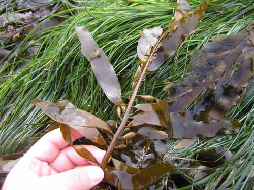
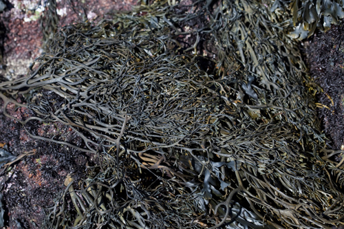
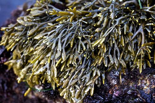
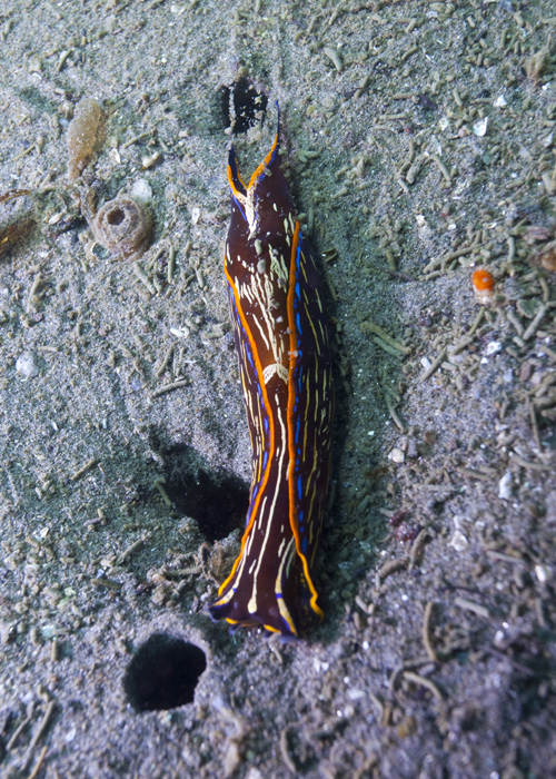
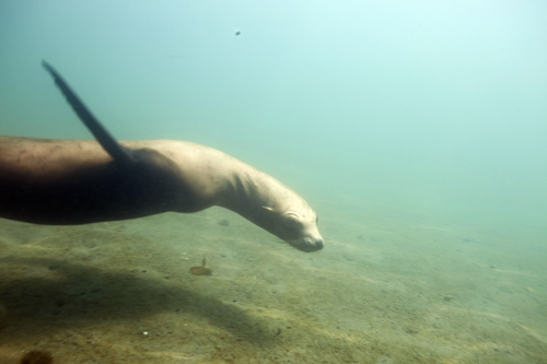
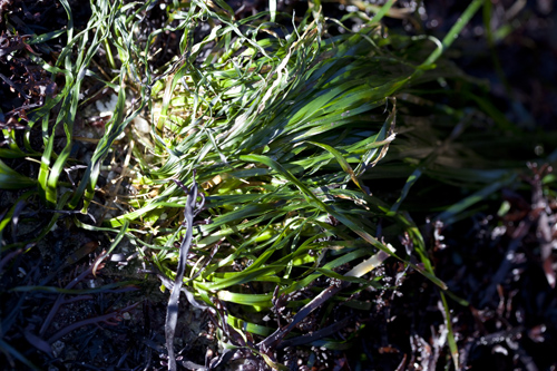
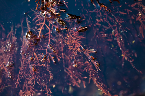
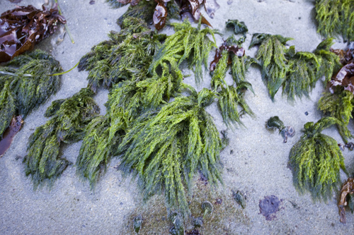
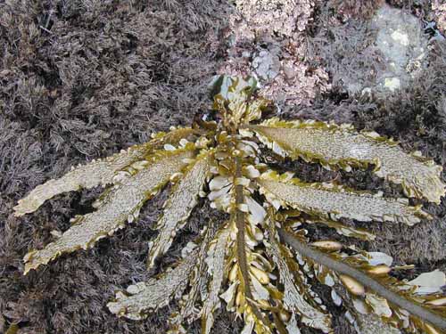
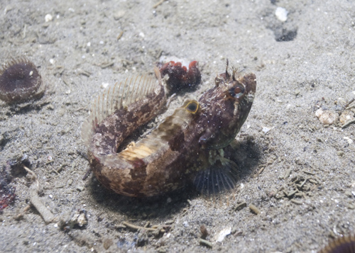
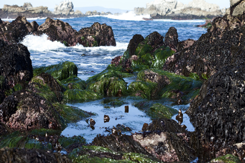
Photos

Maps
Alder Creek slide subtidal surveys (through 11/15/2012)
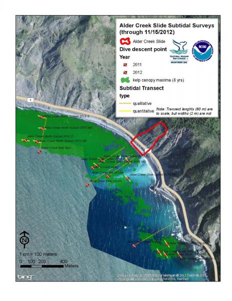
[View Larger]
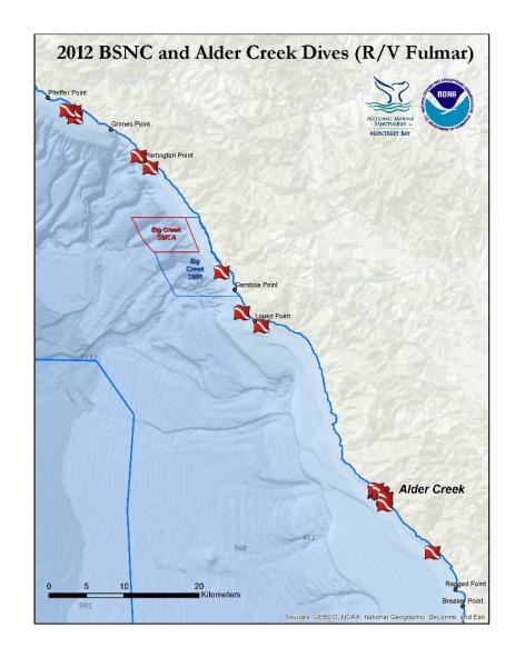
2012 Big Sur Nearshore Characterization and Alder Creek Dives
[View Larger]
Projects
Biodiversity of rocky intertidal of northern Monterey Bay: A 24-year comparison
Species richness and abundnaces were quantified for 10 sites between Pigeon Point and Soquel Point by UC Santa Cruz biology students. Dr. John Pearse led classes into the intertidal from 1971-73 and again from 1996-97, as part of a 24 yr comparison.Black abalone (Haliotis cracherodii) shoreline inventory
Populations of black abalone (Haliotis cracherodii) have been steadily declining in the southern portion of the species' range due to a fatal disease called "withering syndrome." Researchers from the University of California at Santa Cruz work with the Multi-Agency Rocky Intertidal Network and the Partnership for Interdisciplinary Study of Coastal Oceans monitoring groups to monitor and document the northward progression of WS along the central California coast.Characterization of geologic and oceanographic conditions at Pleasure Point, Santa Cruz County
A USGS study is underway to characterize the coastal bluffs, inner shelf morphology and wave conditions at Pleasure Point in Santa Cruz County.Colonization genetics of globally invasive marine bryozoa: does adaptation prior or post-introduction determine spread?
The central goal of this project was to determine the extent to which genetic variation helps explain the success of invasions by non-native marine colonial organisms (in this study, bryozoans in the genus Watersipora).Comparative Intertidal Study and User Survey for Point Pinos, California
The purpose of this study was to investigate the effects of visitor use on the Point Pinos rocky shoreline by comparing intertidal sites with different levels of human use and conducting census surveys to account for visitor use.Damage assessment and site characterization of the rocky shore following the grounding and recovery of the F/V Lou Denny Wayne
On November 29, 2007 at approximately 0130 hours the F/V LOU DENNY WAYNE ran aground one mile south of Pigeon Point, San Mateo County, California. This project served as the initial impact assessment and plans are to revisit the site annually to track recovery of the intertidal community.Detecting non-native species in kelp forests and on rocky shores
As part of a larger research effort focused on detecting marine non-native species in California bays and estuaries, we last year began surveys for target non-native species along the outer coast. We surveyed 10 rocky intertidal sites from Marin County to Monterey County and 8 kelp forest sites from Monterey to Carmel. Our list of target species is comprised of non-native species previously reported from the open coast of California or established in protected bays and estuaries and deemed capable of colonizing the open coast.Impacts associated with the recent range shift of the aeolid nudibranch Phidiana hiltoni (Mollusca, Opisthobranchia) in California
The feeding habits of the aeolid nudibranch Phidiana hiltoni were investigated. Implications for the potential impact to species not used to the increased density of this predator are presented.James V. Fitzgerald Marine Reserve: Resource Assessment
This study was initiated as a result of concerns by the California State Department of Fish and Game and the County of San Mateo about the potential impacts from current visitor use, potential increases in future visitor use, and the effectiveness of management and regulations in protecting the health and viability of the marine life in the James V. Fitzgerald State Marine Park.LiMPETS rocky intertidal monitoring
This page describes the monitoring program implemented by LiMPETS (Long-term Monitoring Program and Experiential Training for Students) in rocky intertidal habitats.Management program for the invasive kelp Undaria pinnatifida
We monitored the spread of the invasive seaweed Undaria pinnatifida within the Monterey Harbor, and studied the effectiveness of manual removal of Undaria from harbor docks and pier pilings, from 2005 to 2012.
Marine Resources Survey in Big Sur
Highway 1 in Big Sur is often subject to delays and closures due to storms, washouts, and landslides. The Big Sur Coast Highway Management Plan (CHMP) develops sustainable strategies that ensure the safe and efficient operation of the highway while protecting the unique terrestrial and marine resources. The Marine Resources Survey will characterize targeted intertidal and nearshore subtidal areas along the Big Sur coast.
Monitoring growth and spread of the invasive bryozoan Watersipora in Monterey Harbor
Monterey Harbor is home to an invasive bryozoan, Watersipora subtorquata, which was first observed in Monterey Harbor in 1994. This project monitors the growth of Watersipora and interactions with native and other invasive species on cement pier pilings.Ocean Margin Ecosystems Group for Acidification Studies (OMEGAS)
This is a three-year, NSF-funded study on the impacts of acidic ocean waters on two ecologically important species (sea urchins and mussels) in the California Current Large Marine Ecosystem.Partnership for Interdisciplinary Studies of Coastal Oceans (PISCO): intertidal component
The goal of the intertidal PISCO (Partnership for Interdisciplinary Studies of Coastal Oceans) program is to investigate the rocky intertidal marine ecosystems of the west coast of the U.S. in an innovative, coordinated, and interdisciplinary fashion.
Persistence and Recovery of Abalone Populations in Central California
We investigated patterns and processes of persistence and recovery of depleted invertebrate populations, red (Haliotis rufescens) and black (H. cracherodii) abalone, in central California.Rocky-shore Community Variation Along Natural and Anthropogenic Gradients of Disturbance: implications for the design and evaluation of marine reserves
Through intensive biodiversity surveys of rocky intertidal habitats of Monterey Bay, CA, we assessed how human and natural disturbances interact to affect these coastal communities.Sea star wasting disease (SSWD) in central California
Sea star wasting disease (SSWD) is a general description of symptoms found among sea stars afflicted with a disease that often leads to death. SWSD is widespread, from Alaska to Mexico, with an onset in Fall 2013. It is the largest, most wide-spread mass mortality event in recent history.
Shipwrecks on sanctuary shores: disturbance and recovery along a rocky intertidal exposure gradient
Recovery rates and processes were assessed along a rocky intertidal exposure gradient impacted by a shipwreck in Monterey Bay, California.Links
MARINe: Multi-Agency Rocky Intertidal Network
Consortium of groups that monitor sites along the entire Pacific Coast of North America, from Alaska to Mexico, and several East Coast sites in Maine and New Hampshirehttps://marine.ucsc.edu/
AlgaeBase
A database of information on terrestrial, marine and freshwater algae, including photos and search functions.http://www.algaebase.org
American Fisheries Society
Strives to advance fisheries and aquatic science and promote the development of fisheries professionals.http://www.fisheries.org
Bilingual MERITO Web Site
The English/Spanish MERITO (Multicultural Education for Resource Issues Threatening Oceans) website provides bilingual information on: MERITO programs, dates of upcoming events, background information on a variety of sanctuary issues, downloadable education materials, and current reports and documents related to MERITO.http://www.montereybay.noaa.gov/educate/merito/welcome.html
Black Oystercatcher monitoring
2011 was the start of the first-ever population assessment of Black Oystercatcher in California.http://ca.audubon.org/birds-0/black-oystercatcher
California Geological Survey - An index to online geologic field trips, including coastal Central California
The California Geotour is an interactive index of Web pages of geologic field trip guides and related Web sites compiled by the California Geological Survey (CGS) for the benefit of all who have wondered about California's geologic features.http://www.conservation.ca.gov/cgs/Pages/Geotours.aspx
Farallones Marine Sanctuary Association Coastal Ecosystem Curriculum – Rocky Shores
Download content on the rocky intertidal of the Gulf of the Farallones National Marine Sanctuary. Curriculum, Powerpoint slideshows, fact sheets, and more. Contact Amy Dean -- Education Manager of the Farallones Marine Sanctuary Association -- PO Box 29386, San Francisco, CA 94129 -- 415-561-6625 x303 -- fax 415-561-6616 -- adean@farallones.orghttp://www.farallones.org
LiMPETS: Long term Monitoring Program and Experiential Training for Students
Middle school, high school and other volunteer groups monitor the rocky intertidal, sandy shore and offshore areas to provide critical data while increasing public awareness.http://limpetsmonitoring.org/
MARINe: Multi-Agency Rocky Intertidal Network
Scientists from Federal, State, and local government agencies, universities, and private and volunteer organizations have formed MARINe to monitor important shoreline resources.https://marine.ucsc.edu/
Monterey Bay Aquarium - Student and Teacher Resources and Activities
The Monterey Bay Aquarium offers teacher and student resources including: species and habitat-specific information, live cams, classroom activities, and interactive online games.http://www.mbayaq.org/lc/
Monterey Bay National Marine Sanctuary - Rocky Shores
A comprehensive and educational scientific characterization of an important habitat in the Monterey Bay National Marine Sanctuary.http://montereybay.noaa.gov/sitechar/rocky.html
NOAA Tide Predictions
Obtain tidal predictions computed by CO-OPS (Center for Operational Oceanographic Products and Services) for more than 3000 water level stations.http://co-ops.nos.noaa.gov/tide_predictions.shtml
NOAA's National Marine Sanctuaries LiMPETS Program: Monitoring the Rocky Intertidal
LiMPETS stands for Long-term Monitoring Program & Experiential Training for Students. LiMPETS offers hands on science opportunities for middle school, high school, and other volunteer groups by monitoring the rocky intertidal, sandy shore and offshore areas of the five west coast National Marine Sanctuaries; Olympic Coast, Cordell Bank, Gulf of the Farallones, Monterey Bay and Channel Islands.http://limpets.noaa.gov/
PISCO: Partnership for the Interdisciplinary Studies of Coastal Oceans
PISCO is a long term, large scale research program aimed at more fully understanding the nearshore environments on the West Coast.http://www.piscoweb.org
Sonoma State University, Department of Biology: Algae, the Forgotten Treasure of Tide Pools
Welcome algae lovers and tide poolers. Celebrate the slimy stuff overlooked by hunters of seastars, urchins, and seaweed! Browse and enjoy this gallery of favorite California green, brown, and red algae.http://www.sonoma.edu/biology/algae/algae.html
University of Rhode Island, Office of Marine Programs: Rocky Shore Classroom Activity
Virtual field trip of Rhode Island's rocky shore.http://omp.gso.uri.edu/doce2.htm
USGS - Geology and Coastal Hazards in the Northern Monterey Bay, California, A Field Trip Guidebook
The purpose of this field trip is to explore the relationships between local geology, coastal hazards, and human influences in the northern Monterey Bay, which is a tectonically active, high wave energy coastal environment.http://geopubs.wr.usgs.gov/open-file/of00-438/
USGS - Photo Tour from Año Nuevo to Santa Cruz, California
A digital photographic survey documenting the coastal morphology and stratigraphy between Point Año Nuevo and Santa Cruz, California, with precision-navigated overlapping images.http://pubs.usgs.gov/dds/dds-61/