Overview
The rocky shores of the Greater Farallones National Marine Sanctuary support an extraordinarily rich array of algae and animals. In fact, more than 320 invertebrate species and 250 algal species have been identified by various surveys and monitoring programs along the gulf’s rocky shores.
Organisms thrive at this rocky confluence of land and sea because they are supplied with nearly unlimited amounts of oxygen, sunlight, nutrients and food. The high diversity of life along the rocky shores may also be attributed, in part, to the unusual mix of substrate – such as the soft shale at Duxbury Reef and hard shale at Estero de San Antonio – and the alternating estuaries and lagoons that line the sanctuary’s shores.
The rocky shore habitat within the Greater Farallones includes areas such as Bodega Head, Duxbury Reef, the Point Reyes Headlands, the rocky shores of Tomales Bay and the intertidal shores of the Farallon Islands. Duxbury Reef receives additional protection by the state of California as a Marine Conservation Area and an Area of Special Biological Significance (ASBS). Bodega Head and the Point Reyes Headlands are also ASBSs.
Zonation
The sanctuary’s rocky shores are divided into a series of zones that are defined by the amount of time the rocks are exposed to air and water. Different algal and invertebrate species inhabit each of these zones.
The Splash Zone
Few species have adaptations to survive in the splash zone. Organisms that survive here are almost always exposed to the air and are rarely submerged by water. Marine invertebrates such as periwinkle snails, barnacles, limpets and a type of green algae, Ulva intestinalis, are among the few taxa that can survive here.
The High Zone
Organisms that inhabit this zone are exposed to air for about 72 percent of the time. The lined shore crab, Pachygrapsus crassipes, survives in this zone by positioning its flat body in rock crevices, out of direct sunlight and hidden from larger predators. Limpets, chitons and black turban snails, Tegula funebralis, form a watertight seal onto the rocks with their shells to protect themselves from desiccation. Some algal species such as rockweed, Fucus gardneri, have moisture-retention adaptations that enable them to survive for many hours exposed to sunlight and air.
The Mid Zone
The mid zone is marked by a high density of living organisms. Black turban snails and aggregating anemones, Anthopleura elegantissima, are common here. The California mussel, Mytilus californianus, also occupies this zone and can form large beds that provide important refuge and habitat for a variety of invertebrates and algae.
The Low Zone
In this zone, organisms may be exposed to air just a few times a month. Species that survive here are more resilient to waves and less resilient to air exposure. The giant green anemone, Anthopleura xanthogrammica, the purple sea urchin, Strongylocentrotus purpuratus, and the sunflower star, Pycnopodia helianthoides, are invertebrates that frequent the sanctuary’s lower intertidal and subtidal regions. The sea palm, Postelsia palmaeformis, a beautiful and edible alga, is also common in the exposed low zones of the sanctuary’s rocky shores.
Threats
Oil spills pose a significant threat to the health and balance of life on the sanctuary’s rocky shores. Past spills, such as the 2007 Cosco Busan oil spill in San Francisco Bay, have deposited oil on the sanctuary’s rocky shores, including Duxbury Reef. Oil can smother mussel beds and kill acorn barnacles, limpets and other species. Monitoring programs are vital in addressing the potential impacts, restoration and recovery rates from spills.
Non-native invertebrates have made their way to the Greater Farallones. These introductions are a major concern, due to the sanctuary’s close proximity to the highly invaded San Francisco Bay.
To date, almost 150 species of introduced marine algae and animals have been identified in the sanctuary. Invasive invertebrates, such as the green crab, Carcinus maenas, make up more than 85 percent of all introductions in sanctuary waters. They threaten the abundance and/or diversity of native species, disrupt ecosystem balance and threaten local marine-based economies.
Other threats include:
- contaminated water from streams and culverts that drain onto the sanctuary’s rocky shores,
- trampling and the collection of organisms for food, bait or “souvenirs” by visitors, and
- accidental boat groundings that can scrape animals off rocks, release fuels and other contaminants into the water, and produce marine debris.
Monitoring
Monitoring programs are essential to understanding short- and long-term natural variability and for assessing the health of the sanctuary’s rocky shores. Several programs monitor rocky intertidal species abundance and distribution in sanctuary waters. The following list includes some of the projects underway in the sanctuary. Please click on the Projects tab at the top of this page for more information.
The Duxbury Reef Restoration Program
This sanctuary program analyzes visitor data, determines baseline species diversity patterns and abundance on the reef, and identifies high- and low-impact areas regarding visitor use.
Long-term Monitoring Program and Experiential Training for Students (LiMPETS)
LiMPETS is a program for middle schools, high schools and other volunteer groups; it was developed to monitor rocky intertidal and sandy beach areas of California’s national marine sanctuaries.
The sanctuaries and their partners monitor the abundance and distribution of major intertidal biota to improve awareness and stewardship of these ecosystems. Various data collection procedures include transects, random quadrat counts, total organism counts, sex determination and size measurements. Data are collected so that interested groups working with the sanctuaries’ education staff can follow long-term changes.
The Partnership for Interdisciplinary Studies of Coastal Oceans (PISCO)
PISCO is a collaboration of scientists from four universities (Oregon State, Stanford, UC Santa Barbara and UC Santa Cruz) that explores how individual organisms, populations and ecological communities vary over space and time.
PISCO has initiated a massive effort to monitor the rocky shores in and around the sanctuary. It is involved in a large-scale, long-term study of the patterns of species diversity in these habitats and the physical and ecological processes responsible for structuring these communities.
Sanctuary Ecosystem Assessment Surveys – Rocky Intertidal Habitat
As part of the SEAS Monitoring Programs, GFNMS has conducted long-term monitoring of the rocky intertidal habitats of the Farallon Islands since 1992. Data collected include percent cover, density counts, and species inventories. Over 200 taxa have been documented at the monitoring sites; five are rare and seven are extended ranges. Surveys are conducted annually during late summer (August), fall (November) and winter (February) months.
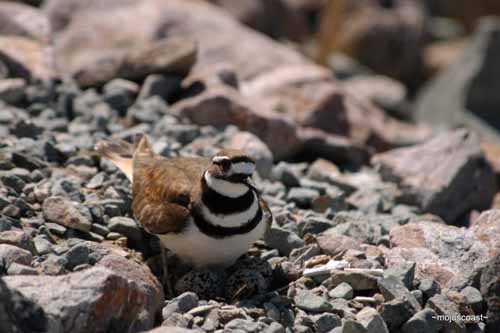
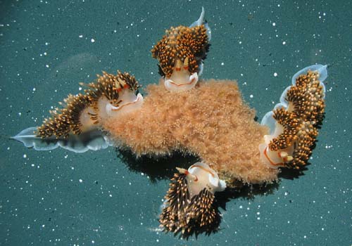
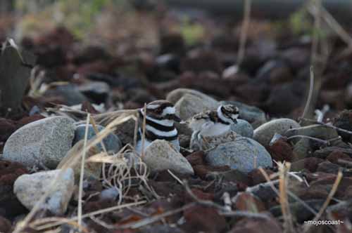
Photos
Maps
Alder Creek slide subtidal surveys (through 11/15/2012)
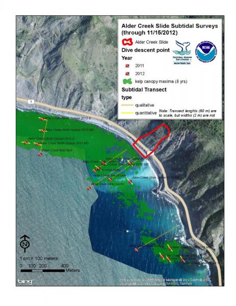
[View Larger]
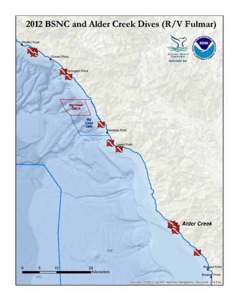
2012 Big Sur Nearshore Characterization and Alder Creek Dives
[View Larger]
Projects
Impacts associated with the recent range shift of the aeolid nudibranch Phidiana hiltoni (Mollusca, Opisthobranchia) in California
The feeding habits of the aeolid nudibranch Phidiana hiltoni were investigated. Implications for the potential impact to species not used to the increased density of this predator are presented.James V. Fitzgerald Marine Reserve: Resource Assessment
This study was initiated as a result of concerns by the California State Department of Fish and Game and the County of San Mateo about the potential impacts from current visitor use, potential increases in future visitor use, and the effectiveness of management and regulations in protecting the health and viability of the marine life in the James V. Fitzgerald State Marine Park.LiMPETS rocky intertidal monitoring
This page describes the monitoring program implemented by LiMPETS (Long-term Monitoring Program and Experiential Training for Students) in rocky intertidal habitats.Partnership for Interdisciplinary Studies of Coastal Oceans (PISCO): intertidal component
The goal of the intertidal PISCO (Partnership for Interdisciplinary Studies of Coastal Oceans) program is to investigate the rocky intertidal marine ecosystems of the west coast of the U.S. in an innovative, coordinated, and interdisciplinary fashion.
Sea star wasting disease (SSWD) in central California
Sea star wasting disease (SSWD) is a general description of symptoms found among sea stars afflicted with a disease that often leads to death. SWSD is widespread, from Alaska to Mexico, with an onset in Fall 2013. It is the largest, most wide-spread mass mortality event in recent history.
Links
MARINe: Multi-Agency Rocky Intertidal Network
Consortium of groups that monitor sites along the entire Pacific Coast of North America, from Alaska to Mexico, and several East Coast sites in Maine and New Hampshirehttps://marine.ucsc.edu/
AlgaeBase
A database of information on terrestrial, marine and freshwater algae, including photos and search functions.http://www.algaebase.org
American Fisheries Society
Strives to advance fisheries and aquatic science and promote the development of fisheries professionals.http://www.fisheries.org
Bilingual MERITO Web Site
The English/Spanish MERITO (Multicultural Education for Resource Issues Threatening Oceans) website provides bilingual information on: MERITO programs, dates of upcoming events, background information on a variety of sanctuary issues, downloadable education materials, and current reports and documents related to MERITO.http://www.montereybay.noaa.gov/educate/merito/welcome.html
Black Oystercatcher monitoring
2011 was the start of the first-ever population assessment of Black Oystercatcher in California.http://ca.audubon.org/birds-0/black-oystercatcher
California Geological Survey - An index to online geologic field trips, including coastal Central California
The California Geotour is an interactive index of Web pages of geologic field trip guides and related Web sites compiled by the California Geological Survey (CGS) for the benefit of all who have wondered about California's geologic features.http://www.conservation.ca.gov/cgs/Pages/Geotours.aspx
Farallones Marine Sanctuary Association Coastal Ecosystem Curriculum – Rocky Shores
Download content on the rocky intertidal of the Gulf of the Farallones National Marine Sanctuary. Curriculum, Powerpoint slideshows, fact sheets, and more. Contact Amy Dean -- Education Manager of the Farallones Marine Sanctuary Association -- PO Box 29386, San Francisco, CA 94129 -- 415-561-6625 x303 -- fax 415-561-6616 -- adean@farallones.orghttp://www.farallones.org
LiMPETS: Long term Monitoring Program and Experiential Training for Students
Middle school, high school and other volunteer groups monitor the rocky intertidal, sandy shore and offshore areas to provide critical data while increasing public awareness.http://limpetsmonitoring.org/
MARINe: Multi-Agency Rocky Intertidal Network
Scientists from Federal, State, and local government agencies, universities, and private and volunteer organizations have formed MARINe to monitor important shoreline resources.https://marine.ucsc.edu/
Monterey Bay Aquarium - Student and Teacher Resources and Activities
The Monterey Bay Aquarium offers teacher and student resources including: species and habitat-specific information, live cams, classroom activities, and interactive online games.http://www.mbayaq.org/lc/
Monterey Bay National Marine Sanctuary - Rocky Shores
A comprehensive and educational scientific characterization of an important habitat in the Monterey Bay National Marine Sanctuary.http://montereybay.noaa.gov/sitechar/rocky.html
NOAA Tide Predictions
Obtain tidal predictions computed by CO-OPS (Center for Operational Oceanographic Products and Services) for more than 3000 water level stations.http://co-ops.nos.noaa.gov/tide_predictions.shtml
NOAA's National Marine Sanctuaries LiMPETS Program: Monitoring the Rocky Intertidal
LiMPETS stands for Long-term Monitoring Program & Experiential Training for Students. LiMPETS offers hands on science opportunities for middle school, high school, and other volunteer groups by monitoring the rocky intertidal, sandy shore and offshore areas of the five west coast National Marine Sanctuaries; Olympic Coast, Cordell Bank, Gulf of the Farallones, Monterey Bay and Channel Islands.http://limpets.noaa.gov/
PISCO: Partnership for the Interdisciplinary Studies of Coastal Oceans
PISCO is a long term, large scale research program aimed at more fully understanding the nearshore environments on the West Coast.http://www.piscoweb.org
Sonoma State University, Department of Biology: Algae, the Forgotten Treasure of Tide Pools
Welcome algae lovers and tide poolers. Celebrate the slimy stuff overlooked by hunters of seastars, urchins, and seaweed! Browse and enjoy this gallery of favorite California green, brown, and red algae.http://www.sonoma.edu/biology/algae/algae.html
University of Rhode Island, Office of Marine Programs: Rocky Shore Classroom Activity
Virtual field trip of Rhode Island's rocky shore.http://omp.gso.uri.edu/doce2.htm
USGS - Geology and Coastal Hazards in the Northern Monterey Bay, California, A Field Trip Guidebook
The purpose of this field trip is to explore the relationships between local geology, coastal hazards, and human influences in the northern Monterey Bay, which is a tectonically active, high wave energy coastal environment.http://geopubs.wr.usgs.gov/open-file/of00-438/
USGS - Photo Tour from Año Nuevo to Santa Cruz, California
A digital photographic survey documenting the coastal morphology and stratigraphy between Point Año Nuevo and Santa Cruz, California, with precision-navigated overlapping images.http://pubs.usgs.gov/dds/dds-61/