Overview
The oceanography of the Monterey Bay National Marine Sanctuary is influenced by the California Current, a 1,200-kilometer (745-mile) broad and 300-meter (985-feet) deep surface current that transports water of subarctic origin southward along the North American coast at 15 to 30 centimeters (5.9 to 11.8 inches) per second (cm/s). Beneath this surface current and within about 100 kilometers of the coast, the California Undercurrent transports waters of subtropical origin northward at about four cm/s. In winter, this current surfaces, where it mixes with California Current waters and is called the Inshore Countercurrent, or Davidson Current.
Together, these currents are termed the California Current System, and the sanctuary lies wholly within this system. Thus, the surface and intermediate-depth water masses in the sanctuary are a mixture of subarctic Pacific water with low salinity and cool temperatures together with warmer, saltier Pacific Equatorial water. The pelagic organisms of the sanctuary originate and travel north- or southwards in these different water masses.
Three oceanographic seasons were originally described for Monterey Bay in the 1940s and are still in common use today:
- the upwelling period from early spring to late summer (February to July), when surface waters are cool
- the oceanic, or California Current, period from late summer to early fall (August to October), characterized by wind relaxation
- the Davidson Current period from late fall to late winter (November to January) characterized by winter storm conditions
During the spring and summer, upwelling occurs along much of the coast within the sanctuary, but Point Año Nuevo and Point Sur “anchor” areas of especially strong upwelling. These upwelling centers are readily observed in satellite images as cool zones, typically 3 to 5 ºC (37.4 to 41 ºF) cooler than waters 100 kilometers offshore.
Satellite images often show a tongue of cool water originating at the Año Nuevo center and flowing southwards across the mouth of Monterey Bay. This upwelling plume spins off eddies circulating both offshore and within the bay.
In the north bay, northward flow and lack of wind (the Santa Cruz mountains block upwelling-favorable winds) create an upwelling shadow characterized by strong thermal stratification and warm surface waters. In summer, this area flushes slowly and is often brown with very high phytoplankton biomass. (It has been called the “armpit” or “incubator” region of the bay.)
The upwelling center near Point Sur is generally cooler and more extensive than that near Año Nuevo. During strong upwelling conditions (persistent northwesterly winds), these cool waters can merge, forming a continuous band of upwelled water from north of Monterey Bay to south of Point Sur.
Varying degrees of iron limitation have been measured in the coastal waters of central California during the summer upwelling seasons. Iron limitation is most common and severe in waters removed from continental shelf sources of iron. Thus, areas with a wide continental shelf (e.g., Monterey Bay and the shelf to the north) tend to have waters that are iron-replete compared to areas with a narrow shelf (south of Monterey Bay). Iron-replete and iron-limited waters tend to differ in the associated phytoplankton communities and relative biomass at many trophic levels.
While the seasonal changes in the coastal ocean and Monterey Bay are important, longer-term interannual variations, principally El Niño events, also affect local physical and biological systems. During the 1982-1983 El Niño (one of the strongest in the last century), for example, dramatic changes were observed in the phytoplankton composition of Monterey Bay, such as an increased relative abundance of dinoflagellates and tropical species and a decreased abundance of diatoms.
During the 1992-1993 El Niño, total phytoplankton abundance and primary production rates measured in March 1992 were reduced by factors of three to four compared to March 1990. In addition, the increase in water temperature during an El Niño brings exotic species of southerly or offshore origin that are usually not found in the sanctuary.
Sanctuary offshore waters are in relatively good condition, but nearshore coastal areas, harbors, lagoons, estuaries and tributaries show a number of problems, including elevated levels of coliform bacteria, detergents, oils, nitrates, sediments and persistent pesticides such as DDT and toxaphene. These contaminants can have a variety of biological impacts – including bioaccumulation, reduced recruitment of anadramous species and transfer of human pathogens – as well as interference with recreational uses due to beach closures.
Phytoplankton blooms, including harmful algal blooms, have increased in frequency and distribution worldwide since 1980. The frequency of such blooms may be increasing with nutrient enrichment from agricultural and urban storm runoff as well as sewage effluent.
Monitoring
Spatial and Temporal Variability in Oceanographic and Meteorological Forcing along Central California
Researchers with the United States Geological Survey (USGS) analyzed more than 20 years (1980-2002) of hourly deep-water buoy data from off central California to investigate long-term trends and the behavior of the measured oceanographic and meteorological variables during different climatic regimes. Statistically significant differences were observed in the monthly mean significant wave height, dominant wave period, sea-level barometric pressures, sea-surface water temperature, and wind speed and direction during normal, La Niña and El Niño months. In addition to these monthly differences, statistically significant long-term trends in monthly mean significant wave height, dominant wave period, sea-level barometric pressures, sea-surface water temperature and wind speed were observed.
Monterey Bay Ocean Time Series Observations
Researchers at the Monterey Bay Aquarium Research Institute (MBARI) are studying the biogeochemical response of the central California ecosystem to climate and ocean variability. They are exploring the dynamic connections among physical, chemical and biological processes. This program has found that since 1998, ocean temperatures have fallen; the California Current has strengthened; and subsurface nitrate, surface chlorophyll and primary production have all increased due to a change in the Pacific Decadal Oscillation (PDO). This PDO-associated cooling makes it difficult to detect global warming in Monterey Bay.
Monterey Bay Aquarium Incoming Seawater Monitoring
As part of the Monterey Bay Aquarium’s ongoing water quality program, incoming seawater is monitored with both spot measurements and continuously on a five-minute interval using in-situ sensor technology. Data on water temperature, dissolved oxygen and nutrients have detected both seasonal events, such as upwelling, and periodic events, such as El Niños.
Center for Integrated Marine Technologies (CIMT)
CIMT is an interdisciplinary coastal research consortium that integrates data collected via remote sensing, moorings and ship-board surveys in the Monterey Bay region. CIMT uses these technologies to investigate linkages among coastal upwelling, nutrient delivery, phytoplankton and organisms at higher trophic levels (squid, fishes, seabirds, sea turtles, seals and whales).
Monterey Bay Microbial Observatory
Small, single-celled planktonic microbes represent the most abundant organisms in the world’s oceans. The goal of this study is to describe the microbes of Monterey Bay and correlate the presence and absence of particular groups with other physical, chemical and biotic variables.
Characterization of Geologic and Oceanographic Conditions at Pleasure Point
The USGS is compiling baseline geologic and oceanographic information on the coast and inner shelf off Pleasure Point in Santa Cruz County. This study will provide high-resolution topography of the coastal bluffs and bathymetry of the inner shelf out to water depths of 20 meters. In addition, the spatial and temporal variation in waves will be documented. These data will provide the baseline data needed for future studies directed toward predicting the impacts of stabilization on the sea cliffs, beach and nearshore sediment profiles; natural rock reef structures; and offshore habitats and resources.
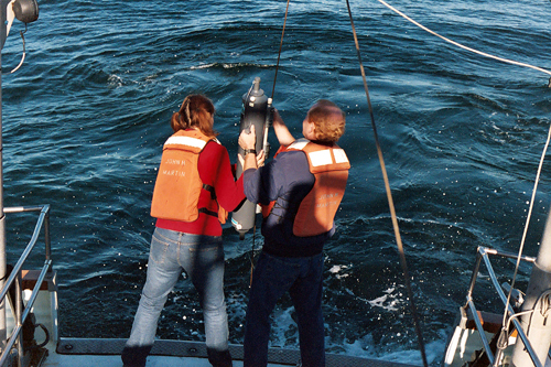
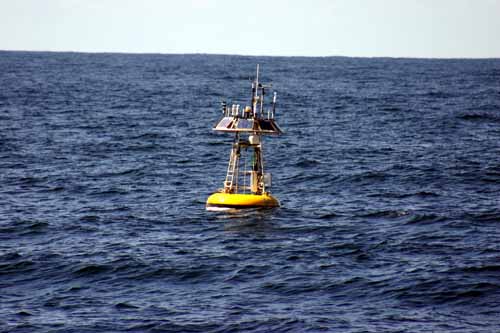
Photos
Maps
Projects
Are the Waters Along the Central California Coast and Monterey Bay Getting Colder?
There are indications that waters along the California coast are getting colder. Here we briefly examine three questions related to this change. First, how evident is this cooling along the central California coast and in Monterey Bay? Second, when did the change to cooler conditions occur locally? And third, why is it happening?California Cooperative Oceanic Fisheries Investigations (CalCOFI)
The California Cooperative Oceanic Fisheries Investigations (CalCOFI) was formed in 1949 to study the ecological aspects of the Pacific sardine population collapse off California. Today, the focus has shifted to the study of the marine environment off the coast of California, the management of its living resources, and monitoring the indicators of El Nino and climate change.
California El Niños
Unusual physical and ecological conditions in the California Current differ during individual El Niño and La Niña events. The project compares large-scale forcing associated with tropical El Niño and La Niña events, to describe and understand differences in the west coast response to these events.Center for Integrated Marine Technologies: Wind to Whales
The Center for Integrated Marine Technologies' (CIMT) mission is to create a coastal ocean observing and forecasting system that provides a scientific basis for the management and conservation of Monterey Bay, and serve as a model for all of California\'s coastal marine resources and the U.S. Integrated Ocean Observing System (IOOS).Center for Integrative Coastal Observation, Research and Education (CICORE)
The CSU Center for Integrative Coastal Observation, Research and Education (CI-CORE) is a distributed coastal observatory for applied coastal research and monitoring in the nearshore (<100 m water depth) along the entire California coastline.Characterization of geologic and oceanographic conditions at Pleasure Point, Santa Cruz County
A USGS study is underway to characterize the coastal bluffs, inner shelf morphology and wave conditions at Pleasure Point in Santa Cruz County.CSCAPE: Collaborative Survey of Cetacean Abundance and the Pelagic Ecosystem.
CSCAPE is a collaboration between the National Marine Fisheries Service and the National Marine Sanctuary Program to assess the abundance and distribution of marine mammals and to characterize the pelagic ecosystem out to ~300 nautical miles off the U.S. West Coast.In-situ Measurements of Turbidity Currents in the Monterey Submarine Canyon
For the first-time, scientists direclty measured the speed and character of turbidity currents in Monterey Canyon.MBARI Time Series (MBTS) Program
The oceanography of the MBNMS has received considerable study over the past 50 years. The California Cooperative Oceanic Fisheries Investigations (CalCOFI) began in 1949 to study the declining sardine fisheries off the North American west coast but over the decades it evolved and expanded in scope. This project describes how the Biological Oceanography Group at MBARI has conducted a focused program of observation on CalCOFI Line 67, within and offshore of Monterey Bay in the MBNMS.Monterey Bay Aquarium Incoming Seawater Monitoring
As part of the Monterey Bay Aquarium's ongoing water quality program incoming seawater is monitored with both spot measurements and continuously on a 5minute interval using in situ sensor technology. Both seasonal events, such as upwelling, and periodic events, such as El Niño are visible in the data record.Monterey Bay Microbial Observatory
Small, single-celled planktonic microbes represent the most abundant organisms in the world's oceans. This study aims to describe the microbes of the Monterey Bay and create a model for understanding marine microbial communities in general.Nearshore water monitoring of oxygen and pH in southern Monterey Bay
A decade-long time series of water quality parameters indicated that the nearshore, shallow subtidal was regularly inundated with cold, low oxygen and low pH waters.Nutrient Sources to Support the Gulf of the Farallones Food Web
The goal of this ongoing project is to determine whether nutrients from San Francisco Bay impact the rich food web of the Gulf of the Farallones in order to assess if anthropogenic changes in the estuary will have management implications for the coastal ecosystem.Ocean Margin Ecosystems Group for Acidification Studies (OMEGAS)
This is a three-year, NSF-funded study on the impacts of acidic ocean waters on two ecologically important species (sea urchins and mussels) in the California Current Large Marine Ecosystem.Ocean observing in the Monterey Bay National Marine Sanctuary: CalCOFI and the MBARI time series
This report introduces the CalCOFI and the MBARI programs as they relate to each other and oceanography within the MBNMS. A report (see below) includes a brief review of MBNMS oceanography with summary graphs, and also provide introductory links to the extensive websites and detailed research papers of both programs.Passive acoustic (sound) monitoring: hydrophone use by MBARI
The marine 'soundscape' is a continuously changing mosaic of sounds that originate from living organisms (communication and foraging), non-living natural processes (breaking waves, rain) and human activities (shipping, construction, and resource extraction). Listening to sound in the sea is a rich exploration of the marine environment, which includes some of the ways in which human activities may intersect with marine life.
Phytoplankton toxins in critical prey species in the Monterey Bay National Marine Sanctuary
Domoic acid (DA) is natural toxin produced by certain species of phytoplankton. When consumed by higher predators (e.g., marine mammals, birds, fishes), DA can cause sickness or death. This project studies samples from current research programs and past studies to the distribution and transmission of this toxin within the food web of Monterey Bay.Pioneer Seamount Ocean Acoustic Observatory
A vertical array of four hydrophones was installed on Pioneer Seamount to passively monitor the Pacific Ocean in the region south of San Francisco, CA.Saildrone West Coast Ecosystem Survey
Saildrone provides high-resolution ocean data via a fleet of unmanned surface vehicles (USVs) to NOAA, the Department of Defense, and other US agencies. Saildrone’s USVs are wind-powered vehicles capable of long duration ocean missions (up to 12 months) and carry a sophisticated solar-powered sensor package that streams real-time data to cost-efficiently augment ship-based methods. Saildrone USVs are 23 feet long and 20 feet high, can be launched from any dock, and travel at an average speed of 3-5 knots. The USVs weigh 1200 lbs and have a 7 ft draft.
Santa Cruz Ocean Observing Platform (SCOOP)
The primary goals of the Santa Cruz Ocean Observing Platform (SCOOP) are to establish and maintain a long-term dataset of weather and oceanographic measurements at the Santa Cruz Wharf that is accessible to both researchers and the public.SCOPE: Simulations of Coastal Ocean Physics and Ecosystems
We propose to model the coastal upwelling ecosystem within the Monterey Bay National Marine Sanctuary (MBNMS) with high spatial (kms) and temporal (days) resolution.Spatial and Temporal Variability in Oceanographic and Meteorologic Forcing along Central California: 1980-2002
High-resolution hourly data from 8 NOAA buoys deployed since the early 1980's off Central California were analyzed to improve our understanding of spatial and temporal variability of oceanographic and meteorologic forcing along the coastline.Tagging of Pacific Predators (TOPP)
The Tagging of Pacific Pelagics (TOPP) research program aims to understand the migration patterns of large predators in the North Pacific basin and how these animals act and interact in their open ocean habitats. By using satellite tagging techniques, TOPP researchers follow the movements of different species across multiple trophic levels (i.e., the food web) and in relation to physical oceanographic features in order to piece together a whole ecosystem picture.West Coast Obs and the Partnership for Interdisciplinary Studies of Coastal Oceans (PISCO): Oceanography component
The Partnership for Interdisciplinary Studies of Coastal Oceans (PISCO) Oceanographic monitoring program began in 1999. The project uses nearshore moorings to monitor ocean temperature at 18 sites between Pigeon Point and San Simeon, with ocean currents also measured at 4 and salinity at 1. Project data support PISCO's ecological studies in kelp forests and rocky intertidal habitats in the MBNMS.Links
Automatic Identification System by NPS
Naval Postgraduate School Ocean Acoustics Laboratory Monitoring Automatic Identification System (AIS) along Central Californiahttp://www.oc.nps.edu/~cwmiller/AIS/
CalCOFI: California Cooperative Oceanic Fisheries Investigation
Learn about a partnership between government agencies and institutions to investigate the California state fisheries.http://www.calcofi.org/
Climate Indices: Monthly Atmospheric and Ocean Time Series
This web site provides links to a variety of indices, allowing you to access the data by month.http://www.esrl.noaa.gov/psd/data/climateindices/list/
Discovery of Sound in the Sea
This web site will introduce you to the science and uses of sound in marine research.http://omp.gso.uri.edu/dosits/dosits.htm
FOR SEA, Institute of Marine Sciences
Site offers comprehensive and proven hands-on/minds-on K-12 curriculum guides that are available for purchase. Each lesson has student activities preceded by a "Teacher Background" section which contains key concepts, background information, materials needed, teaching hints, extension ideas, and answer keys.http://www.forsea.org
Geostationary Satellite Service
A satellite image of the western United States brought to you by National Oceanographic and Atmospheric Administration (NOAA) and the National Environmental Satellite, Data and Information Service.http://www.goes.noaa.gov/browsw.html
MARE: Marine Activities, Resources and Education
MARE is an interdisciplinary science program at the Lawrence Hall of Science (UC Berkeley) offering year-round professional development opportunities, including events that immerse your whole school—faculty, students and families—in the study and celebration of the ocean.http://www.lawrencehallofscience.org/MARE/
MBARI - Current Research Projects
Learn about current research projects conducted by the Monterey Bay Aquarium Research Institute (MBARI).http://www.mbari.org/rd/projects/current_projects.html
MBARI M1 mooring data
OASIS: Ocean Acquisition System for Interdisciplinary Science Mooring Data, Monterey Bay, CAhttp://www.mbari.org/bog/Projects/MOOS/M1.html
Monterey Bay Aquarium - Student and Teacher Resources and Activities
The Monterey Bay Aquarium offers teacher and student resources including: species and habitat-specific information, live cams, classroom activities, and interactive online games.http://www.mbayaq.org/lc/
MOOS: MBARI Ocean Observing System
Instrumented Moorings are set in Monterey Bay to collect data and aid study of the ocean. Access the online data archive and learn more about these mooring observing systems.http://www.mbari.org/bog/Projects/MOOS/default.htm
NASA SeaWIFS Project - Teacher Resources
SeaWIFS uses space technology to study physical and biological properties of the ocean surface. This page lists relevant teacher resources.http://oceancolor.gsfc.nasa.gov/SeaWiFS/TEACHERS/
NOAA - Ocean Explorer Program
Explore the ocean realm with NOAA. This Web site chronicles the adventures and discoveries of NOAA's at-sea science and education teams.http://oceanexplorer.noaa.gov/welcome.html
NOAA - Ocean Explorer Program
Explore the ocean realm with NOAA. This Web site chronicles the adventures and discoveries of NOAA's at-sea science and education teams.http://oceanexplorer.noaa.gov/
NOAA - Online Teaching Materials
Topics covered include El Niño, storms, the atmosphere, fisheries, the oceans and more. Each unit contains background information, data, applications, and additional activities and is written for middle school level.http://www.oar.noaa.gov/k12/index.html
NOAA Photo Library
NOAA's photo library contains incredible shots of an amazing array of animals, technology, scientists, and images of historical treasures. Site also offers search function for images.http://www.photolib.noaa.gov
Ocean Explorer Gallery
Great resource for images and sounds. Collections include maps, living ocean, sound in the sea, cultural heritage, history, technology and explorers.http://www.oceanexplorer.noaa.gov/gallery/gallery.html
Oceanography Resources- Educational resources
This includes links to online courses about oceanography, museum and university exhibitions, sites dealing with significant oceanographic field programs and experiments, technical reports, glossaries and various other documents pertaining to oceanography and related areas.http://stommel.tamu.edu/%7Ebaum/ocean_education.html
Odyssey Expeditions
A website that offers extensive information on Oceanography, Topics include water, seawater, ocean circulation and dynamics.http://www.odysseyexpeditions.org/oceanography.htm
Office of the Naval Research - Science and Technology Focus
This site is packed with ocean facts and information, including some naval discoveries. Lessons and activities are included.http://www.onr.navy.mil/focus/ocean/
Project Oceanography - MBNMS
A University of South Florida distance-learning program for middle school students taught by scientific experts. "Unit II: Monterey Bay National Marine Sanctuary" contains teacher packets on various topics.http://www.marine.usf.edu/pjocean/packets/sp02/sp02.htm
SCOPE: Simulations of Coastal Ocean Physics and Ecosystems
A scientific model simulating physical, chemical and biological processes in the Monterey Bay National Marine Sanctuary can further our understanding of ocean dynamics and aid in ocean management.http://www.mbari.org/bog/NOPP/default.htm
Smithsonian Education - Ocean Planet Lesson Plan
Part of a set of multidisciplinary lesson plans from the Smithsonian, this lesson plan focuses on the ocean bottom features such as the continental shelf, deep ocean plain, and mid-ocean ridges, and includes downloadable student activities. Grades 3-8.http://www.smithsonianeducation.org/educators/lesson_plans/ocean/secrets/essay.html
Texas A&M University and Jason Education Project - Ocean World Activities
Ocean World lesson plans and classroom activities. Associated with each of the background information sections are five classroom activities built on the common themes of: systems and structures, energy, change, interactions, and measurement. These classroom activities are intended to be a starting off point to tailor to a class.http://oceanworld.tamu.edu/educators/lesson_activities.htm
The Bridge - Ocean Sciences Teacher Resource Center
Materials and curricula related to many areas of study in the Monterey Bay. Be sure to check the data tip of the month archives. (Supported by the National Sea Grant Office, the National Oceanographic Partnership Program, and the National Marine Educators Association.)http://www.vims.edu/bridge/
University of Illinois - The Weather World 2010 Project
This website introduces a module focused on El Niño. Information is available on the conditions that are responsible for El Niño's occurrence, information on typical oceanic and atmospheric conditions that exist in the tropical Pacific when no El Niño is present, methods and resources used by NOAA for detecting and predicting the presence of El Niño, and how El Niño impacts local sea life populations.http://ww2010.atmos.uiuc.edu/(Gh)/guides/mtr/eln/home.rxml
USGS Pacific Coastal & Marine Science Center
Homepage of USGS Division that conducts multidisciplinary scientific research in the coastal and offshore areas of California, Oregon, Washington, Alaska, Hawaii, and other US Pacific Islands; and in other waterways of the United States.http://walrus.wr.usgs.gov
Whale Acoustics
A company that works with federal agencies to study man-made noise impacts on whales and the use of passive acoustics to develop census methods for whales.http://www.whaleacoustics.com