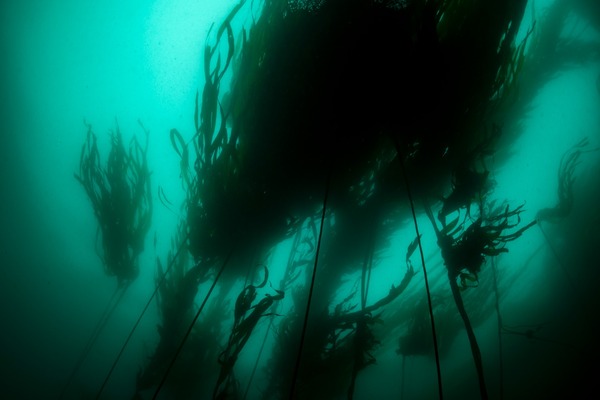
Overview
Kelp forests extend throughout most of the nearshore waters of the Monterey Bay National Marine Sanctuary. Hugging the coastline, they extend from just beyond the breaking waves to depths of <30 meters. Although kelp forests are a familiar and iconic habitat within the sanctuary, kelp canopy cover typically encompasses about 25 square miles, or less than 0.5% of the total surface area within the sanctuary. Although MBNMS encompasses 6,094 square miles of ocean, only 8% is within recreational diving depths (<130 feet).
Two species account for the bulk of physical structure and kelp biomass: the giant kelp, Macrocystis pyrifera, and the bull kelp, Nereocystis luetkeana. Although it is difficult to distinguish the two species using remotely sensed data (e.g., aerial photographs or hyperspectral images), long-term patterns of kelp canopy cover are persistent throughout the sanctuary.
Bull kelp, which tolerates high wave action, is typical along exposed rocky shores, whereas giant kelp is abundant in all areas except the most exposed sites. Both species co-mingle from Cambria to Monterey, but giant kelp is very rare north of Santa Cruz.
Kelp forests provide important structural features and ecosystem function to coastal marine communities. The physical structure of kelp provides vertical habitat similar to trees on land; it is used by numerous fishes and invertebrates. Kelp forests are considered an important nursery habitat for nearshore rockfishes and serve as a primary foraging area for many southern sea otters, Enhydra lutris nereis.
Although giant kelp was harvested commercially in southern California, the only commercial harvesting in the sanctuary is small-scale, limited to extraction by hand, and is used to feed farm-raised abalone. Management and leasing of kelp beds for commercial or other uses is administered by California Department of Fish and Game.
Giant kelp is a perennial but rarely lives longer than two to three years, and bull kelp is an annual. Both species recruit in late spring and early summer.
Rapid growth by giant kelp allows it to dominate nearshore habitats quickly. Kelp can also quickly recover from adverse environmental conditions (e.g., high wave action in winter, El Niño events). Drift kelp serves as in important ecological subsidy to intertidal and deeper shelf habitats, exporting significant amounts of carbon and nitrogen into communities via detritus.
In addition to the canopy-forming species, there are several kelp species (e.g., Pterygophora californica, Laminaria spp.) that form an understory below giant and bull kelp. This understory adds a tremendous amount of biomass to the kelp forest and provides additional habitat for fishes and invertebrates.
Because kelp forests serve such an important ecological role both structurally and functionally, they require monitoring and, when necessary, effective management. To understand and manage this critical habitat, we must first determine what drives the dynamic nature of the system, disentangling natural variation from human-induced change.
To date, our ability to tease apart natural from human-induced change has been poor. However, current and past monitoring efforts, including the Partnership for Interdisciplinary Studies of Coastal Oceans (PISCO) and the Cooperative Research and Assessment of Nearshore Ecosystems (CRANE) programs, will improve our understanding of kelp forest habitats in the sanctuary. These programs monitor and characterize fish, invertebrate and macro-algal assemblages and provide information to enhance resource managers’ abilities to implement ecosystem-based management and conservation.
Monitoring kelp forests at multiple spatial scales (e.g., within a single kelp bed vs. the Big Sur region) and linking trends and patterns to environmental processes (e.g., global climate change, decadal oscillations, El Niño events) help to create a more comprehensive view of the entire system. In addition, this information leads to testable hypotheses that will foster a better understanding of the mechanisms driving environmental change and how we can best alter human behavior to reduce our impact on these natural resources.
Monitoring
Information gathered from recent and ongoing kelp forest monitoring efforts includes the following:
Marine Resources Survey
Prior to SCUBA surveys, sites with persistent kelp canopy cover (based on California Department of Fish and Game remote-sensing data) were assumed to be relatively similar. Surveys showed that kelp cover was not tightly correlated with habitat quality and species richness. Some areas with extensive kelp cover were ranked lower (for richness, abundance, et al.) than those with little or no kelp. These results indicate that remotely sensed data must be ground-truthed before use in the process of resource management.
Juvenile Rockfish Abundance Surveys
From 2000 to 2004, eight species of juvenile rockfish (blue, black, yellowtail, canary, olive, widow, bocaccio and copper rockfish as well as the gopher /black and yellow complex) were observed by Tom Laidig at NOAA Fisheries at two sites offshore of Pacific Grove. In general, blue rockfish was the most abundant species, followed by yellowtail rockfish. Olive and black rockfishes were the next most abundant, and the remaining species were only seen occasionally. Blue and yellowtail rockfishes were abundant from 2001 to 2003, but their numbers dropped in 2004. Yellowtail rockfish were decreasing since their high in 2002. Olive rockfish were at low levels in all years, with the highest in 2001. Black rockfish increased in each of the four years.
Partnership for Interdisciplinary Studies of Coastal Oceans (PISCO) Subtidal Component
Since 1999, researchers from UC Santa Cruz, UC Santa Barbara and Stanford University have monitored intertidal and subtidal sites along central California, from Los Angeles to Half Moon Bay. Fish assemblage structure (relative abundance of species) differs regionally and inside versus outside marine reserves along the central coast. Significantly greater numbers were seen for five of 13 common species targeted by fishing (mostly rockfishes in the genus Sebastes), whereas only one of 10 common species not targeted by fishing was more abundant within reserves. No significant difference in either the average length or the proportion of larger fishes was seen between reserve and non-reserve sites. Based on estimates of size, density and length-specific fecundity for individual species, targeted fish populations have significantly higher biomass and larval-production capacity within reserve boundaries.
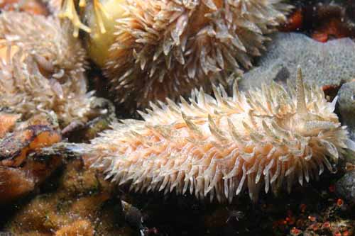
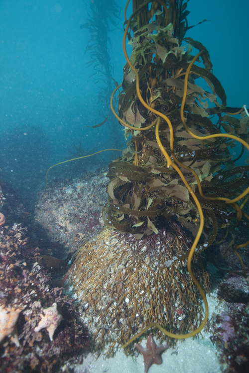
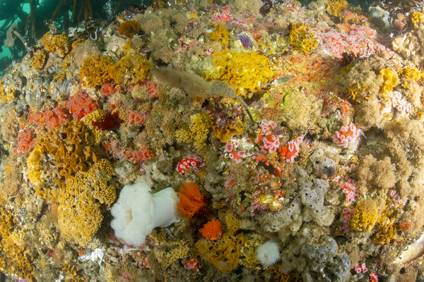
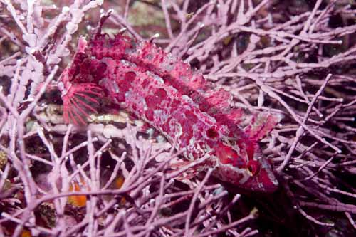
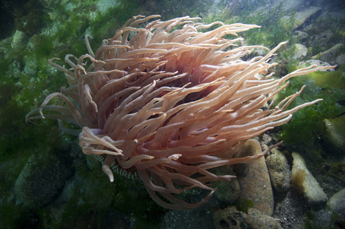
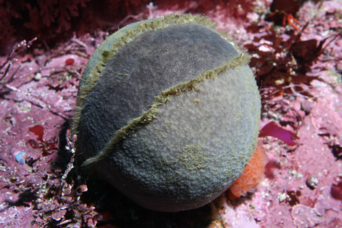
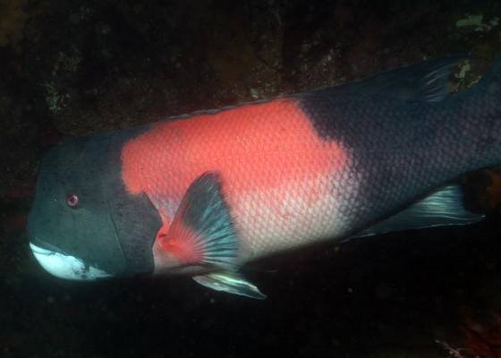
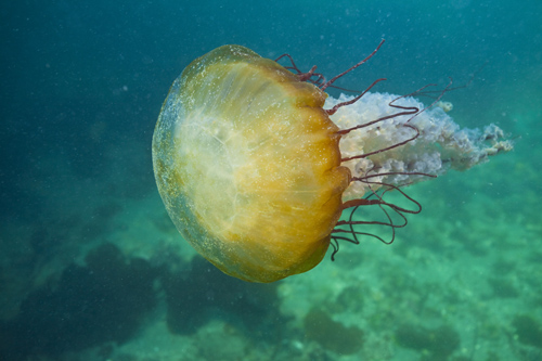
Photos


Maps
Alder Creek slide subtidal surveys (through 11/15/2012)
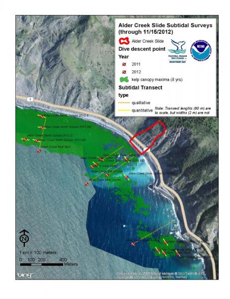
[View Larger]
2012 Big Sur Nearshore Characterization and Alder Creek Dives
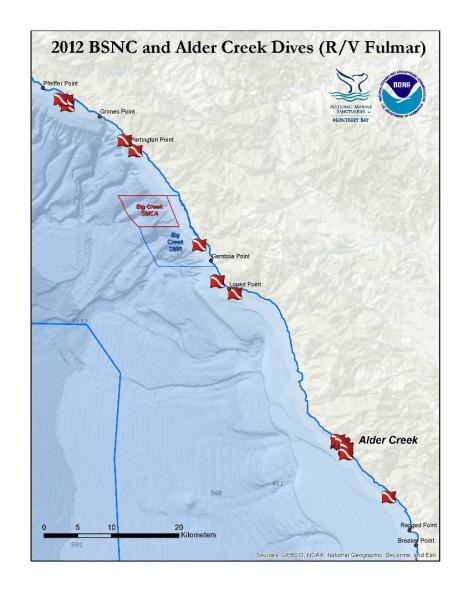
[View Larger]
R/V Fulmar Dive Sites (8/06 - 2/12)
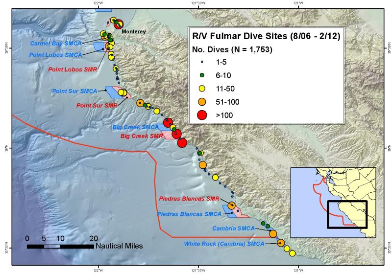
[View Larger]
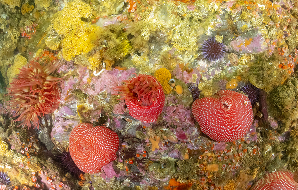
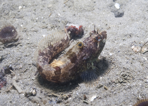
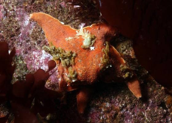
Kelp Forests
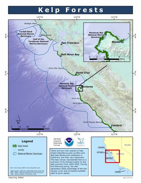
[View Larger]
Projects
Autonomous Reef Monitoring System (ARMS) in a central California kelp forest
This project will assess both marine biodiversity and bioinvasions using a variety of genetic methods, including DNA barcoding and metagenomic analyses of benthic communities, in which bulk DNA from entire assemblages are extracted and sequenced by Next Generation Sequencing technology. Settling modules called Autonomous Reef Monitoring System (ARMS) are deployed, colonized by biota, retrieved and analyzed after collecting the associated biota from the ARM.Big Sur Nearshore Characterization (BSNC)
Led by MBNMS staff, research divers qualitatively characterize subtidal (<20 m deep) algae, invertebrates, and fishes along the Big Sur coast, from Point Lobos to Cambria. These data are used to complement quantitative data collected by PISCO and fill in knowledge gaps.
California Collaborative Fisheries Research Project: Surveys of Nearshore Fishes in and near Central California Marine Protected Areas
This project involved the fishing communities of Half Moon Bay, Monterey Bay, Morro Bay, and Port San Luis, California to develop monitoring protocols for the use of hook and line fishing gear. Baseline data were collected for three Marine Protected Areas that were established by the State of California in September 2007. Experienced volunteer anglers fished with standardized gear for a specified amount of time while aboard one of five Commercial Passenger Fishing Vessels (CPFV), landing a total of 7,928 fishes, comprised of 27 species. Fishes were identified, measured, tagged, and released.Cm-scale assessment of collateral damage due to urchin culling
CDFW or CDFW-permitted divers culled urchins in situ to assess whether hand-held tools caused collateral damage to the reef itself or to the non-targeted organisms on the reef. This experiment occurred at Tanker Reef in Monterey Bay and Lingcod Reef in Carmel Bay in 2021, and then was replicated at Fort Ross in Greater Farallones NMS in 2024.
Colonization genetics of globally invasive marine bryozoa: does adaptation prior or post-introduction determine spread?
The central goal of this project was to determine the extent to which genetic variation helps explain the success of invasions by non-native marine colonial organisms (in this study, bryozoans in the genus Watersipora).Cooperative Research and Assessment of Nearshore Ecosystems (CRANE)
The Cooperative Research and Assessment of Nearshore Ecosystems (CRANE) program was established in spring 2003. CRANE uses quantitative diver visual surveys to sample kelp forests for fishes, invertebrates, and algae.Detecting non-native species in kelp forests and on rocky shores
As part of a larger research effort focused on detecting marine non-native species in California bays and estuaries, we last year began surveys for target non-native species along the outer coast. We surveyed 10 rocky intertidal sites from Marin County to Monterey County and 8 kelp forest sites from Monterey to Carmel. Our list of target species is comprised of non-native species previously reported from the open coast of California or established in protected bays and estuaries and deemed capable of colonizing the open coast.Integrated tracking of kelp and urchin recruitment in Monterey Bay
Our team is leading one of the first integrated efforts to measure kelp and sea urchin recruitment simultaneously across forested reefs and urchin barrens in Monterey Bay. We deploy standardized recruitment substrates to intercept these microscopic drifters, to determine 1) if kelp recruitment naturally reseeds barren areas; 2) if urchin recruitment is strong enough to lock ecosystems into barrens; and 3) if there are the ecological tipping points that determine whether a reef recovers or collapses. Understanding these microscopic beginnings is essential to forecasting resilience and designing effective conservation solutions. This research provides the foundation for science-based restoration and supports California’s broader resilience and 30x30 conservation goals.
Juvenile Rockfish Abundance Surveys using SCUBA
Scuba surveys are conducted by the National Marine Fisheries Service (NMFS) throughout late spring and summer to count the number of juvenile rockfish of all species that settle to the kelp bed and nearshore environments. An annual index is produced from this data for each species.Kelp Watch 2014
The purpose of Kelp Watch 2014 is to monitor California beds of giant kelp and bull kelp for Cesium-134 and Cesium-137, the major isotopes in seawater potentially arriving from the damaged Fukushima reactor in Japan by mid-2014.Marine Biotechnology Development from Marine-Derived Actinomycetes
Dr. Roger Linington and his students collect sediment samples from throughout the sanctuary, then grow and isolate marine bacteria that may provide new and unique natural products with broad applications in microbiology, biochemistry, chemistry and medicine.Marine Resources Survey in Big Sur
Highway 1 in Big Sur is often subject to delays and closures due to storms, washouts, and landslides. The Big Sur Coast Highway Management Plan (CHMP) develops sustainable strategies that ensure the safe and efficient operation of the highway while protecting the unique terrestrial and marine resources. The Marine Resources Survey will characterize targeted intertidal and nearshore subtidal areas along the Big Sur coast.
Mark and Recapture Studies of Nearshore Groundfishes in the Carmel Bay Area
This project collects information to support fisheries management and to provide baseline information for the purpose of evaluating marine protected area (MPA) efficacy for marine resources in the Monterey Bay region. A commercial passenger fishing vessel was used as a platform to hook-and-line catch and tag fishes at the Carmel Pinnacles State Marine Reserve and a nearby, non-protected site at Carmel Point. Tagged, recaptured fishes inform managers on nearshore groundfish populations, movement, and species composition in the Carmel Bay region.Nutritional Constraints on Sea Otters in the Monterey Bay National Marine Sanctuary
We are investigating nutritional constraints on southern sea otters (Enhydra lutris nereis) by examining the nutrient composition of sea otter prey while coupling these data with studies on otter foraging behavior.Ocean Margin Ecosystems Group for Acidification Studies (OMEGAS)
This is a three-year, NSF-funded study on the impacts of acidic ocean waters on two ecologically important species (sea urchins and mussels) in the California Current Large Marine Ecosystem.Persistence and Recovery of Abalone Populations in Central California
We investigated patterns and processes of persistence and recovery of depleted invertebrate populations, red (Haliotis rufescens) and black (H. cracherodii) abalone, in central California.PISCO: central coast MPA monitoring
On September 21, 2007, 29 new Marine Protected Areas (MPAs) went into effect in central California. This project was designed to collect baseline data at sites inside and outside the MPAs prior to their establishment.
PISCO: subtidal ecology in central California
The goal of the subtidal PISCO (Partnership for Interdisciplinary Studies of Coastal Oceans) program is to investigate the nearshore rocky reef marine ecosystems of the west coast of the U.S. in an innovative, coordinated, and interdisciplinary fashion.
REEF (Reef Environmental Education Foundation) monitoring program
The Reef Environmental Education Foundation (REEF)'s Fish Survey Project enlists the help of recreational SCUBA divers to identify and count nearshore fishes.
Reef Check California (RCCA)
Reef Check California (RCCA) is a non-profit organization building a network of informed volunteer divers who support the sustainable use and conservation of our nearshore marine resources. These volunteer divers survey nearshore reefs providing data on the status of key indicator species.
Sea star wasting disease (SSWD) in central California
Sea star wasting disease (SSWD) is a general description of symptoms found among sea stars afflicted with a disease that often leads to death. SWSD is widespread, from Alaska to Mexico, with an onset in Fall 2013. It is the largest, most wide-spread mass mortality event in recent history.
Spatial and temporal variability of kelp forest canopies in central California
This master's thesis studied kelp canopy cover data collected from 1985-1991 along a 65 km stretch of coastline spanning the central coast of California.Tanker Reef: surveys of kelp and urchins by MBNMS and CDFW scientists
In April 2021 scientists at the California Depart of Fish and Wildlife and Monterey Bay National Marine Sanctuary began a collaborative project to survey kelp and urchins at Tanker Reef. Two areas were targeted, a 100x100 m "grid" where sport fishing divers with a valid recreational fishing license used hand-held tools to cull red and purple urchins, and a control area where culling was absent.
Links
Monterey Bay Kelp Forests: Full of Diversity!
Intriguing stories of life, death, and deception.http://www.sanctuarysimon.org/mbnms/docs/build/Kelp_Brochure_AC_2009.pdf
1999 MBNMS Technical Report - The Effects Of Small-Scale Kelp Harvesting On Giant Kelp Surface Canopy Dynamics
See the final report from the Coastal Solutions Group to the Monterey National Marine Sanctuary and the cities of Monterey and Pacific Grove.https://montereybay.noaa.gov/research/techreports/trdonnellan1999.html
AlgaeBase
A database of information on terrestrial, marine and freshwater algae, including photos and search functions.http://www.algaebase.org
Golden State Images - Kelp Forests
Golden State Images features California marine wildlife and scenic coastal photography, including kelp forests.http://goldenstateimages.com/kelp.htm
Monterey Bay Aquarium - Kelp Forest
Learn more about these unique underwater forests.http://www.montereybayaquarium.org/efc/kelp.aspx
Monterey Bay Aquarium - Student and Teacher Resources and Activities
The Monterey Bay Aquarium offers teacher and student resources including: species and habitat-specific information, live cams, classroom activities, and interactive online games.http://www.mbayaq.org/lc/
Monterey Bay National Marine Sanctuary - Kelp Forest and Rocky Subtidal
A comprehensive and educational scientific characterization of an important habitat in the Monterey Bay Sanctuary.http://montereybay.noaa.gov/sitechar/kelp.html
National Geographic Society - Monterey Bay Sanctuary
Take a virtual dive into the kelp forest, or explore the submarine canyon in the Monterey Bay Sanctuary, one of the largest protected marine areas in the world.http://www.nationalgeographic.com/monterey/
National Geographic Society - Monterey Bay Sanctuary
Take a virtual dive into the kelp forest, or explore the submarine canyon in the Monterey Bay Sanctuary, one of the largest protected marine areas in the world.http://www.nationalgeographic.com/monterey/
PBS Online - Secrets of the Ocean Realm, Cathedral in the Sea Activity
This website contains information, teaching activities, quizzes, images and more. This activity focuses on kelp forests and contains a set of objectives, background information, a list of materials, procedures, follow-up evaluation and some additional Web references.http://www.pbs.org/oceanrealm/intheschool/school1.html
PISCO: Partnership for the Interdisciplinary Studies of Coastal Oceans
PISCO is a long term, large scale research program aimed at more fully understanding the nearshore environments on the West Coast.http://www.piscoweb.org
The Bridge - Ocean Sciences Teacher Resource Center
Materials and curricula related to many areas of study in the Monterey Bay. Be sure to check the data tip of the month archives. (Supported by the National Sea Grant Office, the National Oceanographic Partnership Program, and the National Marine Educators Association.)http://www.vims.edu/bridge/