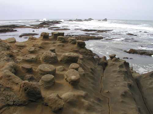
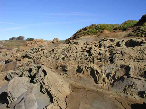
The coastal and seafloor landscapes within the three northern California sanctuaries have been influenced by phenomena including earthquakes, millions of years of wind and water erosion, submarine landslides and changes in sea level.
An area’s character can affect both the location and size of habitats for many marine plant and animal species. Therefore, mapping geologic features and understanding the processes that shape them is essential to recognizing and interpreting change.
Each of the three sanctuaries boasts interesting features that have resulted from its geologic history. For example:
- The Salinian bedrock of Cordell Bank was originally created about 100 million years ago as part of the Sierra Nevada range. When the San Andreas fault formed, it sheared off part of the range, including the granitic feature of Cordell Bank, and carried it north to its present location.
- At the end of the last ice age, the great glaciers that covered much of the northern hemisphere began melting – causing worldwide sea level to rise. It rose to its present-day position within 5,000 years; and in that time, the continental shelf portion of the Greater Farallones sanctuary was flooded, and Tomales Bay, Bolinas Lagoon, Estero Americano and Estero de San Antonio became estuaries.
- Monterey Bay formed as wave action and sea-level rise eroded weaker rocks and sediment of the inner bay, while the stronger sedimentary rocks of Santa Cruz and the granitic rocks of Monterey resisted erosion and became headlands. The concave structure of Half Moon Bay and San Simeon Bay (to the north and south, respectively) formed in the same manner, with only one defining headland.
All three sanctuaries are greatly influenced by their location in the zone where two of the earth’s major tectonic plates – the Pacific and North American – meet. The San Andreas Fault system (comprised of several sub-faults) forms the boundary between these two plates. The Pacific Plate is slowly moving northward relative to the North American Plate, but most of this motion occurs in catastrophic bursts of movement – earthquakes – along the fault system.
Movement along these faults helps to shape the surrounding landscape: coastal mountains are thrust upwards, submarine canyons are channeled and underwater landslides are triggered. In the Greater Farallones, the San Andreas Fault zone splits Bolinas Lagoon, Tomales Bay and Bodega Bay; it is responsible for the long, straight, narrow shape of Tomales Bay.
Monitoring
Research often takes place across the three sanctuaries. Such is the case with the UsSEABED database. This project, spearheaded by the U.S. Geological Survey (USGS), is an ongoing effort to gather diverse geologic data about the continental shelf and organize it through a GIS database.
Of course, many projects are sanctuary-specific as well. For example, researchers have collected and processed high-resolution backscatter and bathymetry data of Cordell Bank and surrounding soft-bottom areas. The data are being used to develop a benthic habitat map of the bank and surrounding region.
In the Monterey Bay region, monitoring efforts focus on three general topics: coastal erosion, the continental shelf and submarine canyons. Some recent studies in each area are noted here.
Coastal Erosion
- Scientists are studying erosion from high coastal cliffs, such as Big Sur, and the effects of this sediment load to the organisms that live below the cliffs.
- Studies have found that erosion rates on beaches from San Francisco to Monterey appear to be increasing from the long-term (within the past 120 years) to the short-term (within the past 30 to 50 years).
- Researchers have observed that most erosion within the sanctuary happens during severe El Niño winter storms, when wave power is strong and rainfall is high.
- An eight-year study found that coastal protection structures, such as riprap or sea walls, had some seasonal impacts to the structure of beaches; however, there were no significant long-term effects on beaches due to waves interacting with riprap or sea walls.
The Continental Shelf
- Researchers published a GIS-based map and database that show geologic interpretations of the continental shelf from Point Año Nuevo to Point Sur, derived from acoustic imagery of the seafloor and geologic samples.
- On a smaller, more detailed scale, researchers are also conducting nearshore mapping at Pleasure Point in Santa Cruz.
Submarine Canyons
- Researchers measured a large turbidity current that carried an estimated 2,200,000 cubic meters of gravelly sediment approximately 550 meters down the Monterey Submarine Canyon.
- Scientists recently documented the first ever in-situ measurements of velocity profiles for turbidity currents in Monterey Submarine Canyon.