Overview
The diverse geologic features of the Monterey Bay National Marine Sanctuary are controlled by dynamic processes that can significantly influence ecosystems and habitats. For example, natural hazards such as earthquakes, erosion and submarine landslides play an important role in shaping the coast and seafloor.
These shifts in the sanctuary’s geologic character can affect both the location and size of habitats for many marine plant and animal species. Therefore, mapping geologic features and understanding the processes that shape them is essential to recognizing and interpreting change in the sanctuary.
The San Andreas Fault System traverses the sanctuary in a northwest-southeast direction and controls much of the overall geologic character of the region. This series of sub-parallel faults forms the boundary between the Pacific and North American tectonic plates, the former of which is sliding northwest several centimeters per year relative to the latter. In the vicinity of the sanctuary, the San Andreas Fault System is comprised of:
- the San Gregorio Fault (which extends from Monterey to Half Moon Bay and is predominantly offshore)
- the Monterey Fault Zone (which extends over a wide area from Monterey to Santa Cruz within Monterey Bay)
- the San Simeon Fault (near San Simeon)
- the infamous San Andreas Fault (which is almost entirely onshore in this region, with the exception of a segment extending from Mussel Rock to Marin County)
Movement along these faults causes earthquakes and helps to shape the surrounding landscape: coastal mountains are thrust upwards, submarine canyons are channeled and underwater landslides are triggered.
A recent study by the United States Geological Survey (USGS) determined that there is a 62 percent chance of a magnitude 6.7 or greater earthquake occurring on one of the faults in the greater San Francisco Bay Area between 2003 and 2032. In this time period, there is a 10 percent chance of a magnitude 6.7 or greater earthquake on the San Gregorio Fault and a 21 percent chance of a similar earthquake on the San Andreas Fault.
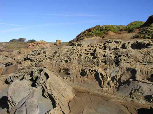
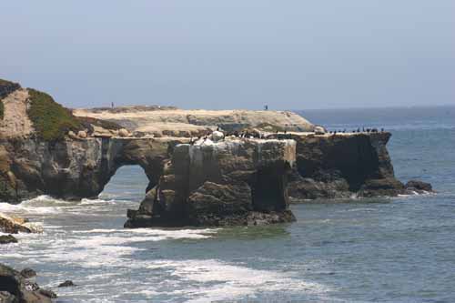
Monterey Bay, one of the sanctuary’s most prominent features, formed as wave action and sea-level rise eroded weaker rocks and sediment of the inner bay, while the stronger sedimentary rocks of Santa Cruz and the granitic rocks of Monterey resisted erosion and became headlands. The concave structure of Half Moon Bay and San Simeon Bay formed in the same manner, with only one defining headland.
Monitoring
Important focus areas for monitoring efforts in the sanctuary include coastal erosion, the continental shelf and submarine canyons.
Coastal Erosion
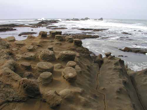
A significant amount of development and infrastructure is threatened by coastal retreat, and coastal erosion can impact habitats, such as kelp forests and bird nesting grounds on beaches. Highlights from recent studies of coastal erosion in this area are described below:
- In areas with high coastal cliffs, such as Big Sur, USGS research has shown that erosion rates are well correlated with local rock types and that cliffs are eroding at an average rate of 18 centimeters per year, mostly through large, episodic landslides. These landslides transfer an average of 21,000 cubic meters (741,608 cubic feet) of sediment per kilometer (0.62 miles) of Big Sur’s coastline to the nearshore zone every year. The sanctuary has teamed with the Partnership for Interdisciplinary Studies of Coastal Oceans (PISCO) and others to study the effects of this sediment load to the organisms that live below the staggering cliffs of Big Sur.
- Over the past 120 years, beaches have been eroding at approximately 0.2 meters (.06 feet) per year (from San Francisco to Monterey). Maximum erosion rates (1.8 and 1.3 meters per year, respectively) were documented just north of Point Antilde;o Nuevo and at Indian Head Beach in southern Monterey Bay. Overall, erosion rates appear to be increasing from the long-term (within the past 120 years) to the short-term (within the past 30 to 50 years).
- Most erosion (landslides, beach erosion, cliff erosion and other coastal processes) within the sanctuary happens during severe El Niño winter storms, when wave power is strong and rainfall is high. For example, the tops of cliffs were found to have retreated 13 meters over the 1997-1998 El Niño winter in Pacifica, where 12 coastal homes were condemned because of cliff erosion.
- An eight-year study by UC Santa Cruz (UCSC) researchers and others found that coastal protection structures, such as riprap or sea walls, had some seasonal impacts to the structure of beaches; however, there were no significant long-term effects on beaches due to waves interacting with riprap or sea walls.
The Continental Shelf
Another important geologic feature is the continental shelf, the shallowly-dipping, submerged extension of the continent that extends to approximately 120 meters’ water depth and varies greatly in width along the length of the sanctuary. The shelf is covered with mud, sand, gravel and rocky outcrops that provide ecological niches for marine species.
Mapping the shelf’s geology and characterizing how it changes over time is essential to understanding sanctuary habitats. Because of the expense and technical challenges of underwater mapping, this research often requires collaboration among several organizations, including the USGS, the Monterey Bay Aquarium Research Institute (MBARI), California State University Monterey Bay (CSUMB), Moss Landing Marine Laboratory (MLML), UCSC and others.
Examples of continental shelf mapping projects in the region include the following:
- Researchers from USGS and other organizations published a GIS-based map and database that show geologic interpretations of the continental shelf from Point Año Nuevo to Point Sur, derived from acoustic imagery of the seafloor and geologic samples. Much of the middle continental shelf is covered with fine-grained sediment, while the regions closer to shore and at the edge of the continental shelf are generally rocky and/or are dominated by coarser-grained sediment (e.g., sand or gravel).
- On a smaller, more detailed scale, USGS researchers are conducting nearshore mapping at Pleasure Point in Santa Cruz. Obtaining accurate maps of the seafloor close to shore is challenging because of intense wave action and variability in bathymetry. The USGS group is using a variety of advanced mapping techniques to provide resource managers with important information on the structure of the nearshore seafloor and coastal cliffs.
- USGS has also spearheaded a major effort to gather diverse geologic data about the continental shelf and organize it through a GIS database. This project, called usSEABED, provides unprecedented coverage of the sediment and rock types sampled from the seafloor as well as a searchable catalog of other observations, such as micro and macro flora and fauna and sedimentary structures.
Submarine Canyons
Within the center of Monterey Bay is the Monterey Submarine Canyon, the largest of a set of canyons that dissect the continental shelf, delivering huge sediment loads via turbidity currents down the continental slope to the abyssal plains of the deep ocean. The Monterey Submarine Canyon is comparable in depth, gradient and length to the Grand Canyon of Arizona; it constitutes a unique deep-water habitat relatively close to shore.
Other large canyons in the area include:
- Pioneer Canyon (offshore of Half Moon Bay)
- Ascension, Año Nuevo and Cabrillo Canyons (offshore of Davenport)
- Carmel and Soquel Canyons (which feed into Monterey Canyon)
- Sur, Partington, Mill Creek, and Lucia Canyons (offshore of Big Sur)
Measuring the sediment-laden currents that carve these canyons is a difficult task because of the episodic nature and immense size of the flows. Researchers have successfully documented turbidity currents in recent years, as described below:
- MBARI researchers measured a large turbidity current that carried an estimated 2,200,000 cubic meters of gravelly sediment approximately 550 meters down the Monterey Submarine Canyon. Instrument packages deployed in the canyon were dislodged by the event, and their recovery allowed the scientists to estimate the scale of the turbidity current. The researchers believe that high wave conditions set off the current, indicating that sediment gravity flows do not require exceptional triggering events such as earthquakes.
- USGS recently documented the first ever in-situ measurements of velocity profiles for turbidity currents in Monterey Submarine Canyon. The maximum along-canyon velocity of a turbidity current was 190 centimeters per second, which is equivalent to 4.25 miles per hour. The currents were generally confined to within 50 meters of the seafloor, and as they moved down the canyon, their heads moved closer to the canyon floor. All of the turbidity current events recorded during this study occurred in winter and may have been triggered by large storm waves and high stream flows from the nearby Salinas River.
Photos
Maps
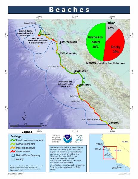
Shoreline type along the central California coastline
[View Larger]
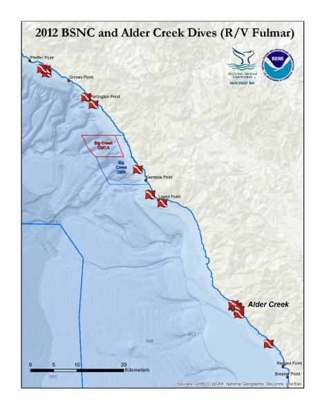
2012 Big Sur Nearshore Characterization and Alder Creek Dives
[View Larger]
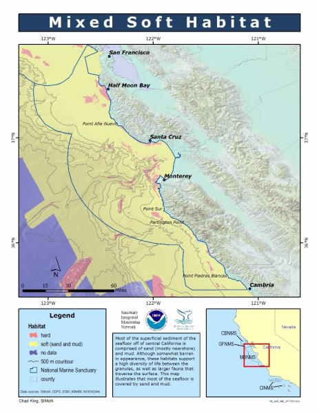
Mixed Soft Habitat
[View Larger]
Projects
Characterization of geologic and oceanographic conditions at Pleasure Point, Santa Cruz County
A USGS study is underway to characterize the coastal bluffs, inner shelf morphology and wave conditions at Pleasure Point in Santa Cruz County.Coastal Cliff Retreat Rates Along the Big Sur Coast, Monterey and San Luis Obispo Counties, California
This study provides coastal cliff retreat rates along the Big Sur coast and relates that erosion to local geology.Coastal Erosion Along the U.S. West Coast During the 1997-98 El Niño: Expectations and Observations
During late summer 1997, NASA's Wallops Flight Facility, NOAA's Coastal Services Center, and the USGS Coastal & Marine Program formulated a plan to determine the magnitude, spatial patterns, and causative processes of El Niño-induced change along the west coast of the United States.Estimated Sediment Yield from Coastal Landslides and Active Slope Distribution Along the Big Sur Coast, Monterey and San Luis Obispo Counties, California
This study was undertaken as a direct result of the need identified by CalTrans and MBNMS staff for fundamental data on background sediment volumes entering the MBNMS from coastal landslides.Gravity Flow Event in Monterey Canyon, 20 December 2001
A sediment gravity flow descended through Monterey Canyon on December 20, 2001. The timing of this event is documented by a current meter found 550 m down-canyon from its deployment site, buried completely within a thick deposit of sediment.In-situ Measurements of Turbidity Currents in the Monterey Submarine Canyon
For the first-time, scientists direclty measured the speed and character of turbidity currents in Monterey Canyon.Interaction of Seawalls and Beaches: Eight Years of Field Monitoring, Monterey Bay, California
A long-term investigation of how coastal armoring structures affect beach morphology, both seasonally and over many years.Marine Resources Survey in Big Sur
Highway 1 in Big Sur is often subject to delays and closures due to storms, washouts, and landslides. The Big Sur Coast Highway Management Plan (CHMP) develops sustainable strategies that ensure the safe and efficient operation of the highway while protecting the unique terrestrial and marine resources. The Marine Resources Survey will characterize targeted intertidal and nearshore subtidal areas along the Big Sur coast.
Multibeam bathymetry mapping of priority habitat areas with the Monterey Bay National Marine Sanctuary
The goal of this project was to provide high-resolution multibeam bathymetry and sonar-derived habitat GIS products for several of the priority mapping areas primarily along the central coast of California from Yankee Point (near Carmel) to the southern MBNMS boundary (near Cambria) at depths <80 m.Northern Central California Coast State Waters Mapping Project (NCCMP)
This project maps the state water seafloor habitats (MHHW out to 3 nm) from Año Nuevo to Bolinas (NCCMP Phase I) using bathymetric LIDAR and multibeam echo sounders (MBES) to obtain both bathymetry data and acoustic backscatter and reflectance imagery.Oblique Aerial Photography - Coastal Erosion from El Niño Winter Storms
The U.S. Geological Survey as part of its Coastal and Marine Program is taking aerial photographs to assess coastal erosion from severe storms.Seafloor Mapping in Monterey Bay, Cordell Bank, and Gulf of the Farallones National Marine Sanctuaries
National Oceanic and Atmospheric Administration and U.S. Geological Survey scientists mapped and characterized seafloor areas on the continental shelf in three west coast National Marine Sanctuaries using side-scan sonar and underwater video technology.usSEABED: A USGS Pacific Coast Offshore Surficial Sediment Data and Mapping Project
The USGS will soon publish its first release of Pacific coast data from the usSEABED database, a map-based compilation of offshore surficial sediment data.Links
Big Sur Region Earth Sciences Bibliography
A compilation of citations pertaining to Earth sciences studies performed in the Big Sur region of central coastal California.http://www.ventanawild.org/news/fe02/geobib.html
California Coastal Commission - 1995 ReCAP Pilot Project, Monterey Bay Region: Coastal Hazards
This chapter summarizes ReCAP's investigation of shoreline hazard response -- protection of upland development by armoring, the permitting associated with existing armoring, the impacts from armoring, the policies which address shoreline protection, and the likely changes which will happen to the shoreline in the future assuming existing trends and policies continue.http://www.coastal.ca.gov/recap/chap3.html
California Coastal Mapping Project
The California Coastal Mapping Program is a comprehensive effort to combine seafloor mapping data with shoreline data to create seamless onshore-offshore maps of California's coastline.http://www.opc.ca.gov/2010/01/mapping-californias-coastal-areas/
California Geological Survey - An index to online geologic field trips, including coastal Central California
The California Geotour is an interactive index of Web pages of geologic field trip guides and related Web sites compiled by the California Geological Survey (CGS) for the benefit of all who have wondered about California's geologic features.http://www.conservation.ca.gov/cgs/Pages/Geotours.aspx
Central Coast Watershed Studies (CCoWS)
The Central Coast Watershed Studies (CCoWS) team is part of the Watershed Institute, in the Division of Science and Environmental Policy at California State University Monterey Bay. They conduct research on watersheds that feed into the MBNMS.http://ccows.csumb.edu/home/
CSUMB Seafloor Mapping Lab
At California State University Monterey Bay, students get hands-on research experience with mapping the seafloor. Find out more!http://seafloor.csumb.edu/index.html
Elkhorn Slough Tidal Wetland Plan
The purpose of this collaborative planning process is to conserve, enhance, and restore tidal habitats in the Elkhorn Slough watershed by developing strategies to address hydrological management issues.http://elkhornslough.org/tidalwetlandplan.htm
Investigating Earth Systems
A new, standards-based, Earth Science curriculum for the middle grades developed by the American Geological Institute in association with It's About Time Publishing.http://www.agiweb.org/ies/
MBARI - Current Research Projects
Learn about current research projects conducted by the Monterey Bay Aquarium Research Institute (MBARI).http://www.mbari.org/rd/projects/current_projects.html
MBARI - Mapping the Monterey Canyon
See how the Monterey Bay Aquarium Research Institute (MBARI) is involved in mapping the seafloor of the Monterey Bay National Marine Sanctuary.http://www.mbari.org/canyon/Mapping_Sections.htm
MBNMS Teacher Curriculum - The Land-Sea Connection
Teacher activity "The Land-Sea Connection": Conducting a Transect Along the Seafloor of the Monterey Bay National Marine Sanctuary, takes students in for a close look at the Sanctuary's benthic region. After becoming familiar with a bathymetric/topographic map of the area, students select a transect along the seafloor to study some of the geological, biological, and physical features that are present. Available in both Spanish and English.http://montereybay.nos.noaa.gov/educate/teachercurriculum/investigation2.html
Monterey Bay Aquarium - Student and Teacher Resources and Activities
The Monterey Bay Aquarium offers teacher and student resources including: species and habitat-specific information, live cams, classroom activities, and interactive online games.http://www.mbayaq.org/lc/
Monterey Bay National Marine Sanctuary Site Characterization - Geology
This site characterization of the Monterey Bay National Marine Sanctuary (MBNMS) summarizes available information about MBNMS geology.http://montereybay.noaa.gov/sitechar/geol.html
NOAA - Ocean Exploration Lesson Plans
Students of all ages can learn about the oceans with near real-time access to a series of multidisciplinary deep ocean explorations. The site offers a set of over 100 hands-on and standards-based lesson plans for student exploration and discovery. Using new technological "eyes" to see, sense, measure, image, and describe a little known ocean world, these lessons bring the excitement of late-breaking ocean discoveries into classrooms.http://oceanexplorer.noaa.gov/explorations/06davidson/background/edu/lessonplans.html
Oceanography Resources- Educational resources
This includes links to online courses about oceanography, museum and university exhibitions, sites dealing with significant oceanographic field programs and experiments, technical reports, glossaries and various other documents pertaining to oceanography and related areas.http://stommel.tamu.edu/%7Ebaum/ocean_education.html
Smithsonian Education - Ocean Planet Lesson Plan
Part of a set of multidisciplinary lesson plans from the Smithsonian, this lesson plan focuses on the ocean bottom features such as the continental shelf, deep ocean plain, and mid-ocean ridges, and includes downloadable student activities. Grades 3-8.http://www.smithsonianeducation.org/educators/lesson_plans/ocean/secrets/essay.html
Teach the Earth - Education Tools and Information for the Geosciences
The Science Education Resource Center's portal for Geoscience Faculty, providing information and resources to undergraduate educators. Much of the information is useful for high school teachers as well.http://serc.carleton.edu/
The Bridge - Ocean Sciences Teacher Resource Center
Materials and curricula related to many areas of study in the Monterey Bay. Be sure to check the data tip of the month archives. (Supported by the National Sea Grant Office, the National Oceanographic Partnership Program, and the National Marine Educators Association.)http://www.vims.edu/bridge/
USGS - Geology and Coastal Hazards in the Northern Monterey Bay, California, A Field Trip Guidebook
The purpose of this field trip is to explore the relationships between local geology, coastal hazards, and human influences in the northern Monterey Bay, which is a tectonically active, high wave energy coastal environment.http://geopubs.wr.usgs.gov/open-file/of00-438/
USGS - Monterey Bay Internet Map Server
Continental Shelf GIS for the Monterey Bay Area - selected data layers for the USGS seafloor for the Monterey Bay National Marine Sanctuary Project from USGS published reports and other sources.http://coastalmap.marine.usgs.gov/ArcIMS/website/usa/westcoast/cencal/montereybay/viewer.htm
USGS - Photo Tour from Año Nuevo to Santa Cruz, California
A digital photographic survey documenting the coastal morphology and stratigraphy between Point Año Nuevo and Santa Cruz, California, with precision-navigated overlapping images.http://pubs.usgs.gov/dds/dds-61/
USGS - Science Education
The U.S. Geological Survey (USGS) provides scientific information intended to help educate the public about natural resources, natural hazards, geospatial data, and issues that affect our quality of life. This website provides links to selected online resources to support education (K-12) and college inquiry and research.http://education.usgs.gov/
USGS Pacific Coastal & Marine Science Center
Homepage of USGS Division that conducts multidisciplinary scientific research in the coastal and offshore areas of California, Oregon, Washington, Alaska, Hawaii, and other US Pacific Islands; and in other waterways of the United States.http://walrus.wr.usgs.gov
USGS Western Region Coastal and Marine Geology - Education and Outreach Activities
Online education and outreach activities highlight geologic information helpful for the public, educators, students, scientists, businesses, and government agencies.http://walrus.wr.usgs.gov/pubinfo/