Overview
The waters of Monterey Bay National Marine Sanctuary, as well as surrounding coastal areas and communities, are experiencing the effects of climate change (e.g., sea level change, increasing sea surface temperature, and ocean acidification). While some resources are inherently more vulnerable to these effects, both natural and human communities throughout the sanctuary will be affected. Among the more pronounced impacts will be increased coastal erosion and submersion of low-lying habitats and estuaries, such as Elkhorn Slough. We are fortunate that the Monterey Bay region is home to leading research centers that increase our understanding of climate change and ocean acidification. Sanctuary staff and both local and state governments are collaborating to face these challenges by means of mitigation and adaptation.
Storms, Waves, and Coastal Erosion
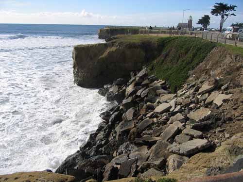
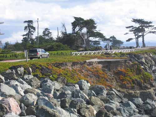
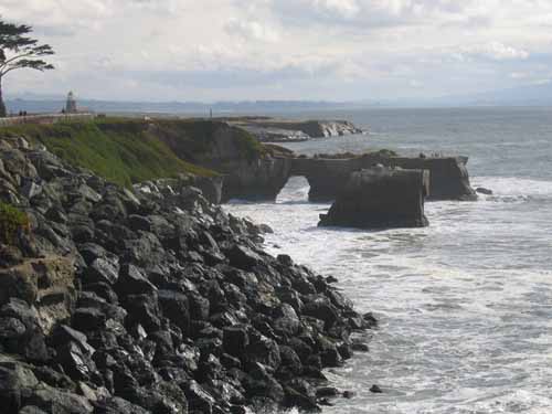
Monterey Bay’s southern coast is already eroding more rapidly than any other region in the state of California. Erosion at the coastal dunes between the mouth of the Salinas River and Monterey Harbor has been measured at rates between 1.0 and 6.0 feet per year (reference here). In northern Monterey Bay, Santa Cruz County’s sea cliffs are experiencing average retreat rates of 0.17 to 2.1 feet per year. A statewide study by the California Energy Commission found that approximately 4.4 square miles of coastline in Monterey County is susceptible to erosion from expected sea level rise, and predicted that coastal dunes and cliffs will retreat by up to 1,300 feet and 720 feet, respectively. In Santa Cruz County, 1.8 square miles of shoreline may be lost by 2100 (Heberger et al. 2009).
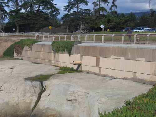
Erosion caused by sea level rise and an expected increase in storm and wave intensity will place many oceanfront facilities at risk and may cause permanent damage to transportation infrastructure, major sewage pipelines, beachfront hotels, condominiums, and private residences. Large, episodic events (such as storms that occur at extreme high tides) pose the greatest erosion threats, and these are forecast to become more frequent (reference here). Forecasts suggest that over 4,600 properties along the Monterey Bay shoreline may be lost, and that 3,420 people in Santa Cruz and Monterey Counties may lose their homes. Coastal armoring strategies such as sea walls, bulkheads and revetments are already common in the sanctuary and may have long-term impacts on natural processes such as sediment transport. As private landowners and local governments become aware of increased risks associated with sea level rise, coastal armoring projects will likely become more common. More information on sanctuary involvement with coastal armoring can be found here.
Coastal Inundation and Runoff
Coastal areas adjacent to the sanctuary may become inundated with seawater as sea level rises. Naturally low-lying habitats will be the most impacted as expected increases in storm intensity combine with sea level rise to cause storm surge, high tides, waves, and floods to reach areas further inland than they have in the past. Areas that will be affected include critical habitat areas such as Elkhorn Slough and other estuaries. If salt marsh accretion (as a result of sediment deposition) or transgression (upland migration) cannot keep pace with sea level rise, marsh areas will become permanently submerged. At Elkhorn Slough, which provides habitat for hundreds of species including more than 340 species of birds, extensive salt marsh restoration is underway to counteract extensive habitat loss due to river diversion, drainage-induced subsidence, and the construction of Moss Landing Harbor. More frequent and more severe flooding events threaten these habitat restoration efforts.
In addition, coastal inundation threatens transportation infrastructure and will subject low-lying coastal agricultural properties to salinization. As storm-induced floodwaters recede, they will draw debris, fertilizers, and other contaminants into the bay, compromising coastal water quality. Such an increase in runoff has the potential to increase the frequency and intensity of harmful algal blooms (HABs) in the sanctuary, posing serious threats to local fisheries, birds and marine mammal populations.
Saltwater Intrusion
Another threat associated with rising sea level is an acceleration of saltwater intrusion, the process by which coastal groundwater aquifers become contaminated by seawater. Local groundwater reserves provide over 80 percent of Monterey County’s total water use. Overdrafts of wells have already caused saltwater intrusion in the Salinas River and Pajaro River groundwater basins (reference here). The current rate of saltwater intrusion in the Pajaro Valley basin is estimated at 100-250 feet per year. Sea level rise will further speed this process, further limiting communities’ supply of usable fresh water for drinking and irrigation.
Throughout the central coast and the Monterey Bay region, coastal communities adjacent to the sanctuary are increasingly aware of the risks posed by global climate change. Local governments, state and federal agencies, and regional collaborations have hosted a number of workshops and conferences to share strategies for building resilience and adapting to climate change. Additionally, the area’s prominence in oceanographic research has attracted international scientific meetings such as the Ocean in a High-CO2 World Symposium.
Research and Monitoring
- Monitoring at Elkhorn Slough Monitoring at Elkhorn Slough by the Elkhorn Slough National Estuarine Research Reserve (ESNERR), CDFW, USGS, NOAA, and many other partners has created a 10 year baseline of data that will track changes in rainfall, salinity, air and water temperature, chlorophyll, and nutrients resulting from climate change. Additional monitoring efforts at Elkhorn Slough include tracking the timing and reproductive success of birds breeding on the reserve and early detection of non-native species. Knowledge gained from these studies will be essential for adapting salt marsh restoration strategies in the face of climate change.
- Ocean CO2 and Ocean Acidification Research The Monterey Bay region is home to research institutions that are world leaders in oceanographic research, including the effects of increased levels of ocean CO2 and ocean acidification. Oceanographers at MBARI and Moss Landing Marine Labs have studied how anthropogenic climate change interacts with large-scale physical and biological ocean cycles, while MBARI chemists and biologists have coordinated a series of experiments on the potential effects of more acidic waters on a variety of marine organisms. Oceanic pH (an indicator of acidity) measurements over the last 20 years show that ocean pH is on the decline in Monterey Bay and correlates with trends in global ocean pH. Some of this research, such as the Free-Ocean Carbon Enrichment (FOCE) experiment, has occurred at the MARS cabled ocean observatory, 900 m below the surface of Monterey Bay.
FOCE is comprised of a semi-enclosed test area on the seafloor where the seawater’s pH can be precisely controlled for extended periods. Small seafloor animals are placed in the test chamber, where their behavior and physiological responses can be monitored. Local research has also investigated the effects that efforts to sequester carbon dioxide in the oceans would have on deep-sea biological communities.
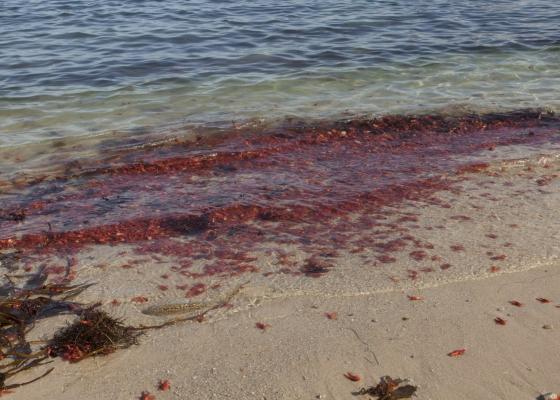
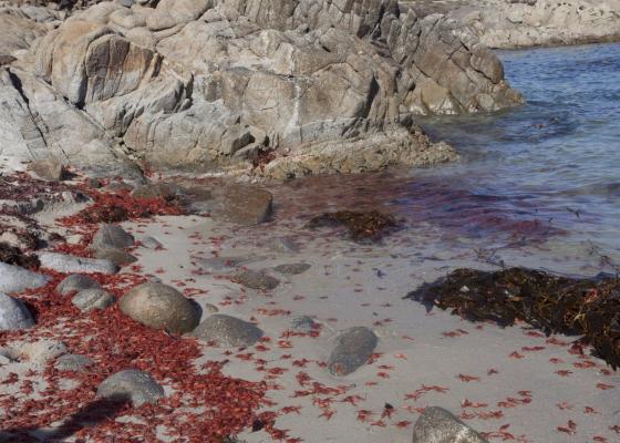
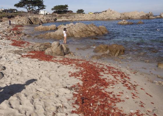
Photos

Maps
Projects
Are the Waters Along the Central California Coast and Monterey Bay Getting Colder?
There are indications that waters along the California coast are getting colder. Here we briefly examine three questions related to this change. First, how evident is this cooling along the central California coast and in Monterey Bay? Second, when did the change to cooler conditions occur locally? And third, why is it happening?Coastal Cliff Retreat Rates Along the Big Sur Coast, Monterey and San Luis Obispo Counties, California
This study provides coastal cliff retreat rates along the Big Sur coast and relates that erosion to local geology.Impacts associated with the recent range shift of the aeolid nudibranch Phidiana hiltoni (Mollusca, Opisthobranchia) in California
The feeding habits of the aeolid nudibranch Phidiana hiltoni were investigated. Implications for the potential impact to species not used to the increased density of this predator are presented.Nearshore water monitoring of oxygen and pH in southern Monterey Bay
A decade-long time series of water quality parameters indicated that the nearshore, shallow subtidal was regularly inundated with cold, low oxygen and low pH waters.Ocean Margin Ecosystems Group for Acidification Studies (OMEGAS)
This is a three-year, NSF-funded study on the impacts of acidic ocean waters on two ecologically important species (sea urchins and mussels) in the California Current Large Marine Ecosystem.Ocean observing in the Monterey Bay National Marine Sanctuary: CalCOFI and the MBARI time series
This report introduces the CalCOFI and the MBARI programs as they relate to each other and oceanography within the MBNMS. A report (see below) includes a brief review of MBNMS oceanography with summary graphs, and also provide introductory links to the extensive websites and detailed research papers of both programs.Saildrone West Coast Ecosystem Survey
Saildrone provides high-resolution ocean data via a fleet of unmanned surface vehicles (USVs) to NOAA, the Department of Defense, and other US agencies. Saildrone’s USVs are wind-powered vehicles capable of long duration ocean missions (up to 12 months) and carry a sophisticated solar-powered sensor package that streams real-time data to cost-efficiently augment ship-based methods. Saildrone USVs are 23 feet long and 20 feet high, can be launched from any dock, and travel at an average speed of 3-5 knots. The USVs weigh 1200 lbs and have a 7 ft draft.
Santa Cruz Ocean Observing Platform (SCOOP)
The primary goals of the Santa Cruz Ocean Observing Platform (SCOOP) are to establish and maintain a long-term dataset of weather and oceanographic measurements at the Santa Cruz Wharf that is accessible to both researchers and the public.Links
Global Ocean Acidification Observing Network
The Global Ocean Acidification Observing Network (GOA-ON) is a collaborative international approach to document the status and progress of ocean acidification in open-ocean, coastal, and estuarine environments, to understand the drivers and impacts of ocean acidification on marine ecosystems, and to provide spatially and temporally resolved biogeochemical data necessary to optimize modeling for ocean acidification.http://www.goa-on.org
Sanctuaries and Climate Change
Climate change is happening and human activities are contributing to and accelerating it. Climate change has consequences for people, the planet, and the ocean, including national marine sanctuaries. In general, the sites in the National Marine Sanctuary System will experience the same types of climate change impacts that will be felt in the broader marine and coastal environments, including changes in water temperatures and oceanic circulation, rising sea levels, increasing ocean acidification, changes in precipitation and storms, and their associated effects.http://sanctuaries.noaa.gov/management/climate/welcome.html