Overview
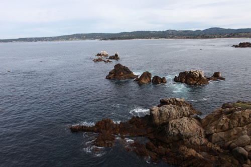
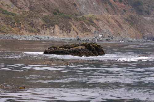
Some of the United States’ most famous coastlines, such as Big Sur and the Santa Cruz/San Mateo coast, fall within the Monterey Bay National Marine Sanctuary. Significant features of the sanctuary’s coastline – and part of what makes it so intriguing – are the numerous rocks and small islands (islets) just offshore.
Above the mean high tide line, most of these offshore rocks and islets in California are managed as a cohesive unit by the federal government as a relatively new National Monument, the California Coastal National Monument. The monument protects “all unappropriated or unreserved lands and interest in lands owned or controlled by the United States in the form of islands, rocks, exposed reefs and pinnacles above mean high tide within 12 nautical miles of the shoreline of the State of California.”
The monument, established by presidential proclamation on January 11, 2000, includes some 20,000 rocks and islets totaling approximately 1,000 acres along 1,770 kilometers (1,100 miles) of coastline. (It does not include the major islands, such as Santa Catalina and the other Channel Islands, the Farallon Islands, or the islands of San Francisco Bay.)
The proclamation creating the monument directed the U.S. Secretary of the Interior to manage the monument through the Bureau of Land Management (BLM) and to protect the geologic formations and the habitat these areas provide for plants and animals.
Since about 25 percent of California’s coast is encompassed by the sanctuary, and the monument includes most of the rocks and islets out to 12 nautical miles, a large portion of the monument’s jurisdiction links with that of the sanctuary. The major difference between the two is that the sanctuary manages resources below the mean high tide line, and the monument manages the resources above the mean high tide.
Except for the sandy beach environs of Monterey Bay, the sanctuary coastline is extensively littered with the rocks and islets of the monument. In addition to the close and cooperative working relationship the sanctuary enjoys with the it, the monument also works closely with California Department of Fish and Game and the California Department of Parks and Recreation. The monument office is presently co-located with the sanctuary office in Monterey.
Currently, a Resource Management Plan (RMP) is being prepared for the monument. An RMP, in the BLM, is similar to a Sanctuary Management Plan. That document will determine such issues as how the monument will be managed in the future and what levels of protection will be afforded its resources. The public will have various opportunities to comment on, and participate in, its development. The RMP is expected to be completed in the Spring of 2005.
Critical and “Pristine” Habitat
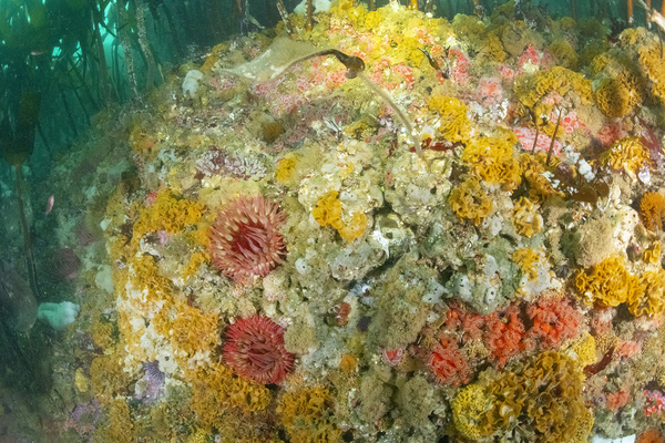
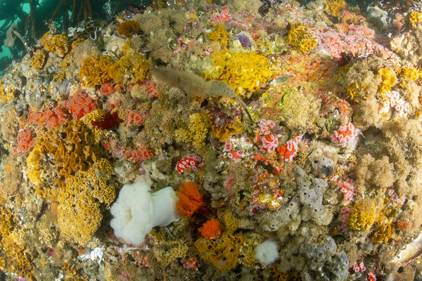
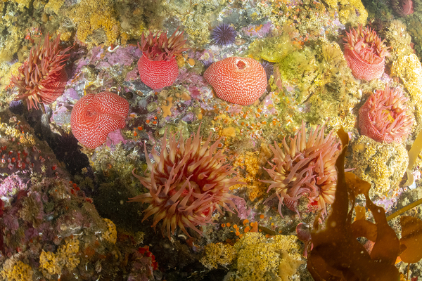
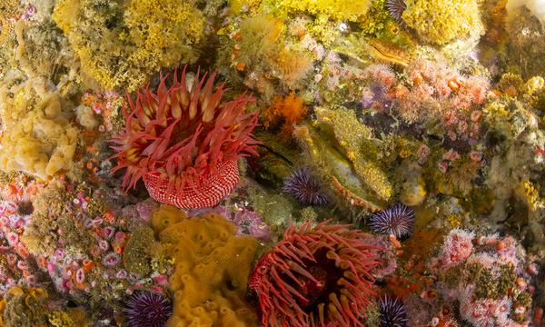
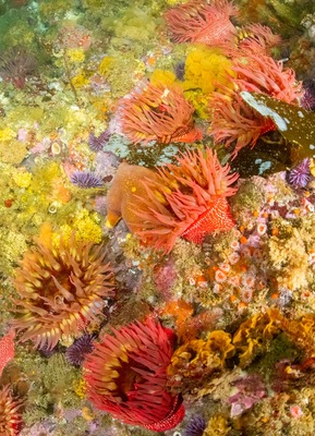
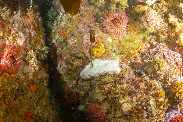
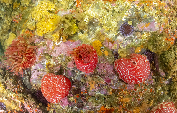
The coastline and offshore rocks and islets along the sanctuary have always been important to certain marine birds and mammals as a refuge from both terrestrial and marine predators. Furthermore, some species have traditionally relied on these structures for mating purposes. A number of these species are listed as endangered, threatened, protected or species of special concern (e.g., Brown Pelicans, Storm-Petrels, Rhinoceros Auklet, Steller sea lion, sea otters, elephant seals).
As the human coastal population of California continues to increase, greater pressures are exerted on the space and natural resources found along the shore. Increasing levels of human activities, introduced predators and invasive species have all served to push certain species to abandon onshore habitats and adapt an increasing dependence on offshore rocks and islets.
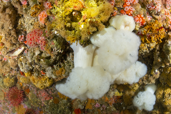
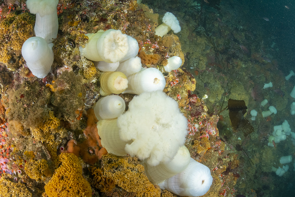
In some areas of the sanctuary, such as the Big Sur coast, the offshore rocks and islets also represent a significant percentage of the intertidal surface area. And, unlike the adjacent coasts, these offshore rocks and islets include a gradient of habitats – from those that are exposed to wind and waves through protected habitats. (Imagine a small offshore islet where the waves crash along the western shore, yet relatively tranquil tidepools are found on the eastern shore.) Furthermore, the offshore rocks and islets are isolated relative to the coast and thus are less directly impacted by human activities.
For these reasons, Michael Foster, Moss Landing Marine Laboratories, suggests that a higher level of biodiversity may exist on offshore rocks and islets as compared to onshore sites. This theory has yet to be tested.
Invasive Species Concerns
Because the rocks and islets along the sanctuary have never before been surveyed as a cohesive unit, the degree to which they are infected with invasive species is unknown. However, invasive plant and animal species are a major problem and concern on the larger offshore islands, such as those of the Channel Islands National Park. A comprehensive survey of the entire monument would help scope the extent of such invasive infestation.
Non-native plant species, such as ice plant (Carpobrotus edulis, a southern African native) and pampas grass (Cortaderia jubata, a South American native) are visually apparent on some of the nearshore rocks and islets along the sanctuary coastline. These plants out-compete native plants for space, water and sunlight.
Likewise, the scope of non-native animal infestation on the monument rocks and islets in the sanctuary is unknown. Again, however, if we look to the Channel Islands National Park, we find that non-native invasive rodents are a major threat to native bird populations there. Therefore, it is conceivable that some of the larger monument islets along the sanctuary and to the north are also infected.
Cultural and Anthropologic Issues
Current theories estimate that humans have occupied the California coastal areas for at least the past 10,000 years or so, since the end of the last ice age. The intertidal areas, including offshore rocks and islets, are known to have been useful to Native Californians as a means of collecting food and other items used in ceremonies and in barter. Post-Columbus settlers, including Europeans and Asians, have made significant use of the offshore rocks and islands for anchorages, hunting (e.g., marine birds and mammals), foraging (e.g., abalone), and navigational aids (e.g., lighthouses).
In recent years, nearshore rocks and islets have been used primarily for recreational collecting and fishing. Recreational fishermen use them as platforms to reach further into the subtidal; they also collect intertidal plants (algae) and animals (mostly gastropods) that are permitted for recreational harvest by California Fish and Game regulations.
Other current uses of the nearshore rocks and islets include positioning of modern communication and navigational equipment.
- The rocks and islets within the monument have been under continuous control of the U.S. Department of the Interior since the Treaty of Guadalupe-Hidalgo in 1848. First managed by the old General Land Office and later transferred to its successor, the Bureau of Land Management, these rocks and islets are to be protected and preserved in a pristine state under the mandates of the Antiquities Act of 1906 and managed as part of the National Landscape Conservation System.
- The monument contains approximately 20,000 rocks and islets, in an oceanic area encompassing some 14,600 square nautical miles (1,100 miles of California Coast, out to 12 miles). The total land surface area of the monument equals approximately 1,000 acres. Some islets are as large as 10 acres and have Sitka Spruce growing on them. While the smallest component is theoretically the size of a thimble, the average size of rocks and islets in the monument is less than a tenth of an acre.
- Because coastal areas in California can frequently be remote and isolated, offshore rocks and islets currently provide ideal locations for commercial cell phone antennas. Balancing the public’s desire to preserve the natural ecology of these areas with a desire for such uses that provide safety and convenience is an example of what sanctuary and monument management struggle with on a daily basis.
- On September 8, 1923, seven destroyers of the U.S. Pacific Fleet, following in single line formation (as was the practice then) crashed one after another into the rocks at Point Honda (just south of the sanctuary, on what is now Vandenberg Air Force Base), killing 23 crewmen. This incident is one of the worse peacetime disasters in U.S. Navy history.
Monitoring
Currently, the California Coastal National Monument is working on a Site Characterization and Survey modeled after that originally created for the sanctuary. This project is conceived as a partnership among BLM’s California Coastal National Monument, NOAA’s National Marine Protected Areas Center, NOAA’s Monterey Bay National Marine Sanctuary and the Friends of Moss Landing Marine Laboratories.
Photos
Maps
Projects
Long-term Studies of Seabirds on Año Nuevo Island and Mainland
Long-term monitoring of seabirds on Año Nuevo Island by PRBO Conservation Science.Links
California Coastal National Monument
The California Coastal National Monument, a program of the Bureau of Land Management (BLM), is dedicated to preserving the offshore rocks and islands of California.http://www.blm.gov/pgdata/content/ca/en/prog/blm_special_areas/nm/ccnm.html
Global Ocean Acidification Observing Network
The Global Ocean Acidification Observing Network (GOA-ON) is a collaborative international approach to document the status and progress of ocean acidification in open-ocean, coastal, and estuarine environments, to understand the drivers and impacts of ocean acidification on marine ecosystems, and to provide spatially and temporally resolved biogeochemical data necessary to optimize modeling for ocean acidification.http://www.goa-on.org