Overview
Banks and seamounts rise above the seafloor and typically consist of a different substrate as compared to the surrounding seabed. Their vertical nature and rocky substrate create habitat complexity and support a very different biological assemblage than that which surrounds them.
A bank is located on the continental shelf and the water depth above it is relatively shallow. Banks have a continental origin and can cover extensive surface area but do not extend thousands of meters into the water column.
In contrast, seamounts are mainly volcanic in origin, rising to considerable height from great depths along the continental rise and are limited in length across the summit.
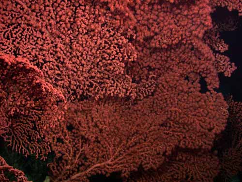
Seamounts, though common in the world’s oceans, often have very different biological assemblages than the surrounding seafloor sediments, due likely to the complex, rocky and current-swept habitats. Rocky outcrops, particularly near seamount peaks, are inhabited by a suite of deep-sea corals and sponges that are typically absent or quite rare in more typical ocean settings.
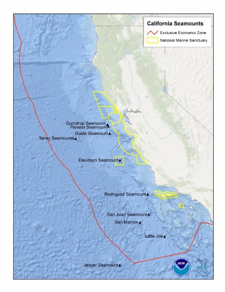
In November of 2008, NOAA designated the Davidson Seamount Management Zone (DSMZ), increasing the Monterey Bay National Marine Sanctuary (MBNMS) and protecting Davidson Seamount, making it the first seamount within a national marine sanctuary. Several other seamounts – including Gumdrop, Pioneer, and Guide Seamounts – occur just beyond this sanctuary.
The Davidson Seamount Management Zone is located 75 miles (121 kilometers) due west of San Simeon. The shallowest point is 4,101 ft (1,250 m) below the ocean’s surface and the deepest part of the DMSZ is 12,713 ft (3,875 m). Davidson Seamount itself is 7,480 ft (2280 m) tall, as measured from the west-side base to the summit. The seamount is also 26 miles long and 8 miles wide. In total, the DSMZ covers an area of 775 square miles and increases the MBNMS to 6,094 square miles.
The geological structure and origin of Davidson, Guide, Pioneer, and Gumdrop Seamounts have only recently been described, by scientists at the Monterey Bay Aquarium Research Institute, as an atypical type of oceanic volcanism, having northeast-trending ridges that reflect the ridge-parallel structure of the underlying crust. Unlike most intra-plate ocean island volcanoes, the seamounts are built on top of spreading center segments that were abandoned at the continental margin when the tectonic regime changed from subduction to a transform margin. The Davidson Seamount consists of about six subparallel linear volcanic ridges separated by narrow valleys that contain sediment. These ridges are aligned parallel to magnetic anomalies in the underlying ocean crust. The seamount is 12.2 ± 0.4 million years old and formed about 8 million years after the underlying mid-ocean ridge was abandoned.
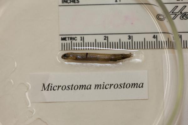
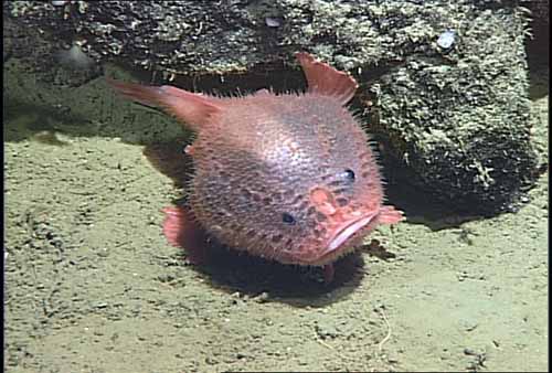
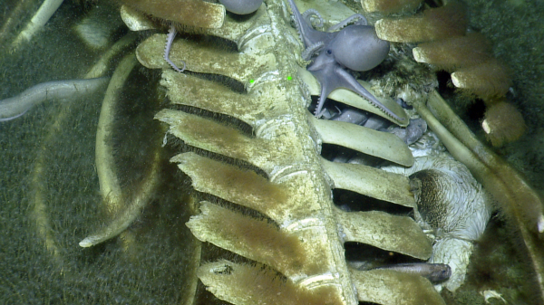
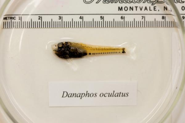
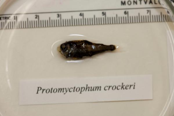
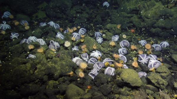
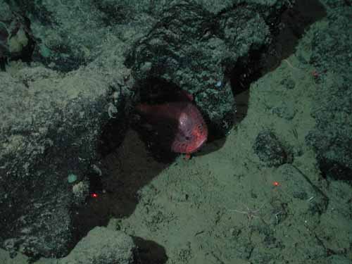
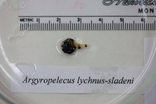
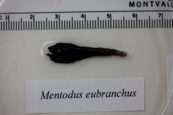
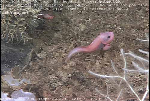
Assemblages of large corals and sponges, along with many associated animals such as sea stars, anemones, crustaceans, octopus and fishes, are common on the seamount. Expeditions in 2002 and 2006 observed 18 species new to science. Recent studies at Davidson Seamount indicate a significant shift in species composition and relative abundances of species occurs with depth. Whereas, species diversity and density at Davidson Seamount do not significantly change with depth, and can vary greatly on a single isobath. Ecological processes influencing the distribution, abundance and dynamics of seamount fauna are less well known than other charismatic ecosystems such as kelp beds and corals reefs, making it difficult to develop management criteria.
Seamount environments may represent optimal habitats for particular faunal groups resulting in thriving and dense populations encountered only rarely in other habitats. Based on research at Davidson Seamount and nearby Monterey Canyon, preliminary evidence suggests seamount communities may serve as a source of larvae for non-seamount habitats.
Due to proximity to the coast, Davidson Seamount faces a number of anthropogenic threats, including but not limited to vessel traffic, sea temperature rise, ocean acidification, commercial harvest, underwater cables, cumulative research collection, bio-prospecting, and military activity. Sanctuary regulations provide important, although not comprehensive, defenses against some of these threats.
Though relatively close to shore and one of the largest seamounts on the West Coast, Davidson Seamount appears to be relatively pristine, based on observations of biological communities during submersible explorations in the past decade. This contrasts with observations of various other seamounts worldwide, which have been subject to severe damage by trawling – a fishing practice that can decimate coral assemblages, which may then require decades or centuries to recover.
Sanctuary staff developed a management plan for the Davidson Seamount Management Zone. It contains background information on the Davidson Seamount, and the activities necessary for effective understanding and protection of this unique area. Goals are to develop and implement a resource protection plan for Davidson Seamount, increase understanding of the seamount through characterization and ecological studies, and develop education programs for this and other seamounts throughout the nation. The plan can be downloaded here.
Monitoring
Several studies have been conducted within the sanctuary at Davidson Seamount, and adjacent to the sanctuary at Pioneer Seamount. These include seamount characterization, coral distribution study, marine mammal and seabird surveys, and passive acoustic monitoring.
Davidson Seamount Expedition 2002
In May 2002, scientists from the sanctuary, Monterey Bay Aquarium Research Institute (MBARI), Monterey Bay Aquarium, Moss Landing Marine Laboratories (MLML) and NOAA Fisheries embarked on an expedition to explore and characterize the Davidson Seamount. Depth-stratified species assemblages were found at the crest, slope and base habitats of the seamount. The crest of Davidson Seamount had the highest diversity of species, including large gorgonian corals and sponges. The majority of corals were observed almost exclusively on high-relief, ridge areas. Faunal assemblages were arranged in large, contiguous patches that are susceptible to physical disturbance.
Davidson Seamount 2006: Exploring Ancient Coral Gardens
In January 2006, scientists returned to Davidson Seamount with the following objectives:
- to investigate why deep-sea corals live where they do
- to determine age and growth patterns of these corals
- to improve species identifications
- to share the exploration with the general public
They used a simple model, derived from results of the 2002 cruise, to test their understanding of coral distribution and to guide exploration in other regions of the seamount. (More than 99.98 percent of the seamount remains unexplored.) Specific regions were targeted based on a topographic index, substratum type and coral species depth records. Complementary studies of the biodiversity and population dynamics of seamount fauna included collections of corals for taxonomic studies as well as age and growth studies of corals using innovative radiometric techniques.
Marine Mammal and Seabird Surveys
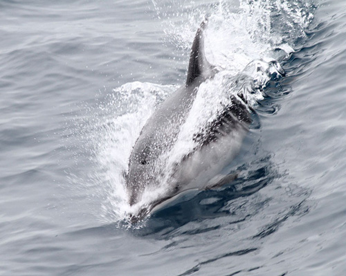
The Davidson Seamount is typically regarded as having a greater abundance and diversity of marine mammals and seabirds than the surrounding area. In an effort to characterize marine mammal abundance above, and moderate distances away from, the seamount, several aerial surveys have been conducted (April 2009, January 2010, April 2010, July 2011). In addition, the first dedicated ship-based survey to record marine mammal and seabird observations above and surrounding the Davidson Seamount was conducted during July 2010. Zooplankton and CTD data were also collected above the seamount. Fin whales (Balaenoptera physalus) were the most commonly encountered marine mammal. The majority of fin whale sightings were above and to the west of the seamount where, based upon zooplankton net tows, krill abundance was greatest; and foraging behavior was noted by observers.
Pioneer Seamount Ocean Acoustic Observatory
A vertical array of four hydrophones was installed at Pioneer Seamount in August 2001 to passively monitor the Pacific Ocean in the region south of San Francisco. The hydrophones were connected to shore via a telephone cable that came ashore at Pillar Point.
Data from the hydrophones were relayed to NOAA Pacific Marine Environmental Laboratories and to San Francisco State University, where they were made available for public access. In this data set, the loudest and most obvious signals were created by passing ships. Ship traffic and relative ship size can be inferred from the data set. Scientists have also identified a method for analyzing the ship signals to determine the speed of each ship and its distance of closest approach to the array.
Blue, fin, humpback and sperm whales were heard on Pioneer Seamount. Humpback and blue whale calls appeared prominent. Seasonality was evident, with most calls appearing in winter and fall months. Sounds from blue whales were quite prominent over the eight months of monitoring. The cable was damaged and had not functioned since September 2002. The cable was removed in 2011.
Photos
Maps
California Seamounts
[View Larger]
Projects
Davidson Seamount 2015: Characterization of Mammals, Birds, and Midwater Fishes Above and Adjacent to Davidson Seamount
This multi-disciplined and complex research mission accomplished most of the research goals for areas within the Davidson Seamount Management Zone and other Sanctuary Ecologically Significant Areas (SESAs). The NOAA fishing survey vessel, "Bell M. Shimada" was used as the operational platform. Individual projects completed included the recording of marine mammal and ocean noise with hydrophones, oceanographic data and water sampling with a CTD, collection of water samples for Fukushima isotope analysis (with a CTD), collection of water samples for environmental DNA analysis (with a CTD), mesopelagic fish surveys (with a tucker trawl), marine mammal and seabird surveys were conducted above and adjacent to Davidson Seamount (although most of the surveys occurred in a Beaufort state 6 or above, making the data incomprable), and filming for video production of NOAA research and collaborative Marine Biodiversity Observatory Network (MBON) was completed. Additional proposed research that could not be completed due to ocean conditions included Puma drone surveys to observe marine mammals at DSMZ. Media Day was held off the wharf in Santa Cruz.Davidson Seamount: 2002 Expedition
The Davidson Seamount is an impressive geologic feature located 120 km southwest of Monterey, California. This inactive volcano is roughly 2,300 m tall and 40 km long, yet its summit is far below the ocean surface (1,250 m). In May 2002, a diverse group of scientists led by the Monterey Bay National Marine Sanctuary embarked on an exploration to more fully characterize the Davidson Seamount.Davidson Seamount: 2006 Expedition to Ancient Coral Gardens
Building off the successes of an Office of Ocean Exploration (OE) expedition to Davidson Seamount in 2002, this project focused on deep-water corals. The week-long expedition in 2002 was the initial effort to characterize the biology and geology of the Davidson Seamount, 1,250 – 3,700 meters deep off Central California.Davidson Seamount: 2010 Marine Mammal & Seabird Survey
MBNMS staff and UCSC scientists conducted a ship-based survey of the waters above and around the Davidson Seamount for three days in July 2010. Efforts aboard the NOAA Ship McArthur II represent the first dedicated at-sea surveys of Davidson Seamount for marine mammal and seabirds.Davidson Seamount: 2010 Marine Mammal Aerial Surveys
In 2010, the Monterey Bay National Marine Sanctuary (MBNMS) and its partners conducted two aerial surveys of the surface waters surrounding the Davidson Seamount, an area typically regarded as having a higher abundance and diversity of marine mammals and seabirds.Davidson Seamount: Ecological Characterization & Habitat Modeling of the Fauna
Davidson Seamount, a massive undersea volcano, is one of the best studied seamounts in the world. Six expeditions to Davidson Seamount yielded over 60,000 observations of marine organisms. We were able to create a faunal list for Davidson Seamount, examine rates of endemicity, and add biogeographic range data for many of the species living on the seamount.Exploration of Sur Ridge
Exploration of Sur Ridge began December 15, 2013 during a larger research cruise to revisit a lost shipping container. The surprising discoveries of that cruise led to subsequent exploration.Pioneer Seamount Ocean Acoustic Observatory
A vertical array of four hydrophones was installed on Pioneer Seamount to passively monitor the Pacific Ocean in the region south of San Francisco, CA.Seafloor Mapping in Monterey Bay, Cordell Bank, and Gulf of the Farallones National Marine Sanctuaries
National Oceanic and Atmospheric Administration and U.S. Geological Survey scientists mapped and characterized seafloor areas on the continental shelf in three west coast National Marine Sanctuaries using side-scan sonar and underwater video technology.Links
Corals of Davidson Seamount
KQED video of the deep-sea corals at Davidson Seamount.http://science.kqed.org/quest/video/exploring-corals-of-the-deep/
Davidson Seamount Management Zone - Management Plan
2013 technical report on the Davidson Seamount Management Zone, including an updated Management Planhttp://montereybay.noaa.gov/research/techreports/trmbnms2013.html
Davidson Seamount Management Zone - Threats Assessment
2012 technical report on threats potentially impacting the Davidson Seamount Management Zonehttp://montereybay.noaa.gov/research/techreports/trmbnms2012.html
Davidson Seamount Taxonomic Guide
2008 guide to species observed on Davidson Seamounthttp://montereybay.noaa.gov/research/techreports/trburton2008.html
Discovering Hidden Habitats: MBARI & NOAA
Join NOAA and the Monterey Bay Aquarium Research Institute's (MBARI) 2002 expedition to the deep trenches of the Monterey canyon where they discovered previously unknown species.http://www.youtube.com/watch?feature=player_embedded&v=jVrugjn79XY#!
MBARI - Current Research Projects
Learn about current research projects conducted by the Monterey Bay Aquarium Research Institute (MBARI).http://www.mbari.org/rd/projects/current_projects.html
MBARI - Deep-Sea Guide
A web-based system that allows for the correlation of visual, descriptive, and observational data with environmental data from multiple sources by providing tools for searching, identifying, and examining occurrence data (e.g., depth, time, abundance) for biological, geological, and experimental observations.http://dsg.mbari.org/
MBARI - Seamounts Research Highlights
Learn about the research that is being done on underwater volcanoes (seamounts) at the Monterey Bay Aquarium Research Institute (MBARI).http://www.mbari.org/volcanism/Seamounts/
MBNMS – Davidson Seamount
Main link to MBNMS web site that covers Davidson Seamount.http://montereybay.noaa.gov/research/dsmz/welcome.html
Monterey Bay Aquarium - Student and Teacher Resources and Activities
The Monterey Bay Aquarium offers teacher and student resources including: species and habitat-specific information, live cams, classroom activities, and interactive online games.http://www.mbayaq.org/lc/
NOAA - Davidson Seamount Exploration
Technological advances have allowed exploration of one of the largest "underwater islands" off the coast of the U.S. See what the exploration entails and what new and exciting life forms are being discovered there.http://oceanexplorer.noaa.gov/explorations/02davidson/davidson.html
NOAA - Mountains in the Sea Lesson Plans
The Mountains in the Sea: Exploring the New England Seamount Chain Expedition presents a unique opportunity to engage explorers of all ages as we journey to a world that few have seen.http://oceanexplorer.noaa.gov/explorations/03mountains/background/education/education.html
NOAA - Ocean Exploration Lesson Plans
Students of all ages can learn about the oceans with near real-time access to a series of multidisciplinary deep ocean explorations. The site offers a set of over 100 hands-on and standards-based lesson plans for student exploration and discovery. Using new technological "eyes" to see, sense, measure, image, and describe a little known ocean world, these lessons bring the excitement of late-breaking ocean discoveries into classrooms.http://oceanexplorer.noaa.gov/explorations/06davidson/background/edu/lessonplans.html
NOAA Explorations - Davidson Seamount
Follow an expedition to the Davidson Seamount located 120 miles southwest of Monterey, California. Student can follow the expedition through the mission plan, cruise logs, images both above and below the water line, interviews with the research scientists and a look at the technology used in such an adventure.http://oceanexplorer.noaa.gov/explorations/02davidson/davidson.html
NOAA Ocean Explorer - Sounds in the Sea
Underwater hydrophones were installed at the Pioneer Seamount to learn more about ocean noise.http://oceanexplorer.noaa.gov/explorations/sound01/sound01.html
NOAA Photo Library
NOAA's photo library contains incredible shots of an amazing array of animals, technology, scientists, and images of historical treasures. Site also offers search function for images.http://www.photolib.noaa.gov
NOAA Vents Program - Acoustic Monitoring
Underwater acoustic monitoring is helping scientists to understand the geological activity in the ocean, the distribution of marine animals, the effect that noise has on marine life and more.http://www.pmel.noaa.gov/vents/acoustics.html
Review of Resource Management Strategies for Protection of Seamounts
http://sanctuaries.noaa.gov/science/conservation/seamount14.html
Sanctuaries Joint Management Plan - Davidson Seamount
NOAA is considering protecting the resources and qualities of the Davidson Seamount through inclusion in the Monterey Bay National Marine Sanctuary.http://sanctuaries.nos.noaa.gov/jointplan/mb_davidson.html
Seamounts Online
An online resource designed to gather and provide information on species found in seamounts as well as to facilitate research in seamount ecology.http://seamounts.sdsc.edu/
SFSU Pacific Oceanography Project - Gallery of Underwater Sounds
See what different underwater sounds "look" like.http://www.physics.sfsu.edu/~seamount/gallery.html
The Bridge - Ocean Sciences Teacher Resource Center
Materials and curricula related to many areas of study in the Monterey Bay. Be sure to check the data tip of the month archives. (Supported by the National Sea Grant Office, the National Oceanographic Partnership Program, and the National Marine Educators Association.)http://www.vims.edu/bridge/